
Station Name: ANN STREET[Source:
Paul Wright]
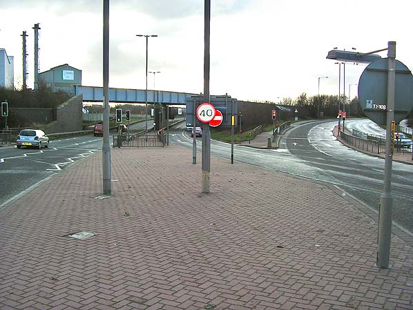
Looking south at the site of Ann Street Station in January 2008. The railway running left to right across the picture is the Ditton to Warrington Arpley Deviation line of 1870. The Widnes to St Helens line followed the route of the main road which is Watkinson Way under the bridge. The original line of 1833 continued south to Runcorn Gap Station and Widnes Dock. When the Deviation was built a spur was put in which connected up to the Ditton to Warrington line allowing passenger trains to reach Widnes (South) station. Watkinson Way follows the route of the spur before heading south towards the Runcorn to Widnes Road Bridge. Another line crossed the Widnes to St Helens line, also by an overbridge at this location but it did not have a connection to either the Widnes to St Helens line or the Ditton to Warrington line. The line was the GC & MR Widnes Branch. The road leading off to the right of the picture is Ashley Way which picks up the alignment of the GC & MR Widnes Branch and follows its course towards the west. The Widnes Branch was at a higher elevation than Ashley Way using viaducts and embankments from this location to the site of Widnes Central Station.
Photo by Paul Wright  Home Page Home Page
|