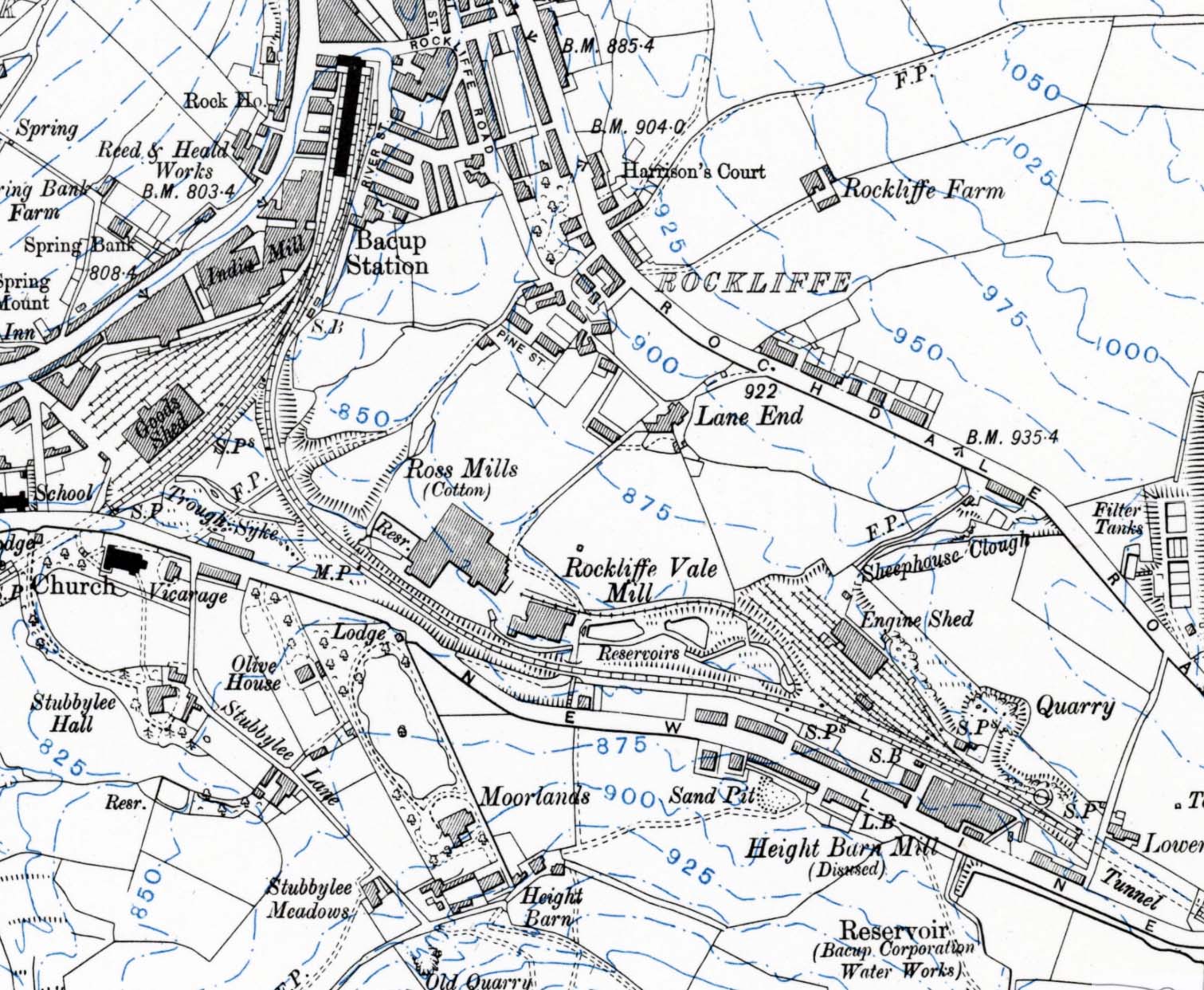
1912 10,560 OS map. The relative positions of Bacup station and the engine shed are seen on this map: both features are named. The line to Facit and Rochdale disappears from the south-eastern corner of the map having passed through the Bacup (or Newline) Tunnel. The scale of the map is sufficiently large to indicate the expanse of sidings associated with the shed as well as the excavation that was necessary to create the near-level site alongside the 'New Line' to accommodate it in the hilly terrain. The station's goods shed and associated sidings are seen close to the passenger station and north-west of the Lancashire & Yorkshire Railway's earlier branch from Rawtenstall and Bury; this branch leaves the map having just passed through the other Bacup (or Stubbylee) Tunnel.


 Home Page