
Station Name: BRITANNIA[Source:
Alan Young]
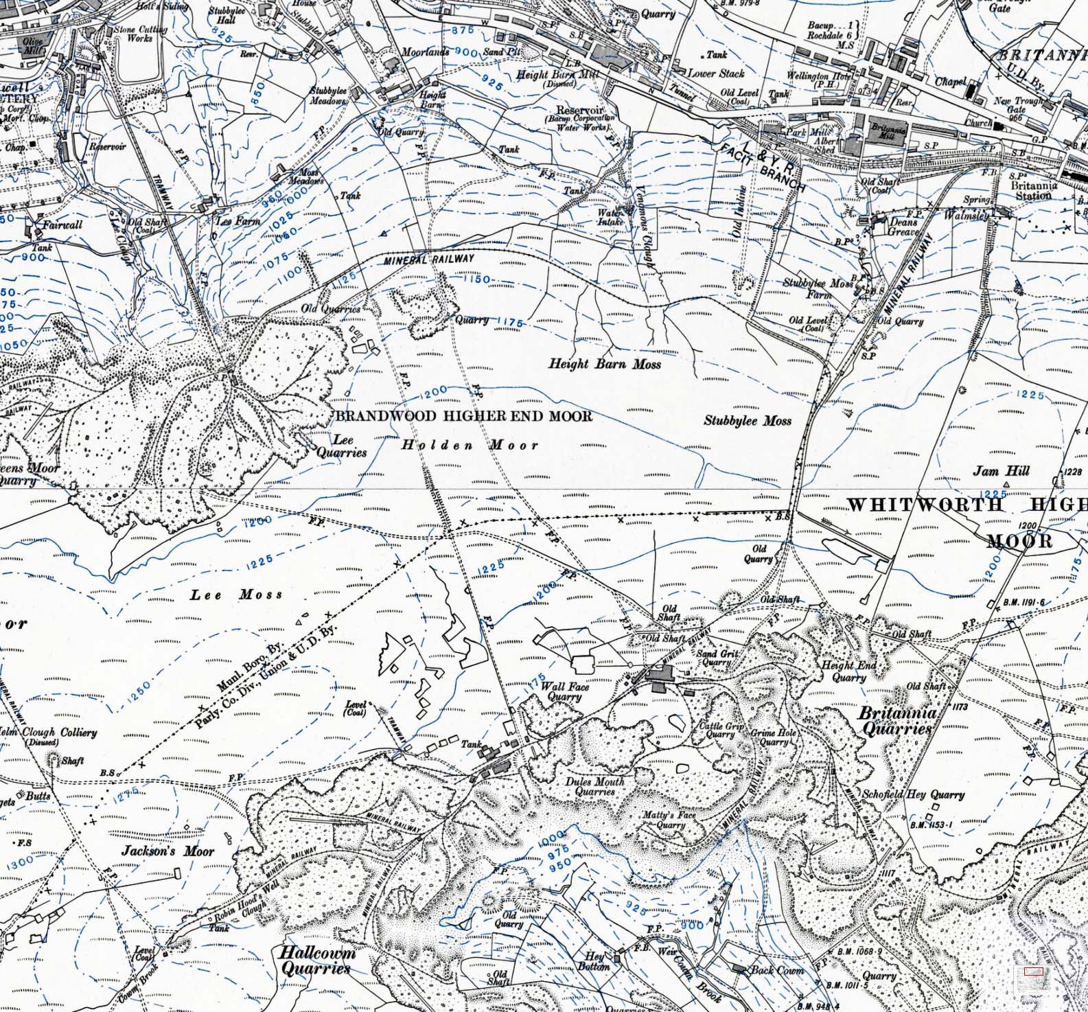
1912 1:10,560 OS map. By the early twentieth century the moors south and west of Britannia were extensively quarried for flagstones which were removed via the various mineral railways. Britannia station is in the north-east corner of this map extract, and the steeply inclined mineral railway which carried the stone from the moorland quarries is seen striking south-westwards from the station. On the moor top there are numerous individually-named quarries, collectively known as Britannia Quarries, and a number of abandoned coal workings (some identified as ‘Old Shaft’). A branch from the line connecting Britannia station and quarries follows a near-level route to Lee Quarries, from which a steeply-graded tramway leads down to a point between Stacksteads and Bacup in the Irwell valley. After being moribund for many years the quarries on the tops are now active again, but the railways have long gone:.
|
 Home Page