
Station Name: BRITANNIA[Source:
Alan Young]
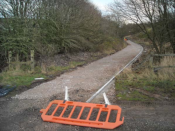
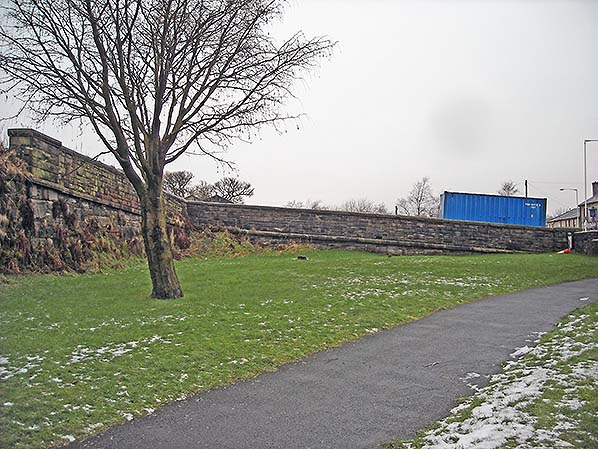
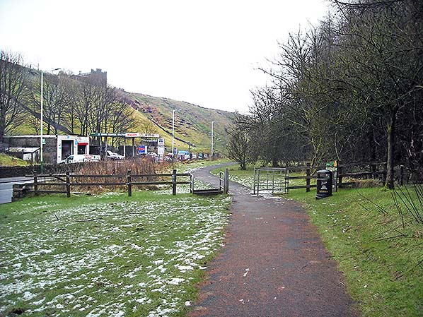
Looking east from the former bridge at Britannia; the viewpoint is similar to John Mann’s view of September 1971. The cutting has been filled in, the remains of Britannia station have been buried and for some years a path has followed the line of the railway. On 7 January 2016 a new gravel path is seen nearing completion, and in the distance two of the workmen can be seen in hi-vis clothing. The barrier is not very effective in barring entry to the work site!
Photo by Alan Young 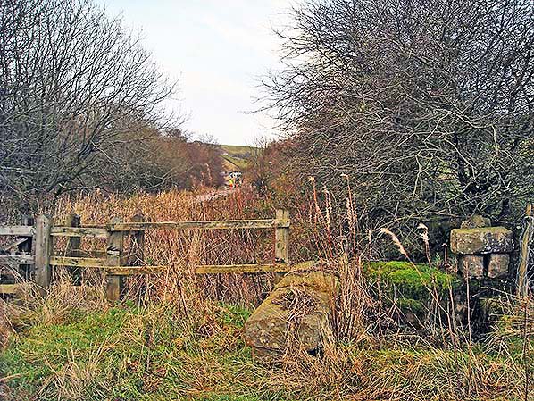
Looking east from the former bridge in January 2016; the viewpoint is similar to John Mann’s photo of September 1971. . The cutting has been filled in, the remains of Britannia station have been buried and for some years a path has followed the line of the railway. A new gravel path is nearing completion, and in the distance two of the workmen can be seen in hi-vis clothing. In the foreground the large stones are possibly the southern end of the former bridge parapet.
Photo by Alan Young
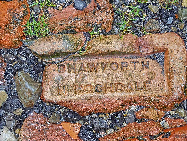
This is a product of the brickworks that formerly stood beside Shawforth station and closed in 1910. It was photographed in January 2016 when it formed part of the track over the bridge adjacent to the site of Britannia station’s entrance.
Photo by Alan Young 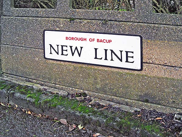
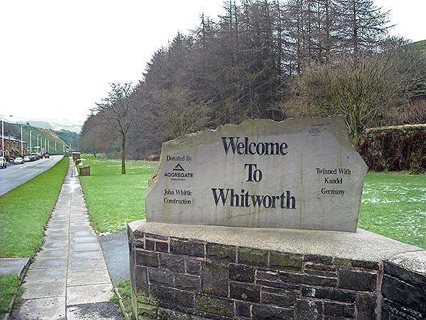
The ‘New Line’ which gave its name to this road was the extension of the Facit Branch railway opened in 1881 to Shawforth, Britannia and Bacup. The road is now the A6066 and connects Britannia with a point between Bacup and Stacksteads. This sign is at the Britannia end of the road and was photographed in January 2016.
Photo by Alan Young
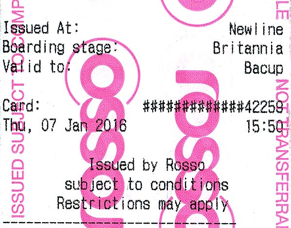
Electric trams began running between Rochdale and Bacup in 1911, and they effectively killed off Britannia station in 1917. The trams themselves ceased to run in November 1932, and motor buses continued to provide competition that saw off the Rochdale-Bacup railway passenger service in 1947. The phantom of the railway still appears on today’s ‘Rosso’ route 464 tickets. The ticket seen here was issued in 2016 at ‘New Line’ (incorrectly printed as ‘Newline’), the stop close to the former Britannia railway station; New Line is still the name of the A6066 road from Britannia to Bacup, its name commemorating the new railway line from Facit to Bacup via Britannia which opened in 1881.
Looking west towards the eastern parapet of Old Lane railway bridge at Britannia in January 2016. The photographer is standing on the infilled and landscaped site of the former double-track Rochdale to Bacup railway which was dismantled in 1964. Britannia station was on the far side of Old Lane bridge.
Photo by Alan Young
Looking south- east at Britannia, Lancashire towards Shawforth. Rochdale Road (A671) is to the left, and the landscaped area ahead has been created by infilling the deep cutting through which the Rochdale-Bacup railway passed at its 967ft summit. On the far right is the upper part of a stone retaining wall of the railway cutting.
Photo by Alan Young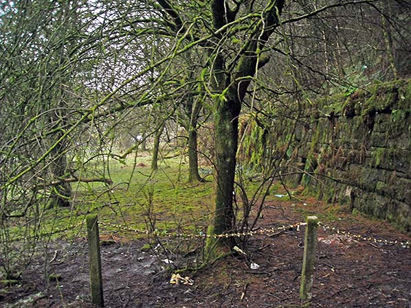
Looking south-east along the course of the former Rochdale-Bacup railway near Britannia. The line was in a cutting, filled in at this point about 400yd from Britannia towards Shawforth station. The upper part of the stone retaining wall of the cutting is to the right. The 967ft summit of the railway was about 100yd ahead in the area now turned over to woodl.
Photo by Alan Young
Looking south-east along the course of the former Rochdale-Bacup railway near Britannia. To the left is Rochdale Road (A671) with Shore Service Station, which can be seen on one of the 1961 views. The railway was in a cutting at this point and was infilled and landscaped many years ago; the rails were removed in 1964. The 967ft summit of the line was about 100yd ahead. The path veers to the left off the course of the railway beyond the fence.
Photo by Alan Young
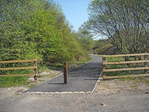
The completed tarmac path on the infilled site of Britannia station, looking east in May 2016.
Photo by Alan Young
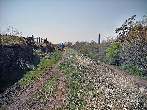
Looking west, about 250yd west of the site of Britannia station in May 2016. On the right, beside the trees, is the railway trackbed between Britannia and Bacup, now used as a footpath. The line was on a downhill (towards Bacup) gradient of 1 in 35. The man and his dog are on a near-level parallel path which formerly carried a siding towards Deans Greave Colliery, closed in the 1890s. Beyond the retaining wall on the left, the mineral line from Britannia Quarries, high up on the moors, formerly descended to Britannia station. In the distance is the chimneystack of Britannia Mill, the premises of the Lancashire Sock Company.
Photo by Alan Young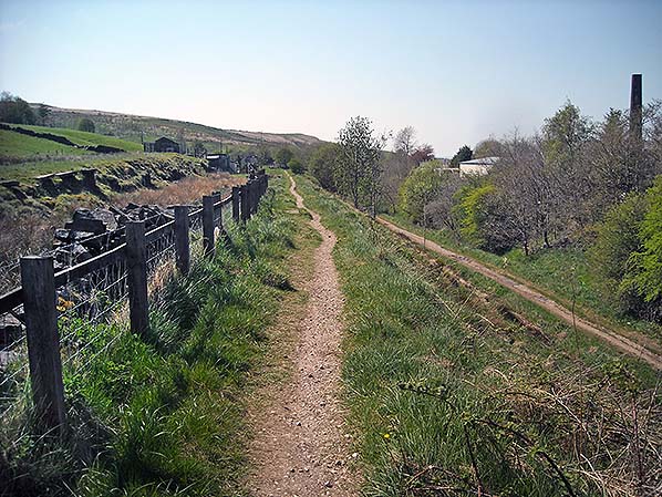
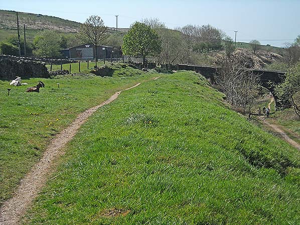
Looking west, about 350yd west of the site of Britannia station towards Deansgreave Road bridge. The railway from Britannia to Bacup passed under the bridge, falling at a gradient of 1 in 35. The trackbed is now a popular footpath, attracting many walkers on the particularly warm Thursday 12 May 2016. The photographer is standing on a near-level parallel path which formerly carried a siding towards Deans Greave Colliery, closed in the 1890s. The pair of goats will be noted.
Photo by Alan Young
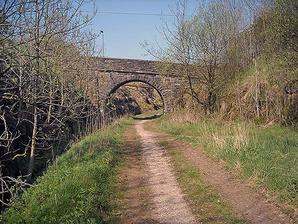
Looking west towards Deansgreave Road bridge, between Britannia and Bacup in May 2016. The trackbed of the former railway is now a footpath; its surface is thought to be higher than the trackbed at this point.
Photo by Alan Young
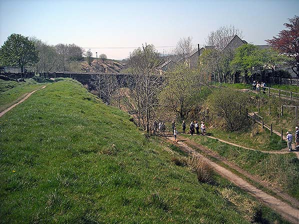
Looking west towards Deansgreave Road bridge between Britannia and Bacup stations in May 2016. The old railway passed under the bridge, and the photographer is standing close to the site of a siding at a much higher elevation. The difference in altitudes reflects the steep downward gradient of the line to Bacup – 1 in 35 at this point. On a warm day in May walkers are taking advantage of the public footpath that follows the old Facit Branch.
Photo by Alan Young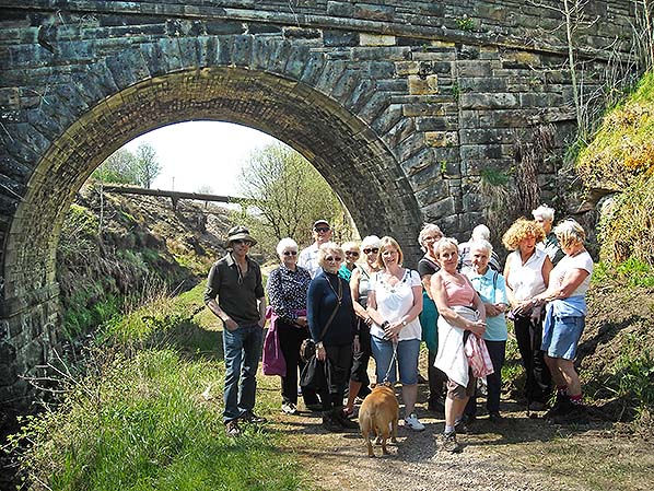
Whilst the railway from Bacup to Britannia with its upward gradient reaching 1 in 34 was an endurance test both for locomotives and their crew, this is barely noticed by walkers using the old trackbed. Some sections of the former Facit Branch are maintained as footpaths; this includes most of the route between Shawforth and Bacup. On a warm Thursday 12 May 2016 an ‘Age UK’ walking group is assembled at Deansgreave Road bridge, Britannia, one of the access points to the old railway.
Photo by Alan Young Click here for more pictures
|

 Home Page