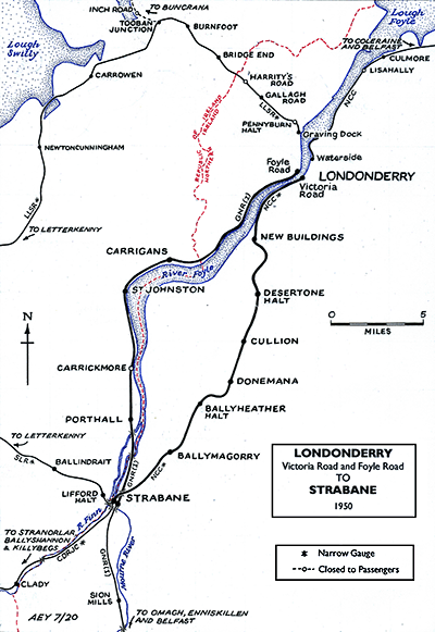
Notes: Carrigans station was opened by the Londonderry & Enniskillen Railway (L&ER) on 19 April 1847. It was located on their single line from Derry/Londonderry to Strabane section of line that had opened on the same day. At the time of opening there were just three intermediate stations on the line. The station was located to the south-east of its namesake in County Donegal and close to the west bank of the River Foyle at the southern end of Foyle View Manor Road. A level crossing provided access to the river.
 The station facilities were located on the north side of the line. It is not known what the passenger facilities consisted of at the time of opening but a brick building that survives to this day may have been the original station house from 1847. The station had goods facilities which included a goods shed on the north side of the level crossing. The station facilities were located on the north side of the line. It is not known what the passenger facilities consisted of at the time of opening but a brick building that survives to this day may have been the original station house from 1847. The station had goods facilities which included a goods shed on the north side of the level crossing.
At the time of opening the station was served by trains that were running between Londonderry (Gallows Strand) and Strabane but from 18 April 1850 Down direction (northbound) services ran to the new terminus of Londonderry Foyle Road.
The L&ER struggled financially and extending the line south from Strabane was slow.
Newtownstewart was reached on 9 May 1852 and a few months later on 13 September 1852, the line opened to Omagh. It would take until 19 August 1854 for Enniskillen to be reached by the railway.
By February 1859 Strabane was connected to Ireland’s capital city, Dublin, and by September 1861 it was connected to the north of Ireland’s largest city, Belfast. It was the route to Belfast, via Omagh, Dungannon and Portadown that later became known as the ‘Derry Road’.
On 1 January 1860 the L&ER leased its line to the Dundalk & Enniskillen Railway for 99 years’ They renamed themselves as the Irish North Western Railway (INWR) in 1862.
In 1876 the INWR merged with other railway companies to form the Great Northern Railway Ireland (GNRI).
The GNRI carried out improvements at Carrigans, which included the building of a longer and raised height platform in about 1879.
In 1907 the line between St Johnston and Londonderry Foyle Road was doubled. An additional platform was added on the south side of the line which became the Up platform (Strabane direction). The original platform served the Down line (Derry/Londonderry direction). A signal cabin was also provided.
 After the partition of Ireland into two separate countries in 1922 (Northern Ireland and The Irish Free State), the GNRI system found itself located within two separate countries with all of the difficulties that imposed. County Donegal became part of the Irish Free State. County Tyrone, in which Strabane was located, and County Londonderry, in which Londonderry Foyle Road was located, became part of Northern Ireland. After the partition of Ireland into two separate countries in 1922 (Northern Ireland and The Irish Free State), the GNRI system found itself located within two separate countries with all of the difficulties that imposed. County Donegal became part of the Irish Free State. County Tyrone, in which Strabane was located, and County Londonderry, in which Londonderry Foyle Road was located, became part of Northern Ireland.
Nearly nine miles of the almost 15 miles long line between Derry/Londonderry and Strabane was within the Free State, including Carrigans which was just 0.5 miles from the border and 5 miles from Derry. This was particularly difficult for the GNRI and a customs post had to be created at the station. Partition affected goods traffic in particular and as an economy measure the GNRI singled the line from St Johnston to Derry in 1933. The former up line was removed and its platform became redundant.
In 1953 the GNRI had to be taken into the joint ownership of the governments of Northern Ireland and the Republic of Ireland (the Irish Free State having been renamed in 1949). The two governments ran the company through a GNRI board until September 1958 when they passed the ownership to their two respective nationalised railway concerns. Carrigans station being in the Republic of Ireland became part of the Córas Iompair Éireann (CIE). Train services however were operated by the Ulster Transport Authority (UTA).
The UTA was a notoriously anti-rail organisation and they reduced the passenger service at Carrigans down to a mere handful of trains a week in 1959.
On 15 February 1965 the UTA closed the ‘Derry Road’ route completely and Carrigans lost all its rail services.
CLICK HERE FOR A DETAILED HISTORY OF CARRIGANS STATION
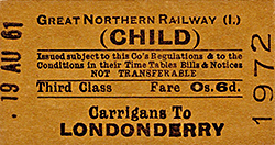
Tickets from Michael Stewary. Timetables from Jim McBride and route map by Alan Young
Sources:
- Challoner, Fairwell the Derry Road (Colourpoint, 2010)
- Johnson, S Johnson's Atlas & Gazetteer of The Railways of Ireland (Midland Publishing, 1997)
- Patterson, E The Great Northern Railway Ireland (The Oakwood Press, 2003)
To see the other disused
stations on the Londonderry Foyle Road - Omagh line click on the station
name: Londonderry Foyle Road,
Londonderry (Gallows Strand), St Johnston, Carrickmore, Porthall
and Strabane (GNRI)
|

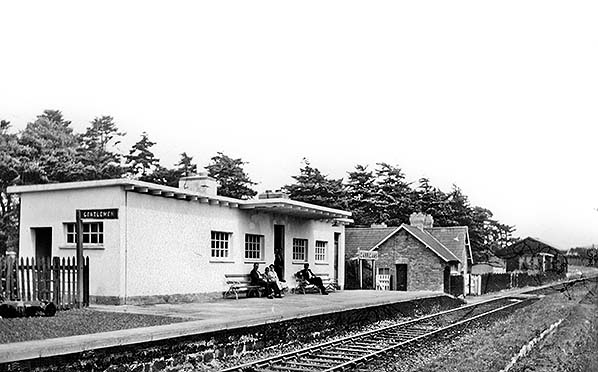 A view of Carrigans station looking east towards Derry/Londonderry from the former up platform on 4 July 1959. The up platform had lost its track in 1933 when the line was singled (it having only been doubled in 1907). The prominent white building was built in 1932. To its right is the Station Master's house which had been the station building in its early days. In the distance the goods shed can be seen. Passengers are waiting for the arrival of a local train.
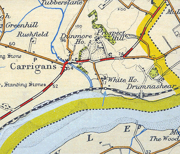
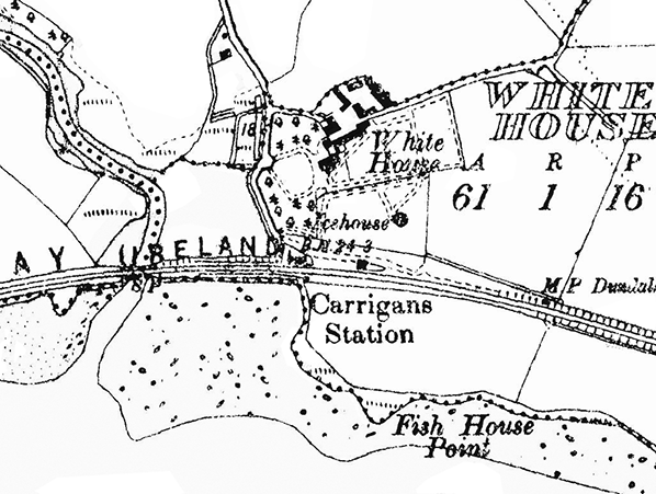 Carrigans station shown on a 6-inch scale map from the 1950s.
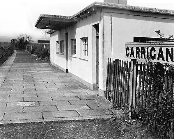
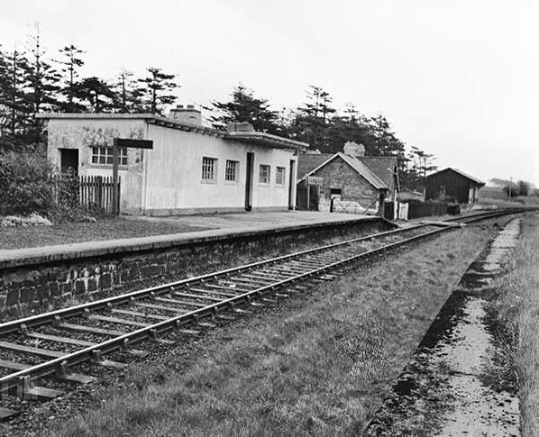 Carrigans station looking east from the former up platform after closure in the autumn of 1965.
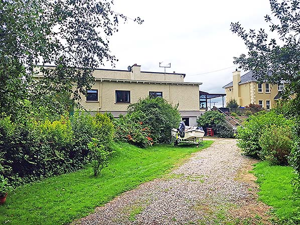 The 1932 Carrigans station building seen looking south in 30 August 2020. The railway had run left to right on the other side of the building.
 Home Page