
Station Name: CIRENCESTER TOWN[Source:Peter Stephenson] 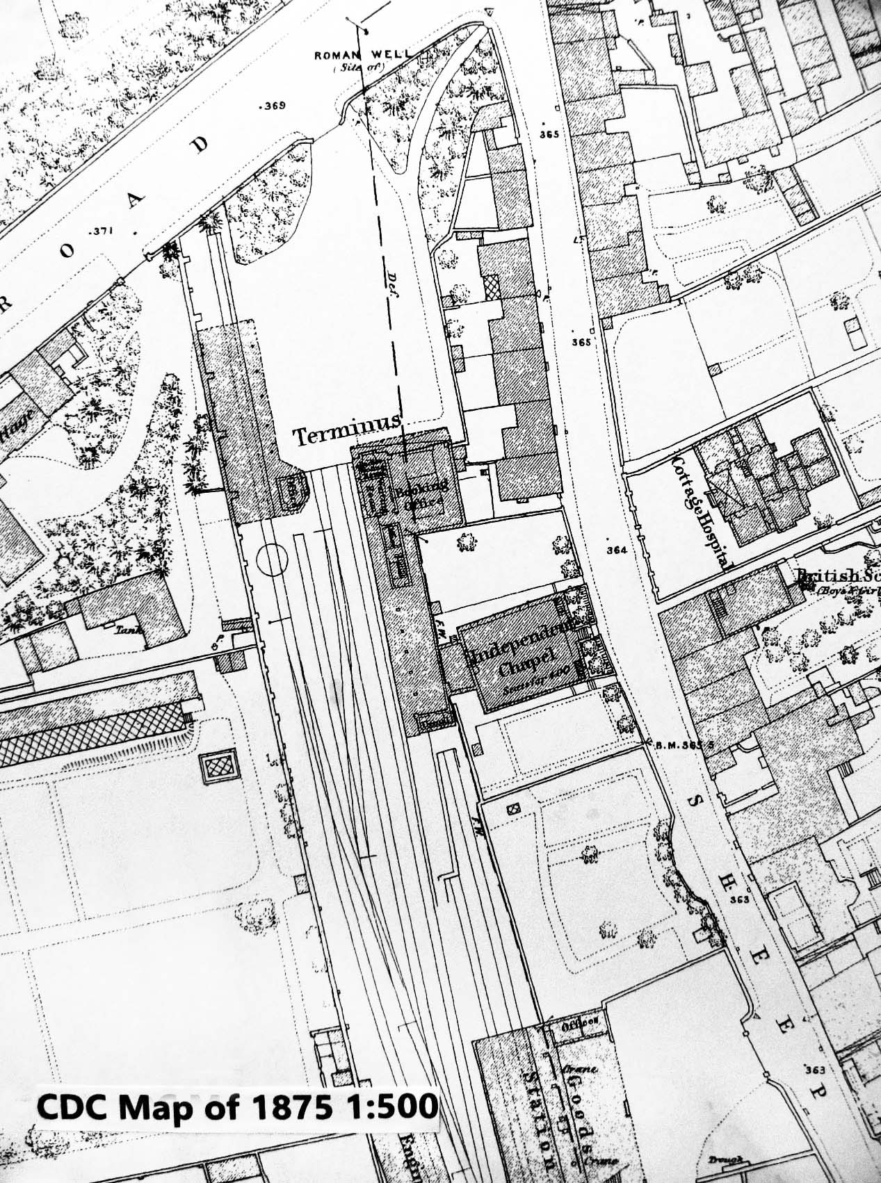 This 1:500 map of 1875 shows the station layout not long after conversion to standard gauge. The platform is straight and the run-round loop appears to use two adjacent sidings rather than the platform road. The platform itself is comparatively short. By 1902 the left hand track from the goods shed had been removed and the platform extended as far as the shed. The map shows the canopy along the station frontage and a further canopy along the left (west) side. Both were probably left when the main overall roof was removed. The map also shows houses on both sides of Sheep Street. Those backing on to the station forecourt have since been demolished. This 1:500 map of 1875 shows the station layout not long after conversion to standard gauge. The platform is straight and the run-round loop appears to use two adjacent sidings rather than the platform road. The platform itself is comparatively short. By 1902 the left hand track from the goods shed had been removed and the platform extended as far as the shed. The map shows the canopy along the station frontage and a further canopy along the left (west) side. Both were probably left when the main overall roof was removed. The map also shows houses on both sides of Sheep Street. Those backing on to the station forecourt have since been demolished.
|

 Home Page