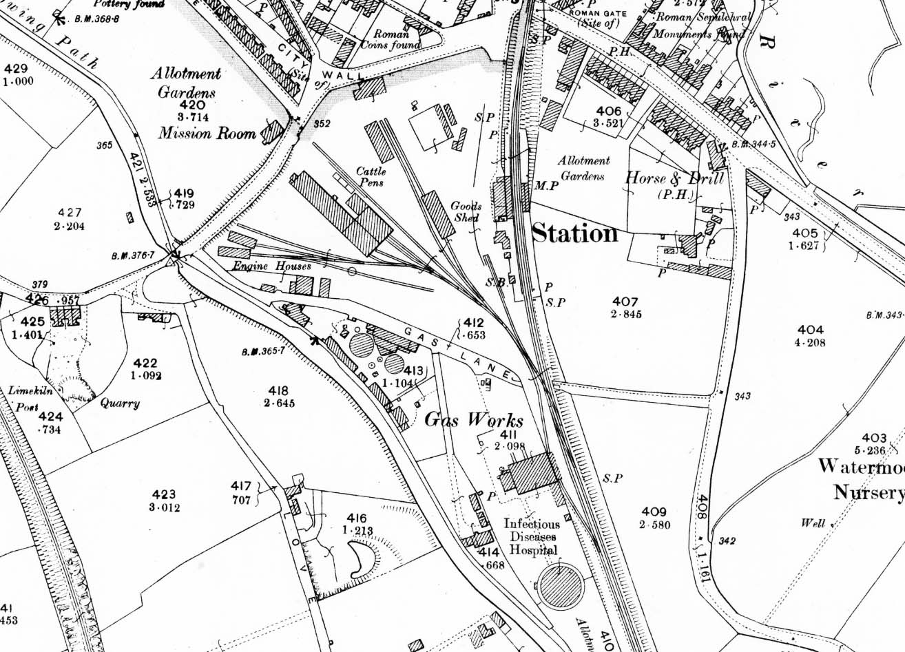
1902 1:2,500 OS map. The station opened in 1883 so this map shows the station and yard as built. The station is on a curve and a low embankment. Public access is along an access road running south from Chesterton Lane to the main station building on the up platform. A generous waiting shelter was provided opposite on the down platform. Passengers used a barrow crossing at the south end of the station to reach the up platform. The stationmaster's house is located on the down platform just south of the main station building with a water tower and signal box also being sited at the south end of the platform. The goods yard comprises four sidings to the west of the station, one short siding serving a dock behind the down platform. Another siding passes through the goods shed and another serves a cattle dock and pens. To the west of the goods yard is the M&SWJR locomotive, carriage and wagon repair shop. West of the works and to the north of Gas Lane, two engine sheds and a turntable are seen. This map is the only reference to two engine sheds. With the arrival of the railway Cirencester Gas works was extended closer to the railway and a new gasometer built on the south side of the works. A siding runs alongside the gasworks.

 Home Page