
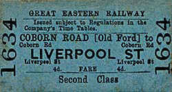
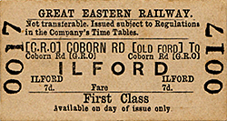
Station Name: COBORN ROAD FOR OLD FORD[Source: Nick Catford]
Coborn Road for Bow Gallery 1: c1905 - December 1946
road_old1.jpg) A postcard view of Coborn Road station, facing towards Stratford, sometime in Great Eastern days and prior to November 1907. This if one of the few so-far-discovered views showing the station in its former glory; full length canopies, ornate waiting rooms, ornate columns and copious numbers of suspended oil lamps. This is also one of the few views which show a nameboard displaying the full station name, albeit partly off the picture at far right. In this view a train bound for Liverpool Street is arriving, headed by what appears to be a Class M15 2-4-2T (later Class F4/F5) but the headcode, and thus the train's origin, is unidentified. The overhead signal box was opened in 1884.
Copyright photo from John Alsop collection 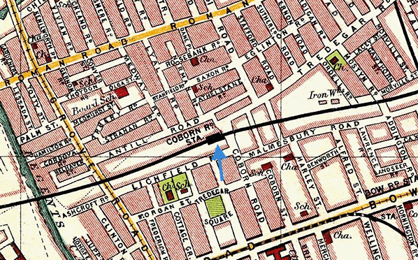 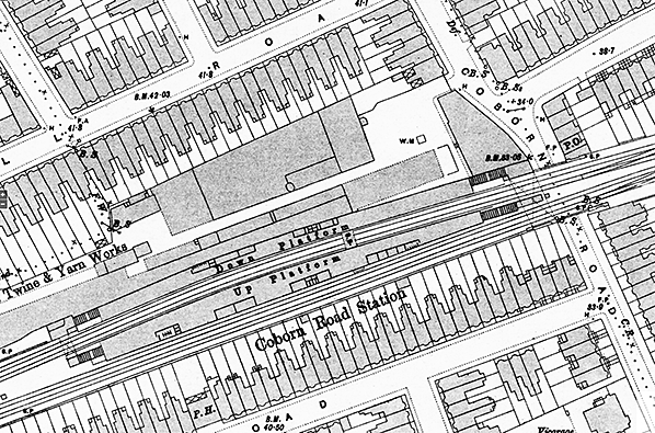
1896 1:1056 OS Town Plan shows the layout of the station. The main entrance was on the north side of Coborn Road with the booking office located in an arch below the viaduct. A wide subway is shown beneath the four lines with steps up to the two platforms. Further steps at the west end of the station lead to another subway, this time only running under two lines, The Grove Road booking office is at the north side of the subway from where a footpath runs parallel with the viaduct for 250 feet to Grove Road. Buildings are shown on both platform; two on the down platform and four on the up platform. Gents' toilets are located at the west end of the down platform building and the east end of the up platform building. A signal box spans the tracks between the two platforms. No platform canopies are shown although they were in place from the opening of the station. The two avoiding lines run to the south of the station. Click here for a larger version.
1916 1:2,500 OS map. Little has changed since the 1896 map although the signal box is now shown as a footbridge.
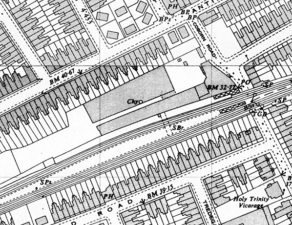 1950 1:2,500 OS map. The station is now closed and all buildings have been demolished with only the covered stairs remaining at the east end of the station. The signal box which was abolished on 6 February 1949 and was quickly demolished. Although this map is dated 1950, the survey was made in 1947. Much of the rope and twine works to the north of the station has been demolished.
road_old2.jpg)
Bridge No.52 (now No. 43) over Coborn Road, date unknown but not later than May 1913. The station was to the right and the entrance from the street out of view to the right. A light is seen suspended in front of the entrance. The view is south towards Bow Road. Coborn Road was one of those pleasant side streets, mainly residential but with a public house, a cluster of shops and one or two industries. Apart from the loss of the station, the gas lights, the terrace of shops and a few other buildings it is not overly changed today. The industrial building far right later gained an additional storey as the premises of A.S.Brown Ltd., manufacturers of a wide range of personal items such as wallets, cigarette cases, mirrors, trinket boxes, lipstick holders, ashtrays, picture frames to name just a few. The site of Brown's premises is now occupied by a block of flats. Among the shops visible in this view are Goodrick's hardware and Jackson's newsagent. Goodrick's stood on the corner of Tredegar Road and in 2016 was a bed shop, albeit looking little like a shop from the outside. What was Jackson's survived as a newsagent until sometime around the end of the 20th century and in 2016 the premises was a clinic. The remainder of the shops are now in residential use. The shield on the wall beneath the road name, far left, was a parish boundary marker. Both it and the road nameplate no longer survive but a few parish boundary markers can still be seen around London and other places. This photograph is convenient to mention a change which had occurred to this scene in 1869 when on 10 November the GER was requested to sell land on the corner of Tredegar Road in connection with the widening of Coborn Road at this point. This may explain, at least in part, the dog leg in Coborn Road to the north of the bridge. The required land was duly sold for £50.
Photo from John Mann collection road_old3.jpg)
Looking north towards Coborn Road bridge on an unknown date; an arrow points to the booking office under the viaduct. Beneath the bridge and on the left is what appears, under magnification, to be a motor vehicle and if so the date is probably shortly before the temporary closure of the station on 22 May 1916. Beyond the bridge, Coborn Road takes a dog leg to the left before joining Antill Road, hence the illusion of a T junction immediately beyond the bridge. The shops facing the camera stood on Tredegar Road; they no longer exist and modern housing now occupies the site, otherwise Tredegar Road remains much the same today. Whilst a good proportion of Coborn Road is still recognisable today, among the buildings which have disappeared is the terraced housing on the right. Lichfield Road can just be seen on the left before the bridge and today, directly opposite, runs Malmesbury Road. Otherwise the terraced houses have given way to modern blocks of flats set further back from the road and in rather more spacious surroundings; thus while the gradient of the road is still obvious today it is not quite so visually obvious as in this view. As was normal for the time, the road has a liberal coating of various dirteries of which much would have come from horses. It is difficult to appreciate what the urban environment was like a century ago. Streets stank of horse muck while domestic and industrial chimneys belched out smoke as, of course, did ships, steam locomotives and steam road vehicles. All that was in addition to conditions inside industrial premises where workers could be exposed to dust, fumes and other things which we now know are hazardous. Life, therefore, was not always the 'good old days' many like to claim.
Photo from John Mann collection road_old4.jpg)
Looking south towards the Mile End Road along Grove Road sometime prior to 1906. On the left and in front of the bridge a gatepost topped by a lamp can be seen, this was the start of the footpath which led to Coborn Road station. The end of the platforms and the Grove Road booking office and steps to the platforms were some 250 feet away while Coborn Road itself was a quarter mile away. There was also a sign announcing Coborn Road Station facing onto the road on the left but out of view here. The bridge itself has long since received a rebuilt superstructure and the road beneath it lowered, while none of the buildings seen here still exist. On the right is Shadforth's chemist and photographer, the address was 63 Grove Road E3. Today, trees stand on the site and an entrance to Mile End Park is located approximately where the side street once was. Perhaps not immediately obvious is the tramway and beyond the bridge a horse tram is approaching, plus what appears to be another going away from the camera. This was North Metropolitan Tramways yellow route between Limehouse and Victoria Park via Burdett Road and Grove Road. Click here for a larger version of this picture with a
greatly extended caption. Photo from JE Connor collection road_old5.jpg) The Grove Road end of Coborn Road station showing the avoiding lines on the right, seen in 1936. The layout of the station was somewhat unusual in that it was effectively double-ended and the covered stairways from the Grove Road end booking office all but mirrored those at the Coborn Road end. The west end on the platforms were some 250 feet from Grove Road and reached via a footpath at ground level. The Grove Road booking office is partly visible through the viaduct railings on the left; the large and somewhat elaborate station name no doubt being designed to be visible from Grove Road. The steps to the Up platform, right, were accessed via a subway in the same manner as per the Coborn Road end. Railings of the type seen here on the left can still be seen in the Grove Road area to this day. The small hut is a fogman's hut from where detonators would be placed on the track as necessary. In front of the hut stands what are thought to be fog repeater signals for the benefit of the fogman. Rodding can be seen leading to them and their purpose would be to inform the fogman of when the tracks were or were not clear. It would appear, perhaps logically, that the apparatus applies to apply only to the avoiding lines. Detonators are small explosive devices strapped to the rails, or in some instances applied to the rails by mechanical means, which explode loudly when train wheels run over them. There are a number of situations when detonators would be used but the purpose of all is to warn drivers of a problem on the line ahead be it fog obscuring stop or caution signals, a failed or derailed train, engineering works and so on. Also carried onboard trains, detonators are still in use today. Behind the fogman's hut a standard-mounted lamp can be seen. As the door of the hut is facing the camera and the hut appears to be against a wall, the purpose of the lamp is something of a mystery.
Photo from JE Connor collection road_old9.jpg) Class N7 0-6-2T LNER No.9614 at Coborn Road with an Epping to Liverpool Street service. The photograph is undated but there are plenty of clues. The locomotives carries the number allocated to it in the LNER renumbering scheme of 1946, in June of that year in the case of this locomotive. The station would appear to be in the early stages of demolition, suggesting after December 1946 when it had closed. A train of main line stock can be seen passing on the right. Some folk today might be puzzled by steam trains running between Liverpool Street and Epping (a limited number also ran through to Ongar at one time). The route was via the Cambridge platforms at Stratford then shortly before reaching Temple Mills trains branched off at Loughton Junction towards Leyton and onwards to Epping. London Transport (Central Line) took over to Loughton on 21 November 1948 and to Epping on 25 September 1949 via a new tube tunnel from Stratford to a point just west of Leyton where the line surfaced and joined the existing route. The connection with what had become BR was retained for many years afterwards for goods trains and an early morning DMU service ostensibly for staff. Liverpool Street suburban trains also operated to Woodford via Chigwell, there once being a connection at Ilford to what is now the Central Line's Hainault Loop. Of No.9614, she became British Railways No.69614 in March 1949 and survived until December 1960. Taking the GER/LNER London suburban headcode disc system as a whole, it was a complicated affair which began as a system of white, red and green lamps and discs. For safety reasons the LNER made changes to eliminate the use of red and green lamps and the disc colour, with white border, settled upon has been variously described as vermillion, scarlet lake and brown. With the passage of time and shortage of colour photographs the truth is difficult to determine. At the same time, knowledge of the indicated routes has also become patchy and many can now only be determined if a Down direction destination board is also present in a photograph. The headcode for the Epping line is one of the handful which are known. The coloured disc system was officially abandoned in East London at the end of 1960 but lingered in use for a little while longer, particularly on the North Woolwich line, either for reason of habit or 'diehard' crews.
Photo from John Mann collection road_old6.jpg)
What appears to be an empty coaching stock train passes Coborn Road station on 2 December 1946, a week before the station closed. The signal on the left and the two arms which are 'On' above the second carriage controlled the two tracks which avoided the station platforms. The locomotive is Class F6 2-4-2T LNER No.7238. She was not to receive her BR number until January 1951, becoming No.67238. She did not survive much longer, being withdrawn from Cambridge shed in November 1955. One of the rather grand Gents' toilets common at the London end of this line is visible on the right. An incomplete Coborn Road running-in board is also visible. Despite the station being named 'Coborn Road for Old Ford' for many decades, not all the signage ever bore the full title and this remained the case until the end. Not that this mattered of course as the vast majority of passengers using the station would have been local people.
Copyright photo by HC Casserley
road_old7.jpg)
On 2 December 1946 and with the signal box looming over the scene; the box would remain in use until 6 February 1949. LNER Class N7 0-6-2T No.9618 calls at Coborn Road with a Liverpool Street to Epping service. The route these trains took from Stratford over what is today the Central Line is described in another caption. The people on the platform and the open carriage door tells us the photograph was taken during the first week of December if not on closure day itself. It is not known if the rubble on the left was due to deliberate demolition or the result of wartime bomb damage. No record has been found, however, of the station receiving either a direct hit or a very near miss unlike nearby Globe Road and Tredegar Square. Locomotive No.9618 became British Railways No.69618 in July 1948 and survived until September 1961. Coborn Road station had been given electric lighting, along with numerous other GER stations in the inner London area, as early as 1907 with work reported as complete on 19 November. By this date much of the canopy had been removed leaving just short sections in front of the waiting room. Much of the wall at the rear of the up platform has also been demolished, this wall hid the station from trains passing by on the fast lines/
Copyright photo by HC Casserley road_old8.jpg) Coborn Road station looking towards Stratford on 2 December 1946, a week prior to closure. In this view we see both entrances/exits from street level and nameboards stating just 'Coborn Road', omitting the 'for Old Ford' addition. A number of permanent way workers can be seen with one, just about to descend the steps from the Down platform, carrying what appears to be a Tilley lamp. This might suggest the photograph was taken shortly after dawn. Not long after this photograph was taken the first visible signs of the delayed, by the war, Shenfield electrification would appear. One of the posters proclaims 'Bovril Gives Strength To Win'. The slogan was well known and had first been used during WWI, reappearing again during WW2.
Coborn Road station looking towards Stratford on 2 December 1946, a week prior to closure. In this view we see both entrances/exits from street level and nameboards stating just 'Coborn Road', omitting the 'for Old Ford' addition. A number of permanent way workers can be seen with one, just about to descend the steps from the Down platform, carrying what appears to be a Tilley lamp. This might suggest the photograph was taken shortly after dawn. Not long after this photograph was taken the first visible signs of the delayed, by the war, Shenfield electrification would appear. One of the posters proclaims 'Bovril Gives Strength To Win'. The slogan was well known and had first been used during WWI, reappearing again during WW2.Copyright photo by HC Casserley Click here for Coborn Road for Bow Gallery 2:
|
 Notes: The Eastern Counties Railway was incorporated in 1836 to link London with Ipswich via Colchester, and then extend to Norwich and Yarmouth.
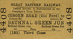 By 1840 it was clear that additional money would be required to complete the ECR line to Colchester. On 25 February 1843 a special inspection train left Shoreditch for Colchester. However, the train was stopped at Brentwood as a timber viaduct at Mountnessing had subsided and it was unsafe to continue. On 7 March 1843 goods trains started operation followed by the commencement of passenger services on 29 March 1843.
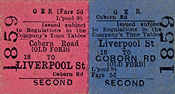 Old Ford was renamed Coborn Road 1 March 1879. Later that year, the GER decided to resite the station to the west side of Coborn Road as the company were planning to quadruple the formation between Bow and Stratford. To accommodate this, the acquisition of land on the west side of Coborn Road for £750 was approved in January 1880. On 19 December 1880 the widening of the line to 4 tracks was approved at a cost of £7,239, the contract being awarded to W Bangs and Co.
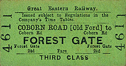 The new station was clearly an improvement on its predecessor with two facing platforms with generous canopies stretching almost the full length of the platforms and built to a style that had been popular with the GER since the 1870s. The canopies were supported by a brick wall to the rear and cast iron columns and spandrels on the platforms. The platforms also had ornate general and ladies’ waiting rooms and copious numbers of oil lamps suspended from the canopies. Gents’ blocks were sited at the west end of the down platform buildings and the east end of the up platform buildings.
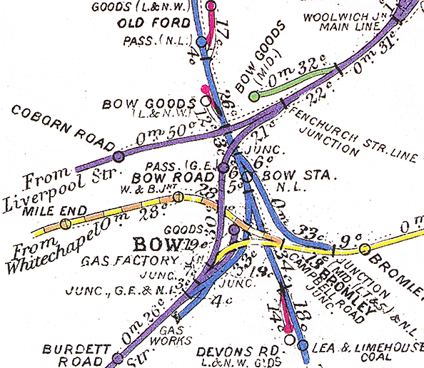
 In 1880 the average passenger revenue at Old Ford (Coborn Road) was £11,000 (excluding season tickets) compared to £15,000 at Bethnal Green. It was expected that passenger revenue would increase to £15,000 per annum after resiting due to new passengers using the second entrance on Grove Road.
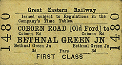 In 1914 the bridge over Coborn Road was replaced at a cost of £438.15s, the contract being awarded to EC & J Keay.
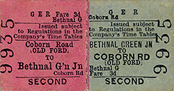 The threat of closure created much anxiety among commuters due to costs of travel. Bus fares at this time cost 4d compared to 1½d for rail journeys into the City. A campaign to prevent closure of the station was launched by B Straus a former Liberal Parliamentary candidate for Bethnal Green.
  Coborn Road station reopened on 5 May 1919 but with a reduced service. Bradshaw for July 1922 shows some trains on the Liverpool Street to Hertford and North Woolwich lines stopping at Coborn Road. On the Hertford line there were 13 (3) down trains and 11 (0) up trains on weekdays (Sundays in brackets). On the North Woolwich line there were 25 (12) down trains and 37 (13) up trains (Sundays in brackets). There was also a new shuttle service between Liverpool Street and Stratford with trains at frequent intervals throughout the day from 4.30 am.
 Coborn Road was clearly not a pleasant place at this time; an East London Advertiser reader recalled trips with his mother to visit his grandparents in this period and catching a train at Coborn Road. He remembers the station as ‘a dark, cavernous, filthy, dirty place.’
 The outbreak WW2 brought the work to a temporary halt. By this date Coborn Road station was looking very shabby with much of its canopy having been removed. The first stage of the extension opened to Stratford on 4th December 1946 and Coborn Road closed four days later. It was not until 1949 that the scheme was completed with electrification being extended to Chelmsford in 1956.
 The wall at the back of the down platform which once supported the canopy was reduced in height in November 2005 but the entrance on Coborn Road and the steps to the down platform survive. Local people are now served by the nearby Bow Road station on the District Line, Mile End on the District line and Central Line and the more recent Bow Church station on the DLR.

 Home Page