| Station Name: COCKERMOUTH |
 |
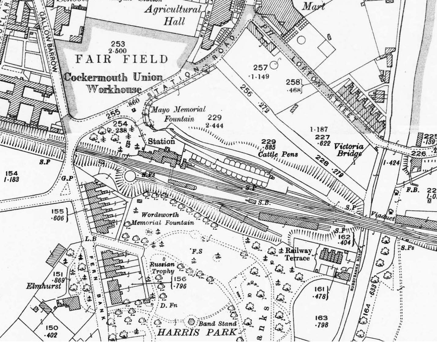
1923 1: 2,500 OS map. Cockermouth station is shown in its prime. The station building and up platform are north of the running lines with sidings trailing in from the cattle loading dock and pens. The island platform is shown with its more modest buildings and a signal box towards the east end. Sidings to the south of the running lines serve a two-road carriage shed, a one-road goods shed and a turntable. Double track ends a short distance west of the bridge under Station Road. Apart from livestock all goods traffic was handled at the site of the original Cockermouth station, and this would coontinue until the closure of the route through Cockermouth to all goods traffic in 1964.
| Last
updated: |
© 1998-2019 Disused Stations
| |

 Home Page