|
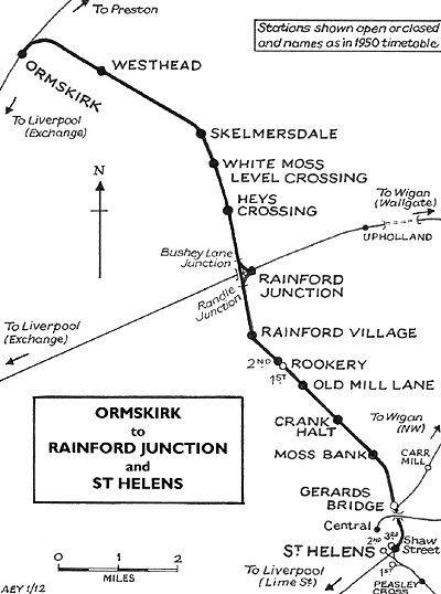
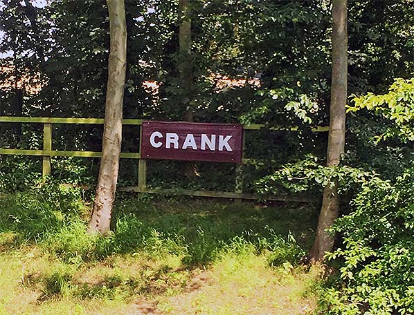
Notes: Crank station was part of what became the St. Helens
to Ormskirk via Rainford Junction line. The route was effectively
made up of two different lines that opened within a month of
each other. Crank was situated on the St. Helens to Rainford
Junction line which was opened by The St. Helens Canal & Railway Company (SHC&RC) on
1 February 1858. The other part of the line ran from Rainford Junction
to Ormskirk and was opened by the East Lancashire Railway (ELR). At
the time of opening new stations where provided at St. Helens
(3rd), Gerards Bridge, Moss Bank, Rainford and Rainford Junction.
A few months later the railway company decided to add another
two experimental stops to see if they were viable. One of these
was Crank, the other was Rookery.
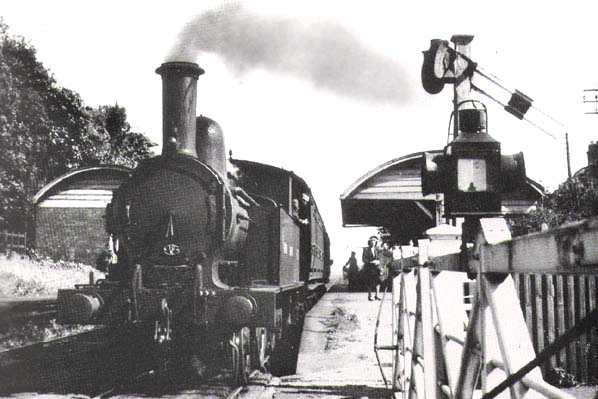
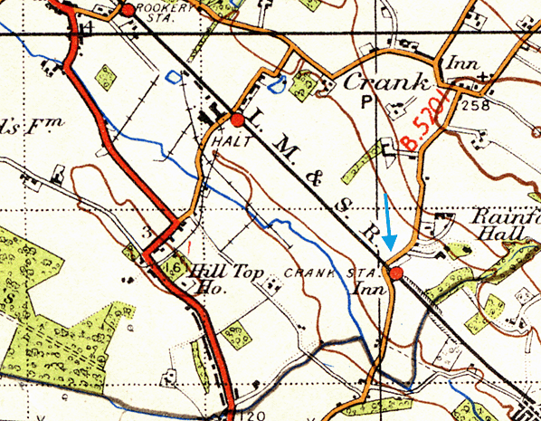
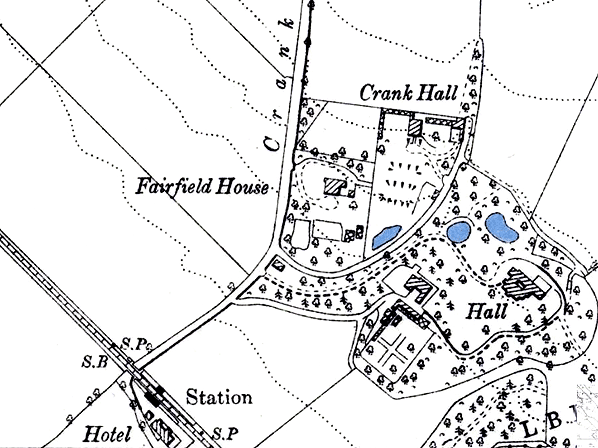
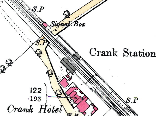
 Crank station was situated on the east side of Crank Road which
crossed the line by means of a level crossing. The line was
double track and so the station was provided with two platforms
each of which had a simple wooden waiting structure built by
a local contractor. At the time of opening the station was served
by four trains each way per day which ran from St. Helens to
Rainford Junction where the SHC&RC had its own platform.
The St. Helens to Rainford Junction section of the line became
part of the London North Western Railway on 4 August 1864 and by 1904 they were operating
8 trains in each direction. Crank station was situated on the east side of Crank Road which
crossed the line by means of a level crossing. The line was
double track and so the station was provided with two platforms
each of which had a simple wooden waiting structure built by
a local contractor. At the time of opening the station was served
by four trains each way per day which ran from St. Helens to
Rainford Junction where the SHC&RC had its own platform.
The St. Helens to Rainford Junction section of the line became
part of the London North Western Railway on 4 August 1864 and by 1904 they were operating
8 trains in each direction.
In 1923 the entire route from St. Helens to Ormskirk became
part of the London Midland & Scottish Railway which brought it under the direction of one
company for the first time. This did not alter the pattern of
services though they remained as they always had with St. Helens
line services terminating at Rainford Junction. Passengers wishing
to travel on towards Ormskirk had to change at Rainford Junction.
On the 9 September 1940 Crank became an unstaffed halt. Traffic levels
on the line had declined and by 1951 (when the line was part of British Railways London Midland Region) only three workman's trains
operated at morning and afternoon rush hour in each direction.
Despite protests regular passenger services ceased on 16 June 1951.
The line remained in use for goods services and for passenger
excursions and diversions up until 6 July 1964.
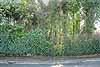
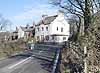
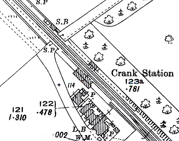
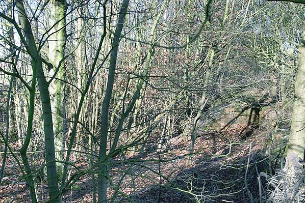
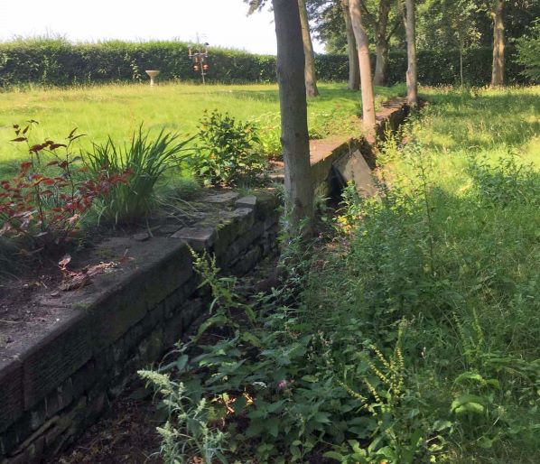
Today the site of Crank Station is hidden from the road by extensive
vegetation growth. The trackbed can be traced only on the west
(Rainford) side of the former level crossing over Crank Road.
The remains of a brick structure can be seen between trees on
the west side of Crank Road.
Route map by Alan Young.
Sources:
- Industrial Railways of St Helens, Widnes and Warrington - Part 2 St Helens Coalfield and the Sandfields - C H A Townley & J A Peden - Industrial Railway Society 2002
- The St Helens Railway, Its Rivals and Successors – J M Tolston – The Oakwood Press 1982
For other Stations on the St. Helens - Rainford Junction line click on the station name:
St. Helens (3rd station), Gerards Bridge, Moss Bank,
Old Mill Lane, Rookery 1st, Rookery 2nd , Rainford Village &
Rainford Junction
For Stations on the Rainford Junction - Ormskirk line click on the station name:
Rainford Junction, Hey's Crossing Halt, White Moss Level Crossing Halt, Skelmersdale & Westhead Halt
|

 Home Page