
Station Name: EASTWOOD (Yorks)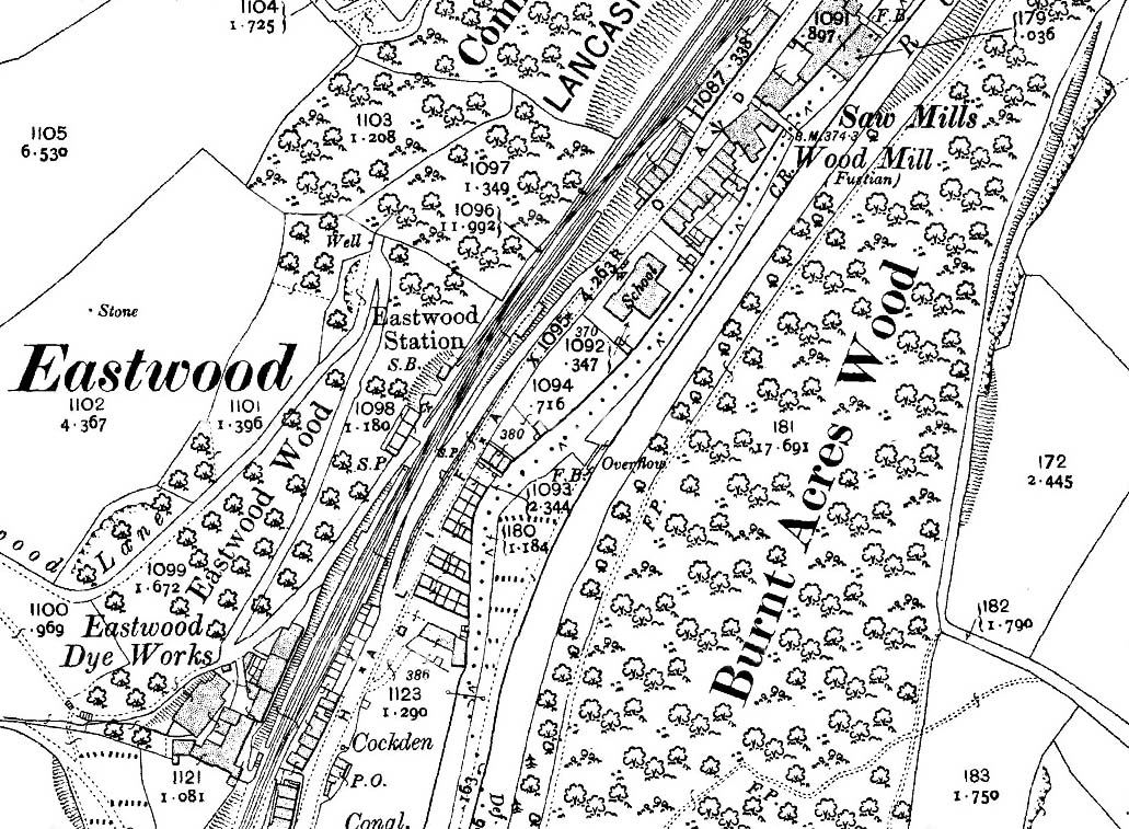 1907 1: 2,500 OS map. The River Calder, the Rochdale Canal, Halifax Road and the railway jostle for space in the deep, narrow valley at Eastwood between Todmorden and Hebden Bridge. Industrial housing, some of it back-to-back, is also squeezed in, together with a school, an independent chapel, a dye works and a moleskin finishing mill. Eastwood station is perched on a valley-side ledge; its main building (west of the tracks) backs directly onto a sheer rock face, and the platforms are staggered either side of the level crossing on Eastwood Lane, a narrow track that zigzags its way up the slope, serving the dye works as it heads for the moors. Despite the constraints of the site, space has been found for goods sidings north-east of the station, and a loop is installed opposite the
Leeds-bound platform.
|
 Home Page