
Station Name: EMBLETON
[Source: Alan Young]
Embleton Station Gallery 2: c1964 - 2018
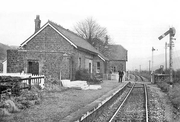
The view eastwards from an up train passing through the disused Embleton station c1964. A railwayman at the far end of the platform is ready to exchange single-line tokens with the driver.
Photo
from John Mann collection
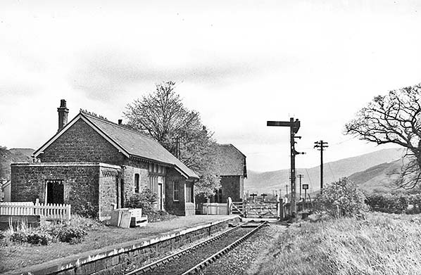
The railway through Embleton closed in April 1966 and this is how the station looks in the following month. Embleton closed to all traffic in 1958 but remained in use by railway staff who operated the signals and crossing gates.
Copyright photo by John Alsop
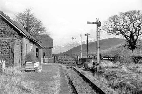
Embleton station is seen here in 1967, the year after all traffic ceased on the Keswick, Cockermouth and Workington line. The station is still intact and the crossing gates and signals are in place, but the trackbed and platform are looking neglected. A dusting of snow on Skiddaw, about six miles away, adds drama to the sombre scene.
Photo courtesy of Cumbrian Railway Association
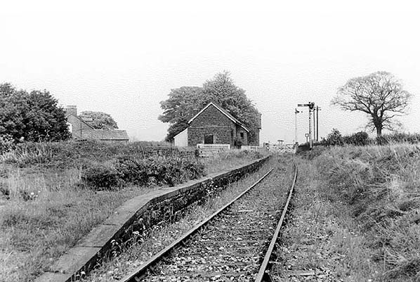 Embleton station looking east towards the level crossing in 1968, two years after closure. The track is now getting overgrown. The next train to arrive at the station would be the demolition train. Embleton station looking east towards the level crossing in 1968, two years after closure. The track is now getting overgrown. The next train to arrive at the station would be the demolition train.
Photo courtesy of Cumbrian Railway Association
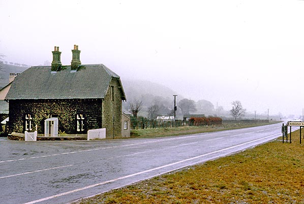
The closure of the railway west of Keswick enabled the A66 trunk road to be thrust across the Lake District providing Workington and Whitehaven with much improved road access from other parts of Great Britain. The trackbed past Bassenthwaite Lake was adopted for the road, and here at Embleton it follows the route of the former railway. All that remains of Embleton station on 12 April 1977 is the former stationmaster’s house which stood apart from the rest of the station to the east of the level crossing. The ‘Embleton ¼’ sign points to the road which passed over the level crossing.
Photo by Alan Young
Embleton stationmaster's house looking east along the trackbed, now the A66 in September 1991.
Photo
by Ben Brooksbank
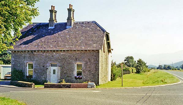
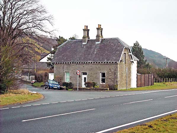
Embleton stationmaster’s house is seen on 9 May 2009, looking north-east. The building has been extended eastwards since 1977 (above). Although the scenery in this locality is far less spectacular than along the stretch of the CK&P at Bassenthwaite Lake and beyond, Embleton is enclosed by uplands to the north and south. Elva Hill (788ft) is seen on the horizon, whilst the peaks of Thornthwaite Forest, exceeding 1,000ft are behind the camera.
Photo
by Roy Lambeth
The stationmaster’s house at Embleton on 9 May 2009, looking east.
Photo
by Roy Lambeth
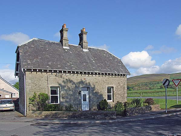
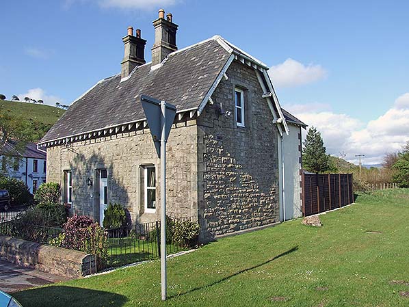
Embleton stationmaster’s house, looking north-east across the A66 road on 24 January 2010. This is all that remains of the former station; the passenger and goods facilities were all to the west (left) of the road which leads into Embleton village.
Photo by Alan Young
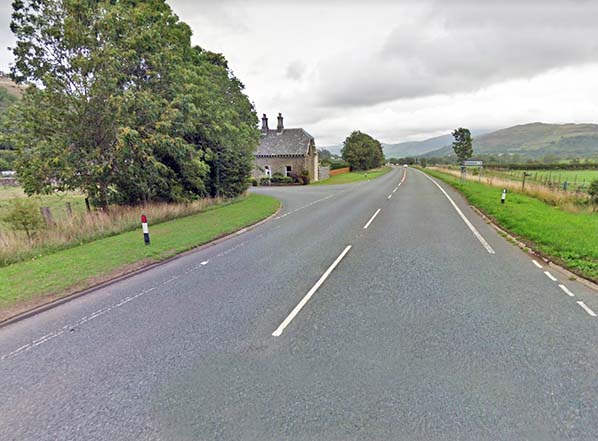
Looking east along the course of the Cockermouth - Penrith line, now the A66 road, in 2018. The stationmaster's house is seen on the left with the site of the level crossing immediately west of the house. The verge on the left occupies the site of the track with the trees on the site of the station.
Photo
by Wes Carthy
| Last
updated: |
© 1998-2019 Disused Stations
| |

 Home Page