
CATLOW QUARRIES[Source: Alan Young]
Catlow Quarries Gallery 3 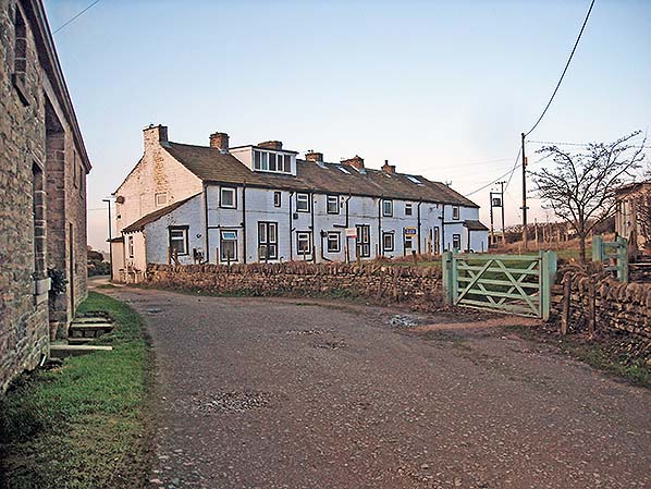
Catlow Row is seen here in December 2016, looking west. The census of 1891 records quarrymen living in all but one of the cottages which are located close to the southern edge of the abandoned
Catlow Quarries. Photo by Alan Young 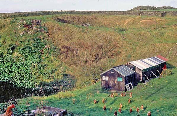
In September 1992 the northern end of the disused Catlow Quarries, east of Southfield Lane, is in use for keeping poultry, as well as for some informal tipping of rubbish. The henhouses have now been removed and the fringes of the quarry have been planted with native trees and shrubs to attract a range of wildlife.
Photo by Alan Young 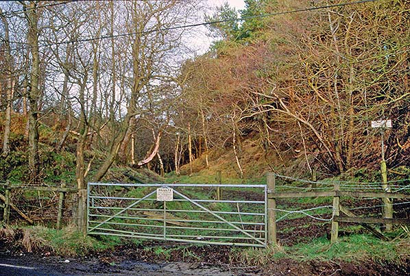
The former entrance to the eastern section of Catlow Quarries is seen here in January 2005. The OS map of 1891 appears to show the two tracks seen here. Until the early years of the twentieth century a blacksmith’s business was located on Southfield Lane, just to the right of the entrance. Much of the former quarry east of Southfield Lane, in council ownership, has been planted with conifers but with a deciduous screen, as seen in the foreground. At the time of this photograph a planning application had been made to develop a holiday village in the disused quarries on both sides of Southfield Lane.
Photo by Alan Young 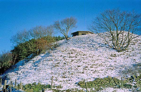 In World War 2 the recently-closed Catlow Quarries were used for Home Guard training and this ‘pill box’ lookout post was established on the bluff at the southern end of the quarries, east of Southfield Lane from which this photo was taken on 25 February 2001. Much of this section of the quarries was planted with conifers as can be seen on the horizon. In 1902 Nelson Corporation built a smallpox isolation hospital in the field off the photo to the right; nothing remains of it.
Photo by Alan Young 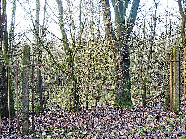
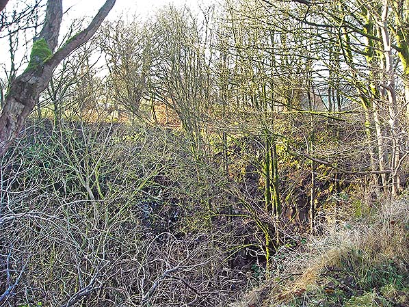
The western section of Catlow Quarries looking west from Southfield lane in December 2016. The woodland was established in the 1980s.
Photo
by Alan Young
The abandoned Catlow Quarries, looking south-west from the lane to Southfield chapel
in December 2016. Photo by Alan Young 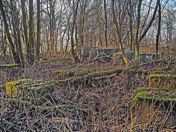
Following an accident in the late 1940s when a young girl fell from a crane in the abandoned quarries the local council ordered the demolition of all remaining structures. Located outside the quarries themselves, the office survives next to Mount Pleasant cottages. In the eastern section these stone blocks which supported a steam-operated stone saw are still in position. The photo was taken in December 2016.
Photo by Alan Young 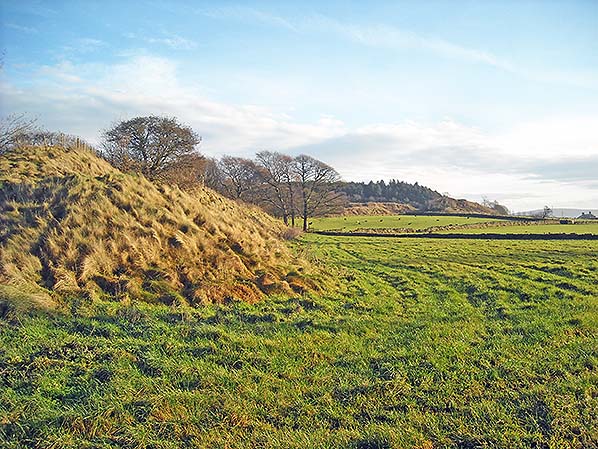 Looking east across Cricket Field, south of the abandoned Catlow Quarries, their extent can be seen in this photo of December 2016. The spoil heap in the foreground lies south of Southfield House; the eastern section of the quarry beyond Southfield Lane is identified by the distant coniferous plantation. The name of the field in the foreground recalls that in the eighteenth century pleasure grounds were laid out around Southfield House.
Photo by Alan Young 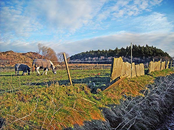
On the southern fringe of Catlow Quarries Nelson Corporation opened a scarlet fever isolation hospital after World War 1; it was about 300yd west of the existing smallpox hospital. The fever hospital stood on the field to the left where the horses are grazing, and nothing remains of it in December 2016, the date of this photograph. Spoil from the abandoned quarry west of Southfield Lane is seen far left and the coniferous plantation ahead is in the section east of the lane. The use of flagstones for walling will be noted; Catlow Quarries produced both massive and flag sandstone.
Photo
by Alan Young
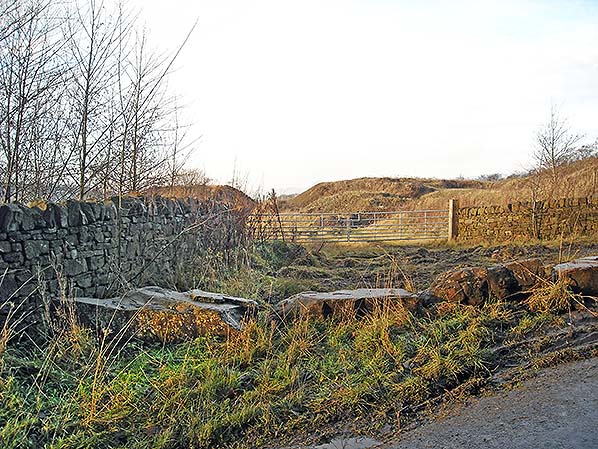
Despite the Conservation Area designation of much of Southfield and Catlow in 2003, a planning application was lodged in 2005 for a holiday village with over 120 timber chalets and other facilities in the former Catlow Quarries. The project was scaled down to affect only an area west of Southfield Lane at the southern end of the quarries, and ground preparation was undertaken. The entrance to the empty site is seen here, looking west from Southfield Lane in December 2016. Presumably the huge stones preventing unauthorised access to the site came from this quarry.
Photo by Alan Young 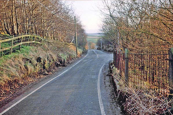
Looking south along Southfield Lane towards Catlow in January 2005. This photo was taken in anticipation of major changes to the landscape in the light of plans for a holiday village which have not happened. The layby on the right corresponds to the point where the lane left for Southfield Chapel and Southfield House. This well-wooded scene would have been very different a century ago, with no trees, but active quarries on both sides of Southfield Lane and a blacksmith’s about 100yd ahead with premises on both sides of the lane.
Photo by Alan Young 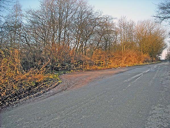 Southfield Lane, looking north-west in December 2016. The layby to the left is the point where the lane left for Southfield Chapel and Southfield House. The lane was diverted c1900 to enable quarrying to take place across its route.
Photo by Alan Young 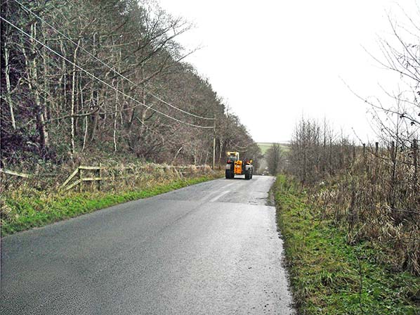
Southfield Lane looking south in December 2016 between the abandoned Catlow Quarries. A blacksmith’s workshop and stores were located here on both sides of the road, but nothing remains of them. The holiday village development is planned for the area ahead to the right of the road, and a belt of deciduous trees has been planted to screen it.
Photo
by Alan Young
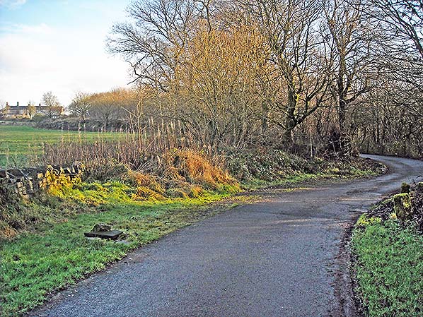 Looking up the lane from the hamlet of Southfield Chapel and Southfield House towards Mount Pleasant (left, horizon) in December 2016. This lane was twice diverted to enable the expansion of the eastern section of Catlow Quarries. The sudden north-west swerve (from which this photo is taken) and more pronounced ‘S’ bend where it enters the hamlet were made c1914, and the original route ahead towards Southfield Lane was diverted along the course of an existing footpath towards Mount Pleasant sometime between 1891 and 1912, according to map evidence.
Photo by Alan Young
 Home Page Home Page
|
