
COPY PIT SUMMIT AND THE COLLIERIES FORMERLY SERVED BY THE COPY PIT ROUTE [Source: Alan Young] 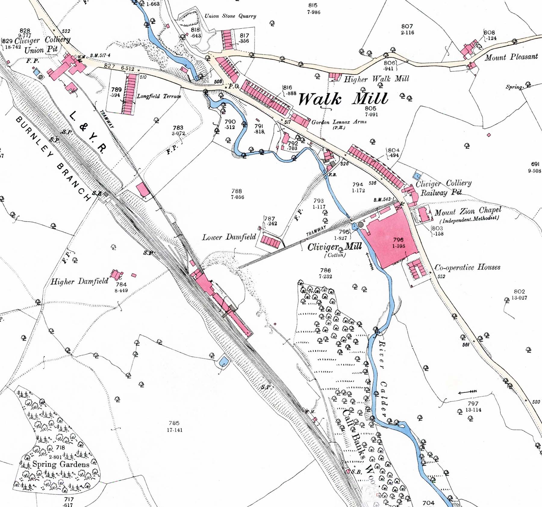 1893 OS 1: 2,500 map. Cliviger is a large parish in east Lancashire, and its name was used by the company that operated several coal mines. Two of the mines appear on this map at either end of the Cliviger village of Walk Mill which straggles along the Burnley-Todmorden road. The coals produced in Railway Pit and Union Pit are conveyed by tramways to the reception sidings with associated coke ovens on the up side of the railway between Towneley and Holme stations. Railway Pit would close in 1938 and Union Pit in 1943. 1893 OS 1: 2,500 map. Cliviger is a large parish in east Lancashire, and its name was used by the company that operated several coal mines. Two of the mines appear on this map at either end of the Cliviger village of Walk Mill which straggles along the Burnley-Todmorden road. The coals produced in Railway Pit and Union Pit are conveyed by tramways to the reception sidings with associated coke ovens on the up side of the railway between Towneley and Holme stations. Railway Pit would close in 1938 and Union Pit in 1943.
|
 Home Page