
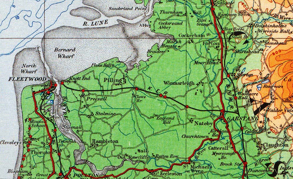
[Source: Paul Wright] The Knott End branch shown an an OS quarter-inch scale mao from circa 1920. The map shows all of the stations/halts that were open at that time. Two addition halts opened after this map was produced (Carr Lane - 1920 and Garstang Road - 1923). Map from the Alan Young collection
 Source: Paul Wright  Home Page Home Page
|