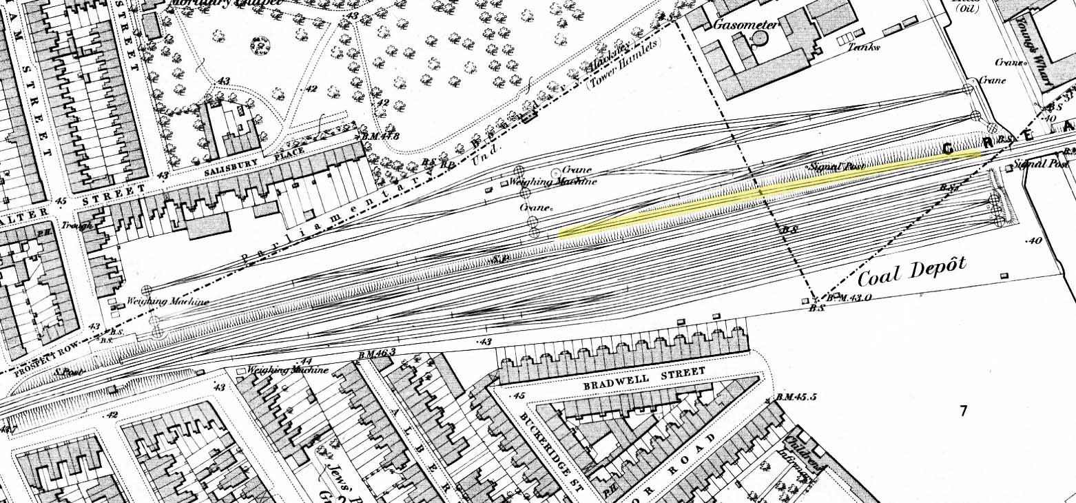
1876 1:2,500 OS map. This map shows the original layout of the Devonshire Street goods yard before the yard expanded onto the south side of the viaduct. At this time Globe Road and Devonshire Street station had not been built and the viaduct was yet to be widened. The steep incline trailing in from the down line is highlighted in yellow. Small turntables for moving wagons around the yard are shown at both ends of the lower yard and in the centre. At the east end of the yard a siding runs alongside the Regents Canal for transhipment of goods between the canal and railway. Two cranes are shown in the centre of the lower yard with another alongside the Regents Canal. Wagon turntables are also seen at the east end of the upper yards. The upper yard comprised a series of coal drops with the coal depot located beneath the viaduct. There was no direct rail access to the depot with coal being transferred to road vehicles. Access to the lower yard was at the end of Warley Street and access to the coal depot was at the north end of Bancroft Road. Weighbridges are shown at both entrances. A signal box is shown but not named at the west end of the yard on the up side.

 Home Page