
Station Name: GRANGE COURT JUNCTION[Source: Darren Kitson]
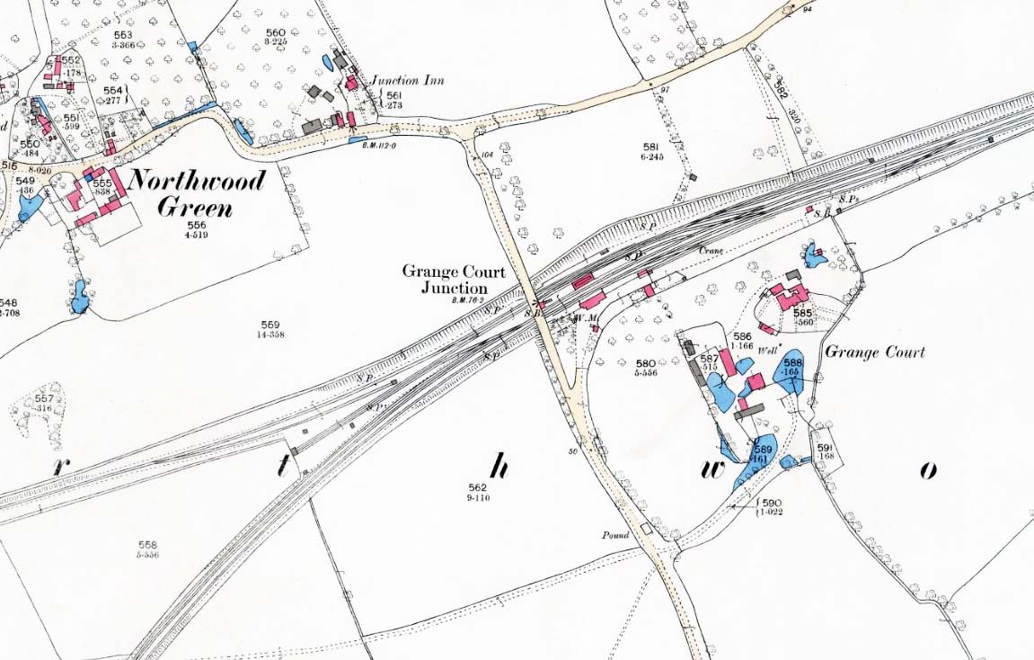 The OS 6in map surveyed in 1879 shows Northwood Green as a mere scattering of houses and cottages amongst woodland. The Junction Inn can be seen at its then location north of the railway. Grange Court, after which the station was named, can be seen right of centre. The Up Hereford line platform and loop had yet to appear as had any form of buildings in the 'V' formed by the divergence of routes. The original East and West signal boxes may be seen. Note at the entrance to the goods yard a weighing machine and hut are indicated, features which would later disappear. The mileage, 121 from London, was and still is via Swindon and Stonehouse.
|
 Home Page