
Station Name: HYTHE (Kent)[Source:
Nick Catford and Brian Hart]
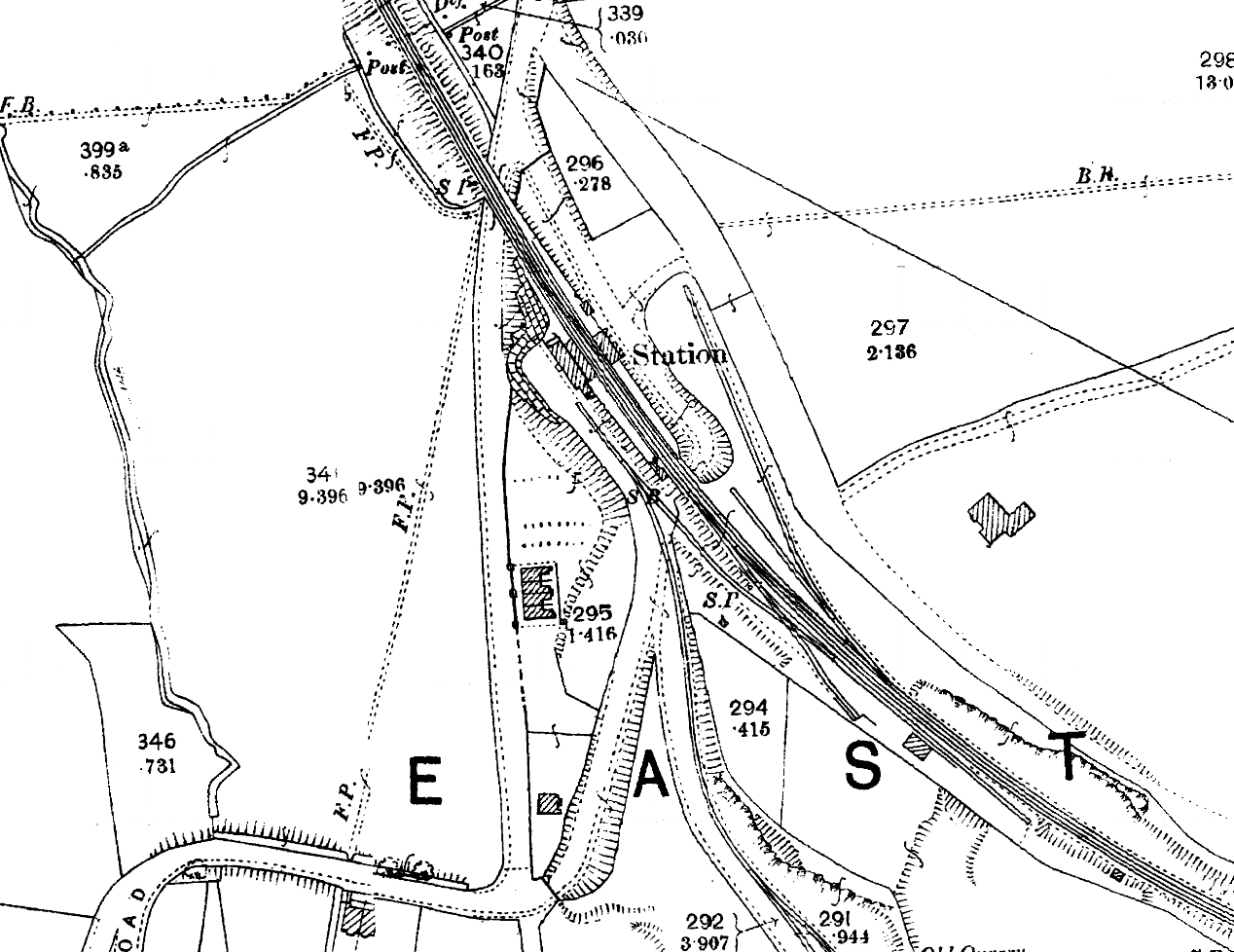
1898 1:2,500 OS Map. The station is sited on a flat areas excavated in the side of the hill. The retaining wall is seen to the west of the station. The station approach road passes under the line to the east of the station with direct access to both platforms. Sidings are seen on both sides of the line. The coal yard is on the down side with the livestock dock at the end of the long siding on the up side. The signal box is seen on the up side north of the approach road bridge. The small yard crane is seen between the two sidings on the down side. The roader shed is seen on the up platform just north of the shelter. The Hythe & Sandgate tramway is seen running south from the station forecourt with a direct connection to the Sandgate branch in the up side yard.
|
 Home Page