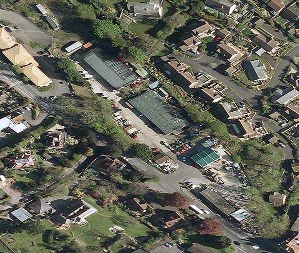
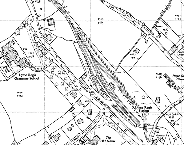
Recent aerial view showing the site of the station and goods yard; compare with the 1958 map below. The two houses built at different angles on the map can be seen on the north side of Penny Plot and to the left of the photo. The station building was opposite the end of Penny Plot.

 Home
Page
Home
Page