Notes: Brunel's broad gauge Great Western Railway joining London and Bristol opened in stages between 1838 and 1840. Between 1854 and 1875 the line was supplemented with a third rail for dual gauge operation allowing standard gauge trains to also operate on the route.
The first Maidenhead station (sometimes referred to as Maidenhead Riverside) opened with the first stage of the line on 4 June 1838. It was located a mile from the town centre and west of the Dumb Bell skew bridge over the Bath Road. The location was chosen to provide easy interchange between the railway and the busy coach route between London and the West Country and it was quickly well used for that purpose. Brunel's Maidenhead Bridge over the Thames although completed in 1838 did not come into use until July 1939, so for its first year Maidenhead was a temporary terminus. The GWR quickly realised that the station was too far from the town centre and and, in August 1838, it was planned to construct a new station closer to the town as soon as the line had been extended. This didn't however happen until 1871 and in the meantime, the Wycombe Railway opened its own Maidenhead station much closer to the town centre. The GWR's Maidenhead station was renamed Maidenhead and Taplow in August 1854.
 The Wycombe Railway Company was incorporated by an act of Parliament passed in 1846. The act authorised the construction of a single line from the Great Western Railway's Maidenhead station to Aylesbury via High Wycombe. In 1852 construction started; the first section to be built was between Maidenhead and High Wycombe, and this opened for passenger services on 1 August 1854. It linked the town of High Wycombe with the Great Western Main Line, and the Great Western Railway operated the services for the Wycombe Railway company. As the GWR had been built to Isambard Kingdom Brunel's broad gauge, so the Wycombe Railway was also built to this gauge. Stations were provided at Maidenhead, Cookham, Bourne End, Wooburn Green, Loudwater and High Wycombe, all stations opening with the line. The Wycombe Railway Company was incorporated by an act of Parliament passed in 1846. The act authorised the construction of a single line from the Great Western Railway's Maidenhead station to Aylesbury via High Wycombe. In 1852 construction started; the first section to be built was between Maidenhead and High Wycombe, and this opened for passenger services on 1 August 1854. It linked the town of High Wycombe with the Great Western Main Line, and the Great Western Railway operated the services for the Wycombe Railway company. As the GWR had been built to Isambard Kingdom Brunel's broad gauge, so the Wycombe Railway was also built to this gauge. Stations were provided at Maidenhead, Cookham, Bourne End, Wooburn Green, Loudwater and High Wycombe, all stations opening with the line.
In 1862, the Wycombe Railway opened an extension from High Wycombe via Princes Risborough to Thame. In 1863, it opened a branch line from Princes Risborough to Aylesbury. In 1864, it opened an extension from Thame to Kennington Junction on the GWR line between Didcot and Oxford, thus finally completing its route to Oxford.
The GWR took over the Wycombe Railway Company in 1867 and converted the entire line to standard gauge in one week, between 23 August and 1 September 1870. The Risborough to Aylesbury section was converted to standard gauge two years earlier in 1868, the first line in England to be converted.
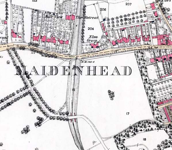
 The station at Maidenhead was initially known as Maidenhead (Wycombe Branch) up to c1866 after which it was named Maidenhead Boyne Hill. The station was actually located on the south side of Castle Hill (the Bath Road) in the western part of the town which was known as Boyne Hill. Maidenhead & Taplow station was renamed Taplow on 1 May 1869 to avoid confusion with the Wycombe Railway's station. The station at Maidenhead was initially known as Maidenhead (Wycombe Branch) up to c1866 after which it was named Maidenhead Boyne Hill. The station was actually located on the south side of Castle Hill (the Bath Road) in the western part of the town which was known as Boyne Hill. Maidenhead & Taplow station was renamed Taplow on 1 May 1869 to avoid confusion with the Wycombe Railway's station.
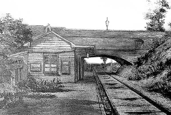
The station had a long wide platform on the west side of the line stretching between Castle Hill and Grenfell Road to the south. It is claimed that access to the station was through two arches in the side of the bridge with the booking office being located beneath the bridge. There is no evidence to confirm this.
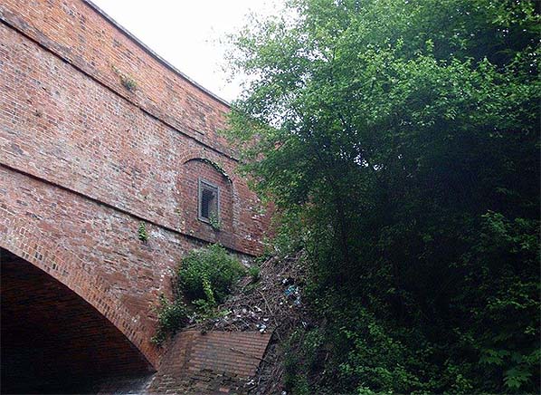
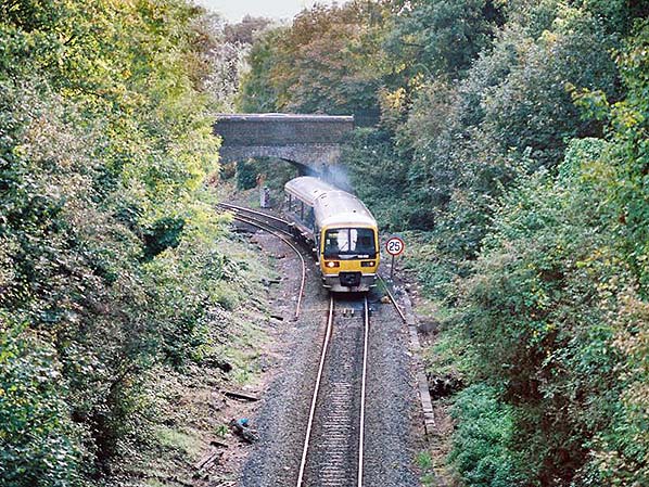
The brick bridge is unusual being two parallel bridges at different levels. The lower level is used for road vehicles and the higher level which has the arches in the side is used for pedestrians. There are also arches on the railway side of the bridge. It is said that steps led from the arches to the platform but there are two arches, one on either side of the line, and only one platform.
The GWR open its new station on the main line on 1 November 1871, it was initially called Maidenhead Junction. Maidenhead Boyne Hill closed on the same day. Maidenhead & Taplow station closed less than a year later on 1 September 1872, when a new Taplow station was opened 1⁄4 mile to the east.
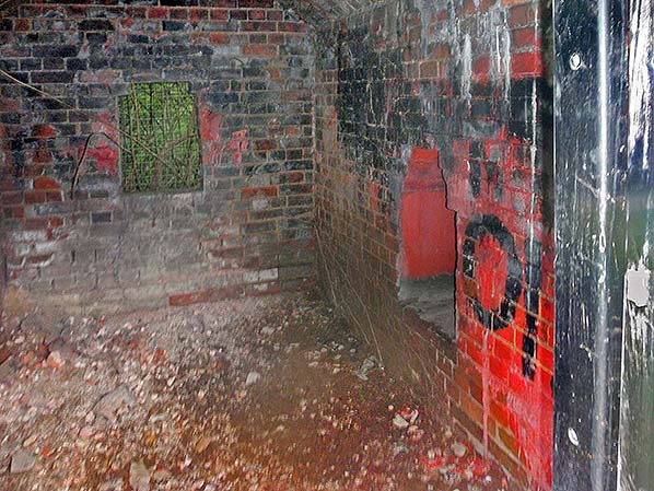
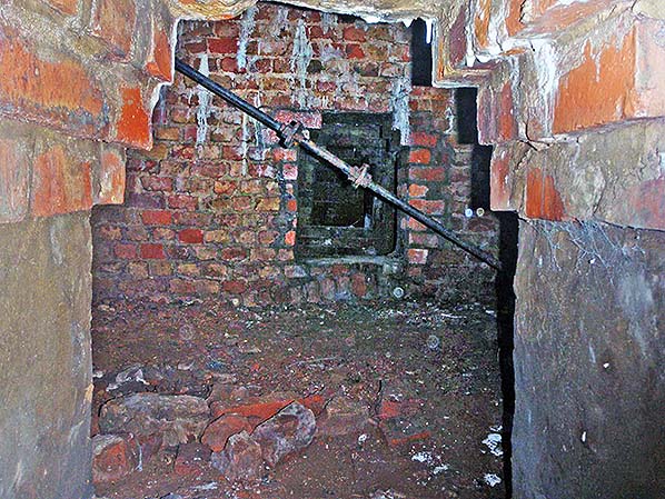
Although there is no trace of Boyne Hill station at track level the mysterious vaults beneath the pedestrian bridge still exist and the two arches, one bricked up and the other with a wooden door can be seen in the side of the bridge. The vaults were opened for an engineers inspection in 2015 and 2016. The bridge consists of a series of vaults along Castle Hill, below the footway and across the railway bridge. There are nine vaults in total, with the two end ones being the arches which were blocked up and are visible from the roadside and from the railway; within these two, there are small openings on the railway side of the bridge. Two of the other seven vaults are completely sealed. At some point in the past minor repairs have been carried out which included installing supporting bars and creating holes between the vaults to allow access to them all. The headroom in the vaults does not appear sufficient for passenger use and it seems likely they had no connection with the station.
Tickets from Michael Stewart & Godfrey Croughton
SOURCES:
|

boyne_hill3.jpg)
boyne_hill1.jpg)

 Home Page