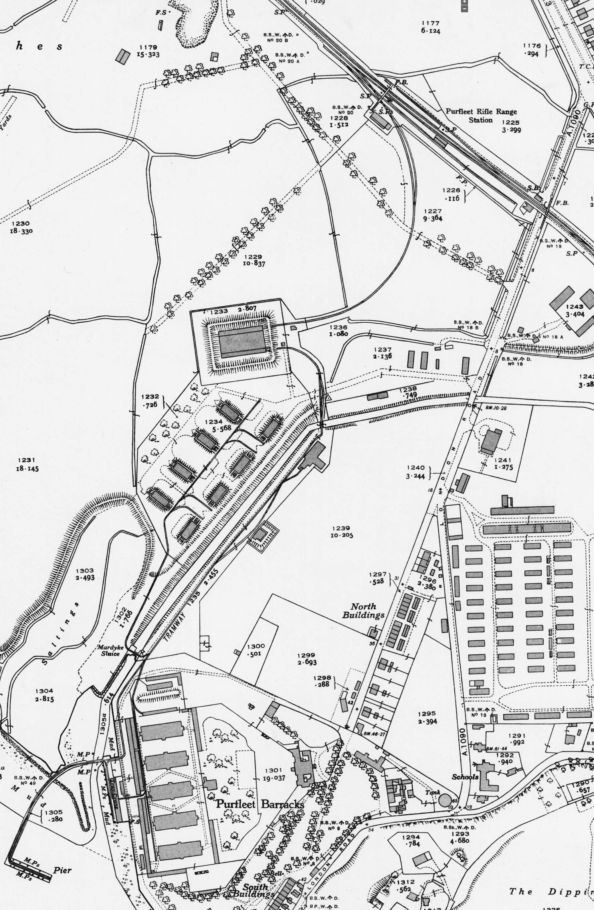
1947 1:2,500 OS map. The staggered platforms of Purfleet Rifke Range station are clearly seen as is the shelter on the island platform. There is a footbridge at the level crossing and another wider footbridge at the north end of the up platform spanning the platfims and the spur into the cordite store. Steps are seen down to each platform and a thirds stairway gives access to the rifle range. The building close to the steps probably includes a ticket office. A standard gauge spur with a passing loop curves round to enter the cordite store. A narrow gauge line from the store runs south towards the River Thames. It passes the eight magazines of the WW2 EAM, each magazine having rail access. On the approach to the five gunpowder magazines the line splits, one line serving the magazine while the other runs onto a jetty on the River Thames. A branch from this lines also runs along a riverside quay with a travelling crane.

 Home Page