
Station Name: SANDGATE[Source:
Nick Catford and Brian Hart]
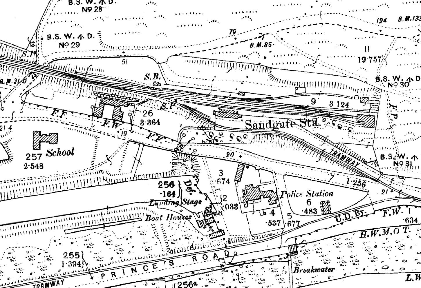
1898 1:2,500 OS map. Sidings are shown on both sides of the station. The main goods yard was on the down (north) side and comprised the down platform road with sidings at either end of the platform. A small goods shed is seen on the platform opposite the station building. The coal yard was on the down side to the east of the platform with the coal bins above and to the left of the figure'9'. The building at the end of that siding is the stable block. The signal box is seen at the west end of the down platform. On the down side there are two short sidings, one has been extended along the approach road to join the Hythe and Sandgate Tramway. A flight of steps are seen leading up to the station forecourt from Seabrook Road; these were built in October 1884 for the benefit of passengers arriving from the west. The large building at the end of the line to the east is the engine shed. The road running north of the station is Military Road (now Hospital Hill) which leads to Shorncliffe Camp. The terminal basin of the Royal Military Canal is seen to the south of the station.
|
