
Station Name: SHAWCLOUGH & HEALEY[Source:
Alan Young]
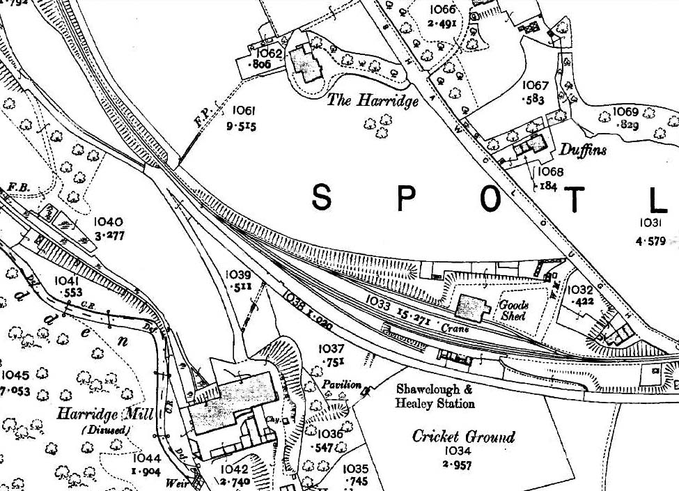
1910 1: 2,500 OS map. The platform of Shawclough & Healey station is south of the running line (on the down side). The station building on this platform is shown with its internal divisions, and immediately west is the signal box, which also stands on the platform. Shawclough & Healey station signal box, which was on the platform just west of the building (and shown on an 1893 OS map) closed in 1899 and has been removed. The neighbouring Harridge woollen mill has closed. Three loop lines face the platform, one of them passing though the goods warehouse. A crane is shown, as is a weigh office (WM=weighing machine) at the north-east corner of the goods yard. A siding extends behind the western half of the platform. The station cottages are marked, but not named, on a short cul-de-sac off Shawclough Road, east of the station. These are older than the station and are shown on the 1851 map as ‘Swinerootings’. West of the station is Harridge Mill, notable as a woollen mill in a county where the cotton industry was dominant. A cricket ground occupies the field directly south of the station. Presumably visiting cricket teams use the station, and another sporting association is with Rochdale Football Club whose ground is within easy walking distance; Shawclough & Healey station is a busy place on winter Saturday afternoons.
|
 Home Page