
Station Name: SHAWFORTH[Source:
Alan Young]
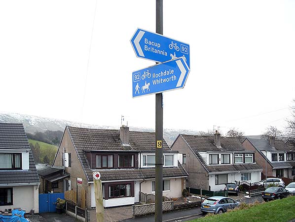
For much of the length of the former Rochdale–Bacup railway a recreational path now follows the route. The sign directs to places connected by the old railway. This view, looking east in January 2016, emphasises the steep gradient of the railway. The photographer is standing on the site of the double-track ‘running lines’ and the coal yard sidings were formerly ahead, at a lower level , where the houses now stand– the steep 1 in 40 gradient of the running lines from the station is preserved in the topography of the ground here. The station was off the picture, only 100-200yd to the right, at which point the siding to the coal yard and the running lines were at the same altitude.
Photo by Alan Young
|
 Home Page