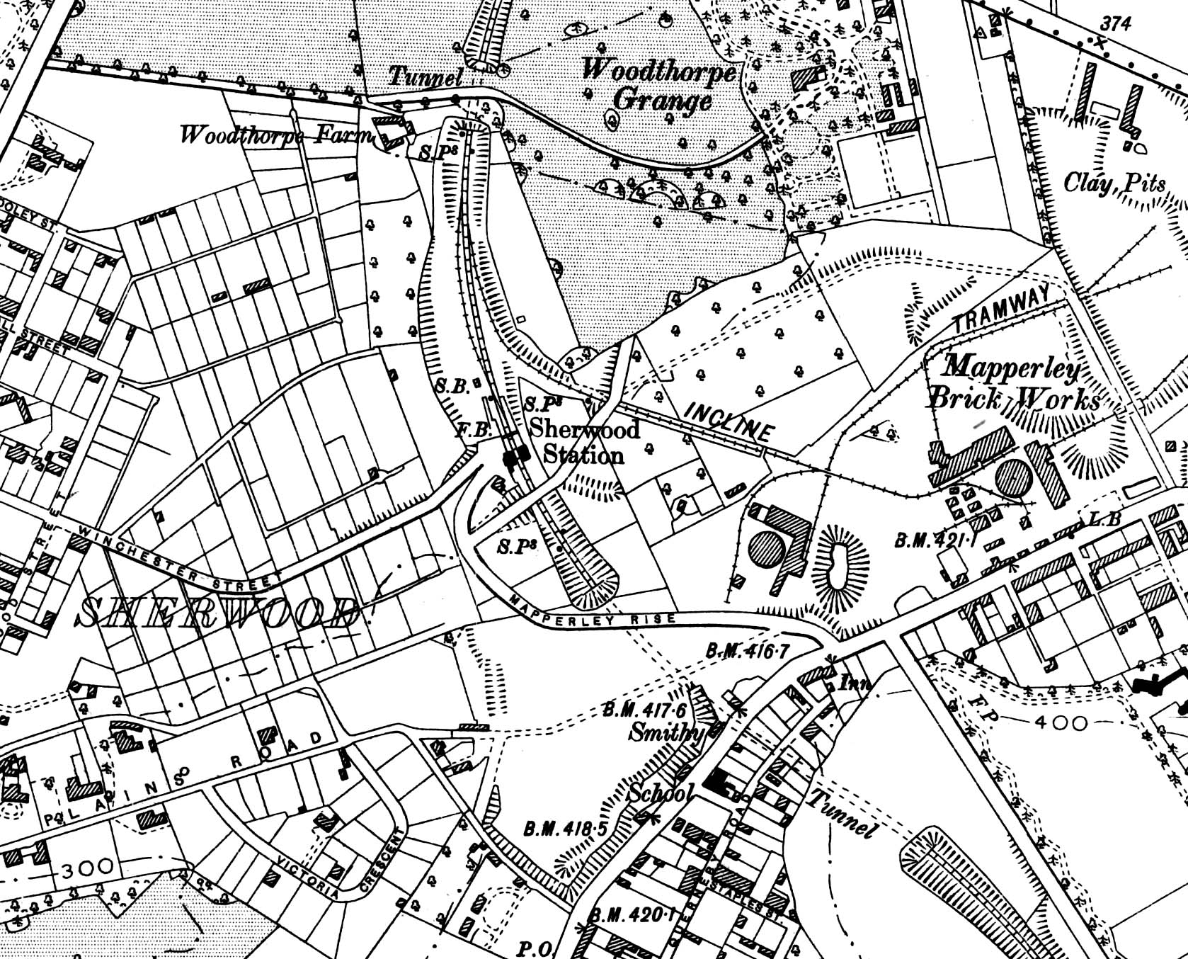
1901 1: 10,560 (6") map showing Sherwood station and the surrounding area. Sherwood Tunnel is seen to the south with the 70yd Ashwell's Tunnel to the north. Note the cart track to Woodthorpe Grange above the tunnel; this is the reason why a tunnel was required rather than a cutting. A rope-worked incline to the north of the station served the Mapperley Brickworks of the Nottingham Patent Brick Company. To the south of the station, on the down side, another siding ran into the Nottingham Builders' Brick Company works.

 Home Page