
ST. HELIER ESTATE RAILWAY[Source: Nick Catford] The St Helier estate was built between 1928 and 1936 (the main building work being done between 1929 - 1934) by the London County Council for the re-housing of people from decaying inner London areas. The area chosen south of Mitcham and west of the River Wandle, was then part of the Urban Districts of Merton and Morden; Carshalton; and Sutton and Cheam. It was the largest of the L.C.C. estates south of the Thames, and the second largest overall. Its development was spurred by the opening of Morden Underground station in 1926 and the Wimbledon to Sutton railway line in 1930, with a station at St Helier. These services provided rapid links into central London for the residents. 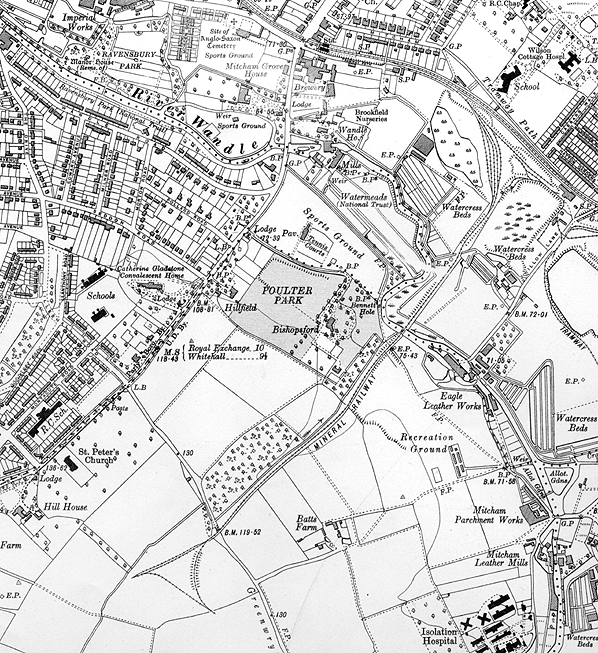 1932 6" Ordnance Survey map showing the St. Helier Estate railway. Click here to see a large 1:2,500 version of this map from 1935.
The estate was named in honour of Lady St. Helier, who was an LCC Alderman from 1910 to 1927 who had fought hard for the improvement of housing facilities in London, but who died in 1931 before the estate was completed. (St. Helier, Jersey, objected that the name would cause confusion, and suggested Jeuneville instead - Lady St. Helier was formerly Lady Mary Jeune.) It was the second largest (after the Becontree-Dagenham estate) of a series of overspill estates and was based on the Garden City ideas of Sir Ebenezer Howard, founder of Letchworth and Welwyn Garden City; preserving as many as possible of the existing trees and natural features and including many open spaces and sports and recreation grounds. It was hoped that greens, gardens, and shrubberies, backed by houses with bays and gables, would make the roads visually interesting and diverse. To this end 120 acres, more than an eighth of the site, were kept as open spaces. The area had previously consisted largely of lavender fields, the last remnants of the famous Mitcham lavender industry, the estate brining this local industry to an end. 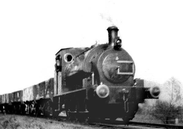
A rare view of one of the 0-6-0ST's at work on the St. Helier Estate Railway in about 1930
Photo from I Gotheridge collection In remembrance of the area's historic ownership by Westminster Abbey, the roads are named in alphabetical order after Monasteries and Abbeys starting in the north-west with Aberconway Road and ending with Woburn Road in the south-east. The area was intended to function as a community, or a series of communities, and for this purpose eighteen schools, seven churches, two large pubs, and the 2,000-seater Gaumont cinema (now a bingo hall) were built. Shops were constructed too, sixty by 1938. There were 9,000 houses and flats, to accommodate 40,000 people. The huge St. Helier Hospital, a landmark for miles around, built near the top of Rose Hill, was opened in 1938. In 1943, John Major, later to be Prime Minister, was born there. 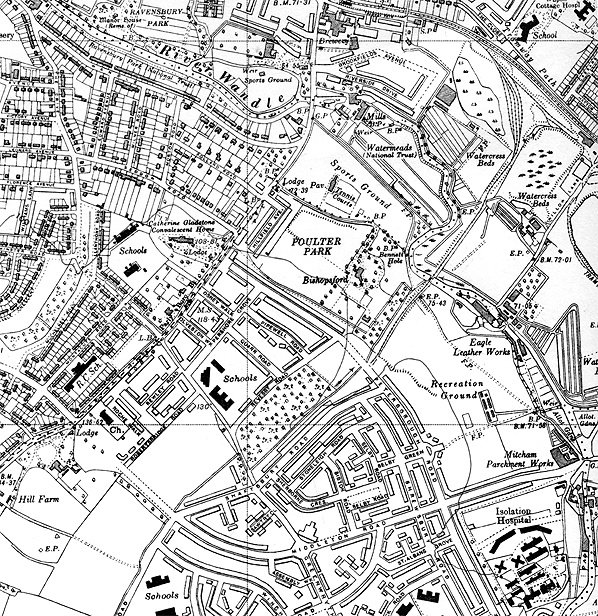
This 6" Ordnance Survey map from 1938 shows the line was cut back to Peterborough Road following the completion of the estate.
The estate comprised of around 825 acres of land and required its own private railway to deliver the necessary materials.The track was laid, using flat bottomed rail and cinder ballast, by the contractor C.J. Wills & Sons, and commenced from Hall’s siding, just east of Mitcham station. It then crossed the Wandle by a 30ft bridge and continued for about a mile before reaching a depot to the south of Green Wrythe Lane, where a triangular junction was located. One road of this was equipped with a weighbridge, whilst another had a coaling stage and a third was kept clear for traffic. The formation was uphill all the way from Mitcham and engines invariably attacked the grade chimney first. The formation was enclosed by tall chestnut fencing for much of its length and the numerous level crossings were equipped with proper gates. There were no signals or signal boxes, so the gates had to be opened and closed by the footplate staff. 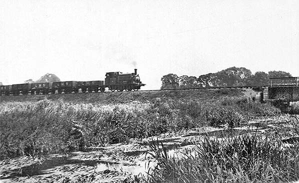 One of the Manning Wardle 0-6-OSTs pulling a rake of LMS wagons towards the bridge over the River Wandle.
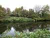
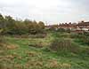
Photo from John Mann collection 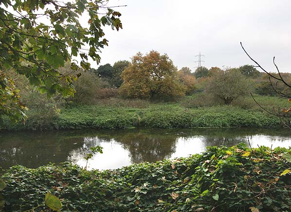 The site of the bridge over the River Wandle looking south from Bennetts Hole nature reserve in November 2007. The line continued to the left of the tree in the centre of the picture.
Photo by Nick Catford Six inside cylinder Manning Wardle 0-6-OSTs were employed on the line having previously worked on the Watling Estate near Edgware and each was named. The locomotives were called ‘Hendon’, ‘Partington’, ‘Limilicart’, ‘Woodcroft’, ‘Edgware’ and ‘Mermaid’. All these were painted in a shade of Tuscan red reminiscent to that used by the Furness Railway, with the exception of ‘Mermaid’, which was originally black, but later changed to dark green. All of these locomotives carried brass nameplates on their tank side, again with the exception of ‘Mermaid’, which was applied in paint. 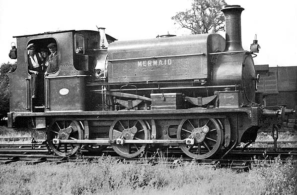 Manning Wardle saddle tank 'Mermaid' on 7th August 1935
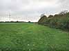
Photo by G Alliez The LCC provided rolling stock in the shape of dumb-buffered open wagons, and covered vans, but most of the building materials were conveyed in vehicles belonging to the main line companies. When not in service, the locomotives were kept, and maintained in a specially constructed shed at the depot, where they could also be turned by using the triangle. 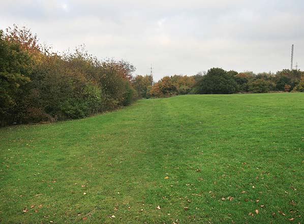 Looking north along the shallow cutting separating the two rugby grounds in November 2008
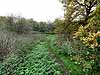
Photo by Nick Catford After completion of the estate in 1936 the line was cut back to Peterborough Road and is still shown on the 1947 1:25,000 Ordnance Survey map. Today there is little evidence of the railway. The northern section of the line almost to the River Wandle is lost under the Willow Lane industrial estate. A short stretch of the route on the north bank of the Wandle is within the Bennetts Hole nature reserve but there is no evidence of the line or of the bridge over the Wandle. On the south bank of the Wandle the course has not been developed and lies within a series of open spaces incorporated into the estate. A footpath follows the next sixty yards of the line which then passes on to the south side of a narrow wood separating the Pelhamanian Rugby Football Club from the Mitcham Rugby Union Football Club. Here the line runs in a shallow cutting, the only remaining earthwork along its course. Beyond the wood, the line crosses the south side of Poulter Park roughly on the line of an access road into the park. Form Peterborough Road the line ran a little to the north of Shaftsbury Avenue on what is still public open ground before crossing Green Wrythe Lane where the triangular junction and depot was sited on the south side of the road. The site of the junction is mainly lost under housing. Source: London Railway Record Volume12 Connor & Butler & London Borough of Sutton web site. Click on thumbnail to enlarge
|

 Home Page