
Station Name: STALEY & MILLBROOK
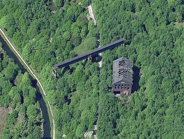 A recent aerial view of Staley & Millbrook station: north is towards the top of the image. The course of the Micklehurst Loop railway can be seen running from south to north through the woodland, and it is now a footpath. The derelict goods warehouse is seen to the east of the footpath, with many of the roofing slates missing and rafters exposed to the elements. A section of a disused overhead conveyor crosses the course of the railway just north of the warehouse; this was the means by which coal was taken from Millbrook Sidings – whose site was beyond the eastern edge of the photo - and across the canal (on the western edge) and River Tame to Hartshead Power Station which closed in 1979 and has been demolished.
| Last
updated: Friday, 26-May-2017 11:02:12 CEST |
© 1998-2015 Disused Stations
| |

 Home Page