
Totternhoe Quarries[Source:
Nick Catford]
Totternhoe Stone is a relatively hard chalk outcropping in the middle of the Lower Chalk in the Chiltern Hills in Hertfordshire, Buckinghamshire, Bedfordshire and Cambridgeshire. Geologically, it is located in the upper part of the Cenomanian stage of the Cretaceous.
centuries. Work at Windsor continued after that time (the light, porous stone was particularly suitable for vaults such as that of the treasury).
The Totternhoe Stone is underlain by the argillaceous Chalk Marl. Above is the less argillaceous Grey Chalk. The bed varies in thickness from 0.5 to 5 metres. The stone is khaki in colour and largely composed of fine shell debris which imparts a gritty texture. It often contains small brown pebbles and is appreciably harder than pure Chalk.. It forms a distinct escarpment at several locations at the base of the Chiltern ridge, notably at Totternhoe. 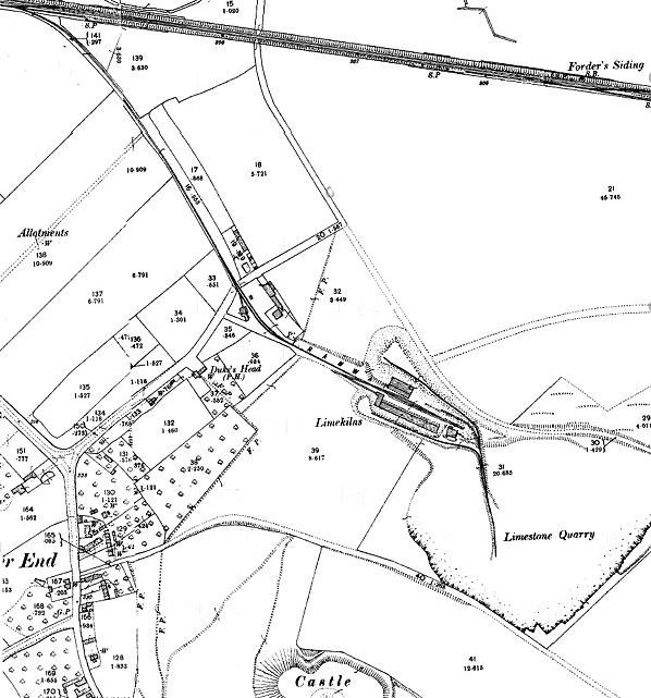 1901 1:2500 OS Map
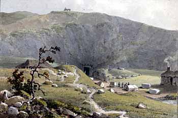
Over the centuries, the Totternhoe quarries have dramatically altered the landscape. Workers began by removing the overlying chalk to expose the Totternhoe Stone. As demand grew in the Middle Ages the workers started to mine the stone, driving adits (horizontal passages) into the hillside between Totternhoe and Sewell. The made ground east of the current quarry is the spoil from these adits. The Totternhoe Knolls Nature Reserve lies on the spoil from adits extending under Castle Hill. Local legend has the adits running 2 miles to Dunstable, but a quarry worker said in 1949 that the longest ran about 0.25 mile. The adits resembled a gallery supported by pillars of 'clunch' [chalk] varying in thickness from 18” to 6’, square or rectangular in section. The effect was of a maze or labyrinth in which it was extremely easy to become lost.
The underground quarries were last entered in the 1970s, and all the entrances are now lost. The Dunstable Caving Club succeeded in re-entering two of the underground quarries in 1972 and 1973, and the following information is taken from their Journal No.1 1973-4 and No. 2 1974. "At midnight on 16.12.72 Ian Kemp, Chalky (White) and Kevin X lifted a large steel and timber lid in a disused quarry at Sewell to reveal a stable shaft 9m deep and 1½ m in diameter. The first two made a descent and at the bottom a small hole gave access to a large chamber with several passages leading off. Most of these proved to be blocked by roof falls or walls of 'deads’ (waste rock left in the quarry). However on the right of the shaft, in one of the collapsed sections, a loose crawl led to a small drop into some lower workings. They than spent about two hours in exploring a series of very stable passages with a cross section averaging 3m X 2.5m. 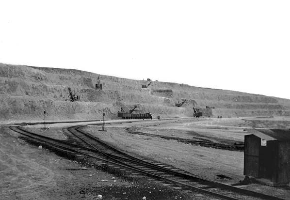 Totternhoe Quarry c.1957 On 6.1.73 a larger party, including members of the Derbyshire Caving Club, entered the mine, and several people became temporarily lost in the quite impressive labyrinth. Four carvings and a very interesting poem dated 16th November 1756 were found, as well as material left by the miners who were known locally as Carls
a small chamber, but the way on was blocked. However in the following week more digging broke into 28m of large passage which was named West Passage.
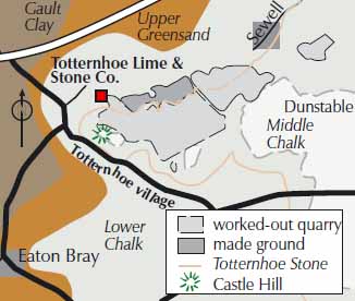
Shortly after this, the quarry owners withdrew their permission to explore, and the farmer at Hunger Hill Mine deliberately blocked the shaft. This is the position at the time of publication" In the 1980s Hunger Hill, which once stood east of Castle Hill, was completely quarried away for cement and lime. The worked-out quarry is now an arable field lying at the level of the upper surface of the Totternhoe stone. The area from where the medieval tunnels were dug is now designated a Site of Special Scientific Interest (SSSI) called Totternhoe Chalk Quarry, as an example of chalk grassland. It is managed as a nature reserve by the Wildlife Trust for Bedfordshire, Cambridgeshire, Northamptonshire and Peterborough. 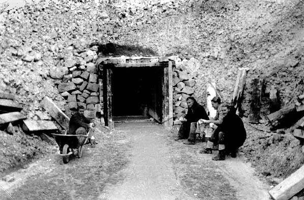
Totternhoe Quarry adit c.1957
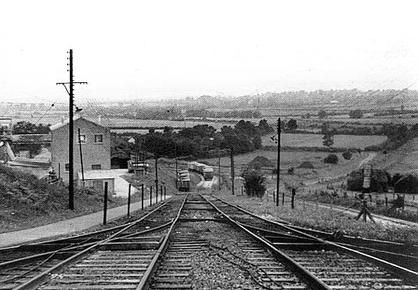
The quarries were connected to the Leighton Buzzard - Dunstable railway. Wagons of stone were lowered down a 1 in 10 rope-worked incline to exchange sidings alongside the Dunstable line. There was also an engine shed here. At times of peak production there were up to five trains a day with as many as 42 wagons per train. The wagons were bound for Long Itchington in Warwickshire where the chalk was used for the manufacture of cement. Rail transport ceased due to increased costs on 15th April 1965. In recent times the stone has been quarried in an area between the Knolls and the mines. This has been designated an SSSI called Totternhoe Stone Pit. The Stone is quarried by a family run business, H.G Clarke and Son. This was started in 1920 by Herbert G.Clarke. It was then passed to his son Stanley W.Clarke and is now being run by his son Angus J.Clarke. H.G Clarke and Son are the main suppliers of this rare English stone. Sources:
|
 Home Page