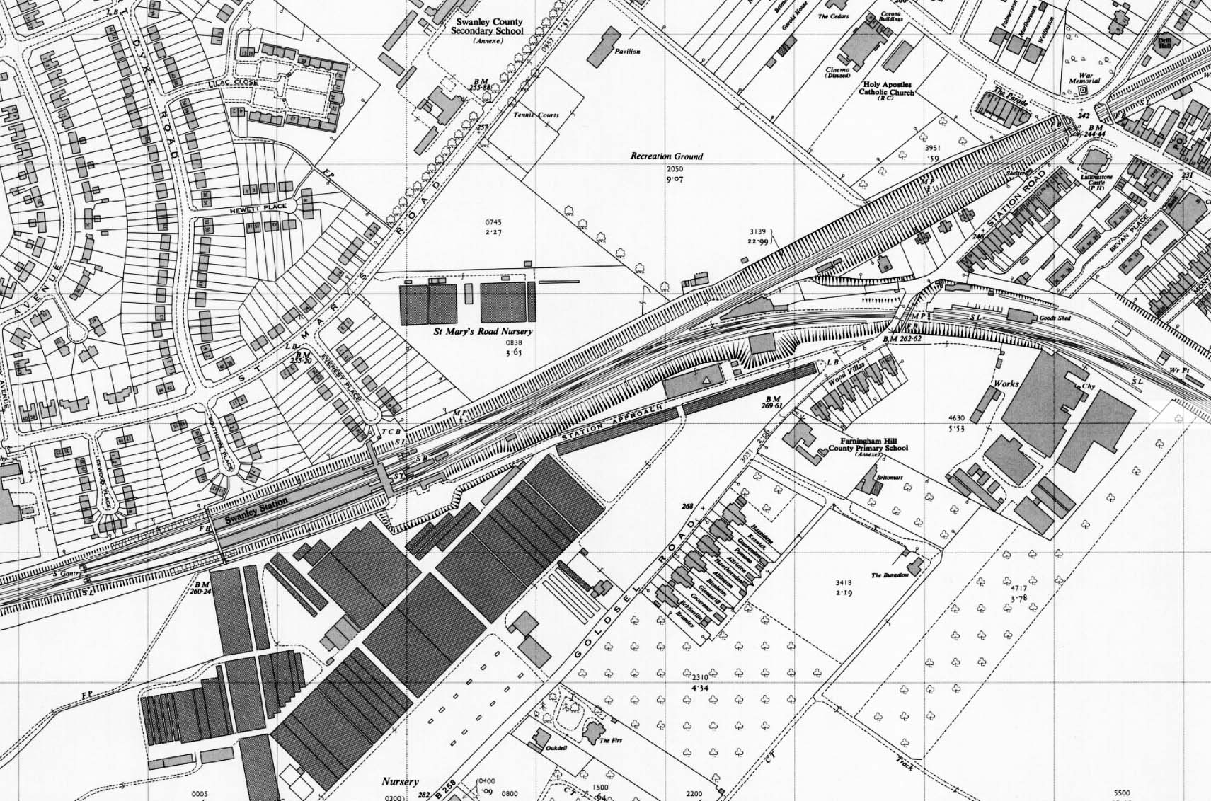
1962 1:2,500 OS Map. There has been further residential development to the north of the station. The High Street bridge has been widened and a footbridge has been added on both sides of the bridge. A third line has been added on the site of the branch up platform. One of the new sidings has now been removed. A watering point is shown at the goods station. The refuge siding and turntable on the up side of the branch have gone.


 Home Page