Station Name: THORNEYWOOD
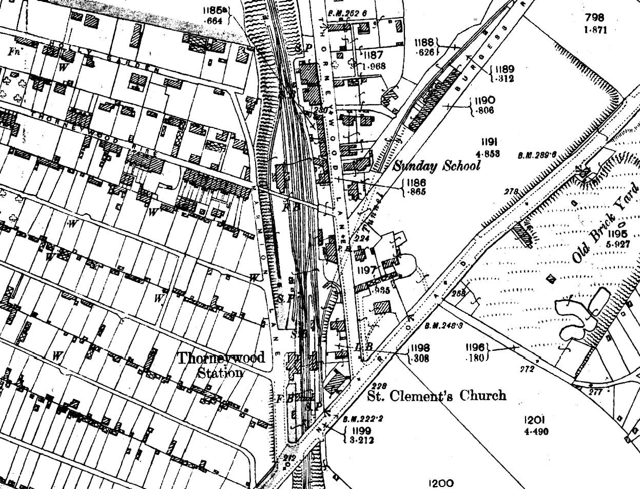 1912 1:2,500 OS map shows the layout of the station and goods yard. The station fronts directly onto Marmion Road. There are facing buildings on the two platforms with a footbridge spanning the line to the south. To the north, a public footbridge spans the cutting linking Marmion Road and Thorneywood Lane. The goods yard is on the down side to the north of the station with its entrance off Marmion Road just north of the station building. The yard comprises two loops, one passing under the canopy of a large goods shed. From these a short siding runs behind the north end of the down platform where there is a cattle dock. A weighbridge and office are seen just inside the entrance to the yard. The small building to the south of the main station building is a lamp room. An additional siding entered from the north loops around the western perimeter of the yard. There is also a loop on the up side; from this a rope-worked incline runs through a short tunnel under Thorneywood Lane and on to the Thorneywood Brickworks. All traffic movements around the station are controlled from two signal boxes: one is on the up platform just north of the waiting room, and the other is to the north of the goods yard on the up side. The stationmaster's house is the second (L-shaped) building along Thorneywood Lane on the left. The next building north is the Cooper's Arms public house..
| Last
updated: Friday, 26-May-2017 08:54:45 CEST |
© 1998-2014 Disused Stations
| |

 Home Page