Station Name: TWEEDMOUTH
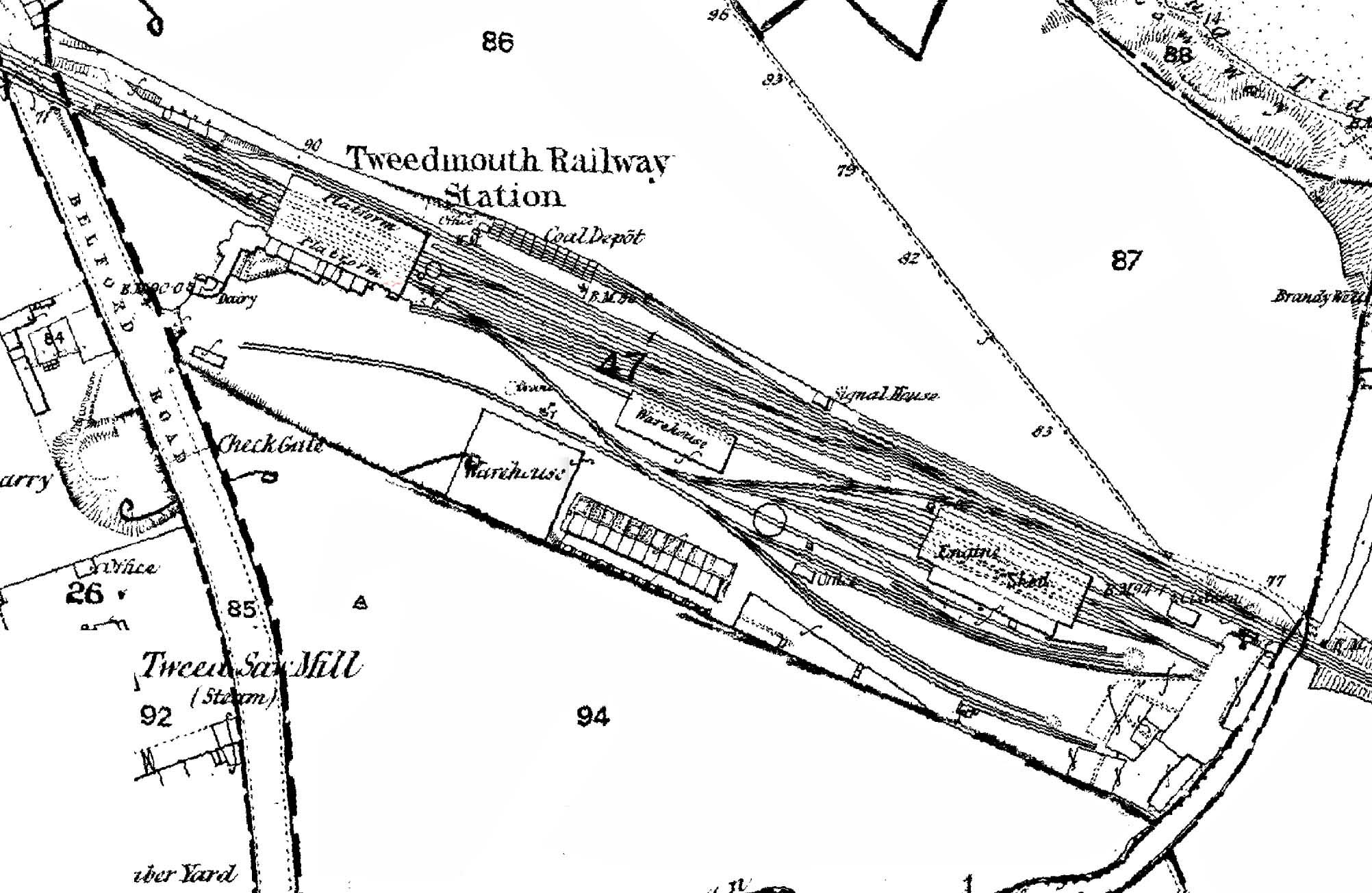
1866 1:2,500 OS map.. The passenger station, with its two facing platforms and trainshed, is seen towards the western (left) side of the map. Intriguingly, the southern end of the Station Hotel is identified as ‘Dairy’. Immediately north-east of the passenger station is the coal depot, approached by a siding leaving the through line at the ‘Signal House’ (=signal box) and splitting into two above the coal drops, indicated as ‘Coal Depôt’. The coal office is named, plus ‘WM’ (=weighing machine), and a roadway is shown parallel to the railway giving access to the coal handling facilities from Belford Road. Belford Road would later be renamed ‘Northumberland Road’. South of the station, adjacent to the enginemen’s cottages is a large warehouse, which does not appear on later maps. Amidst the complex of down-side sidings, south-east of the passenger station, the Newcastle & Berwick Railway warehouse and the locomotive shed – erected in 1850 by the York, Newcastle & Berwick Railway (successor from August 1847 to the N&B) – are shown. The steam-operated Tweed Saw Mill is seen on Belford Road; it would later be provided with a siding passing through the station forecourt.
 Home Page Home Page
| Last
updated: Saturday, 08-Sep-2018 16:20:37 CEST |
© 1998-2005 Disused Stations
| |