Station Name: WALWORTH ROAD
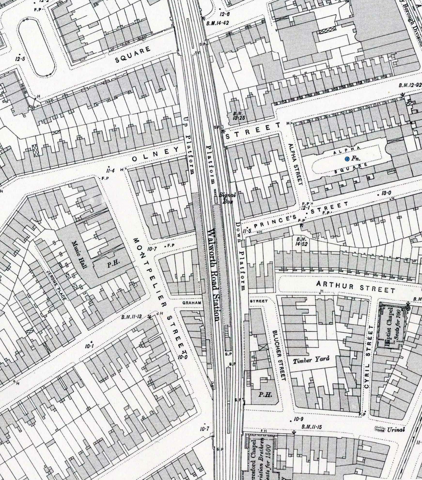
1898 1:1,056 OS Town Plan. This shows the station spanning three roads. The entrance is in Beresford Street at the bottom; it then passes over Graham Street, Princes Street and Olney Street, stopping short of Sutherland Square to the north. The local lines are to the west with the main lines to the east. The down main line platform is noticeably shorter then the other platforms, stopping between Princes Street and Olney Street. The shaded area indicates the position of the canopies, that on the down main line platform being shorter than the others. There are external stairs on the side of the viaduct serving the outer platforms. The signal box is seen at the north end of the island canopy. Click here for a larger version of this map.
 Home Page Home Page
| Last
updated: Friday, 26-May-2017 09:53:56 CEST |
© 1998-2014 Disused Stations
| |