Station Name: WARBOYS[Source:
Nick Catford]
Warboys
Station looking south in May 1966 shortly after the track was lifted.
Copyright photo by Nigel Mundy 11.jpg)
Warboys station looking south in July 1970. The small cattle dock is seen on the left; a cattle pen stood on the dock (see aerial view above).
Photo
by John Mann
12.jpg)
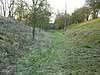
Warboys station looking south in July 1970. Nature has taken over the trackbed and the platforms, especially the up platform which is barely visible.
Photo by John Mann 13.jpg)
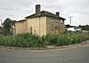
The station building at Warboys in July 1970.
Photo by John Mann 14.jpg) 40 years after passenger services ceased, unsuspecting potential passengers in Warboys were still being directed to the station in July 1970.
Photo by John Mann 17.jpg) Warboys station building in 1972.
Photo by Peter Howie 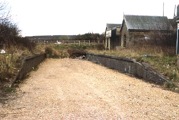
Warboys station looking south in March 1976. the cutting has been partially filled in burying the south end of the platform; this was later used for a realignment of Puddock Hill. Part of the trackbed has been cleared ready for the storage of hollow bricks.
Photo by Nick Catford 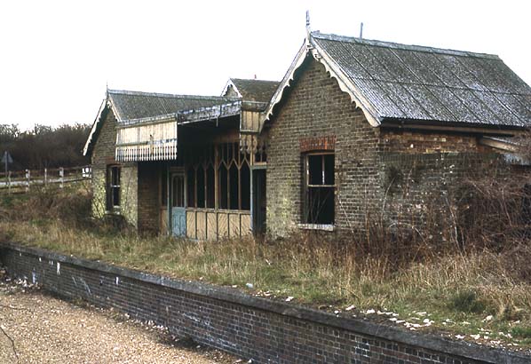
Warboys Station in March 1976. Although the undergrowth around the station building has been cleared the building remains in a very dilapidated state
Photo by Nick Catford 15.jpg)
In 1976 The London Brick Company cleared part of the station site for storage, mainly for hollow clay bricks as seen here in February 1977. Between the fence and the bridge (behind the photographer) the cutting was partially filled burying the platforms.
Photo by Alan Young 16.jpg) Hollow clay bricks stored on the trackbed in front of the Warboys station building in February 1977.
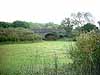
Photo by Alan Young 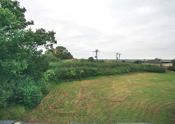 The site of Warboys station looking north from the road bridge in September 2007. The level of the land has been raised burying the platforms apart from the south ramps under the bridge. A section of the bridge parapet can be seen bottom left.
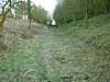
Photo by Nick Catford 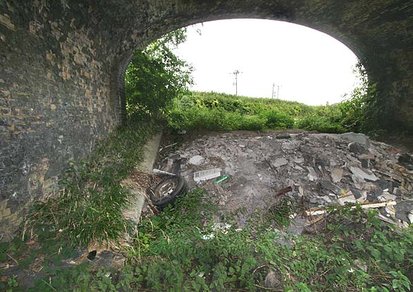 Warboys station looking north in September 2007. The two platform ramps can still be seen but the remainder of the station has been buried.
Photo by Nick Catford 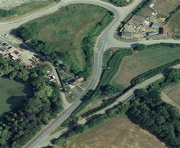 Aerial view showing the site of Warboys station. Puddock Hill runs south-west to north-east having reverted to its original alignment before the railway was built. It now runs through the middle of the station site. The road bridge can be seen centre right. Between the bridge and Puddock Hill is a darker green strip of land; this is the infilled cutting, the platforms being buried beneath the infill. The trees on the right surround the surviving Pingle Wood cutting on that side of the bridge. The building at the road junction (top right) is the former Railway Hotel which is now a private house. On the left the road once led to the brickworks which is now a landfill site.
Click on thumbnail to enlarge
 Home Page Home Page
| ||
old14.jpg)
6.jpg)