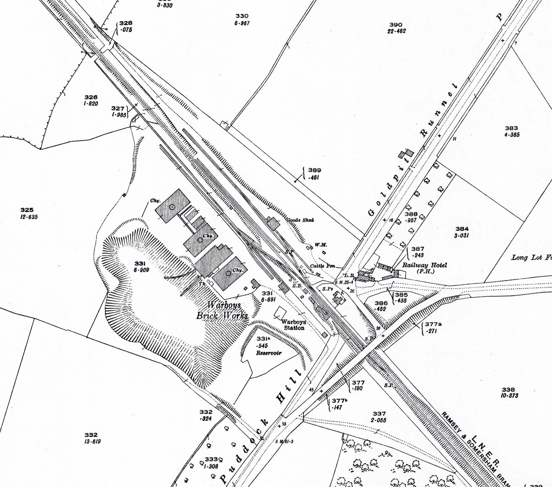
 A 1926 OS 1:2500 map of Warboys railway station and brickworks area. Warboys village is some distance away off the map to the right. Somersham is to bottom right and Ramsey to top left. The brickworks had at this time been open for less than thirty years and it is interesting to compare the then size of the clay pit to its vastly expanded size in later views. A 1926 OS 1:2500 map. The station building is seen on the down side at the end of an approach road; there are no buildings on the opposite platform. Access to the goods yard and brickworks sidings was controlled by the signal box (SB) at the north end of the down platform. The goods yard is entirely on the up side with all the sidings on the down side serving the brickworks. Access to the goods yard is along a short, wide approach road opposite the Railway Hotel. Halfway between the road and the goods shed is the weighbridge and adjacent weigh office (WM). One siding runs from the loop passing the small cattle dock before splitting with one line running parallel to the main line with the other running towards the goods shed where it splits again with one line running through the goods shed and another alongside it on the south side. Another short siding trails back to the rear of the cattle dock. Beyond the diamond crossing at the end of the loop another siding runs parallel to the main line. The stationmaster's house is seen at the rear of the up platform. The name 'Goldpit Runnel' may arouse the curiosity of those not familiar with the region. A Runnel is a stream or ditch while the origin of 'Goldpit' in this context is something of a mystery although it has been suggested it refers to Marigold, a type of flowering plant. Certainly there are no gold mines in the Warboys area!

 Home Page