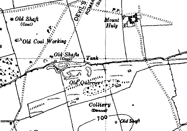
Notes: In Private and Untimetabled Stations (1982) of which I was co-author with G Croughton and R W Kidner, reference was made to Kirkheaton Colliery station at NZ041769, with the beginning and end of the untimetabled passenger service stated as 1921 and 1929. I repeated this information in Suburban Railways of Tyneside (1999). However C R Warn Rural Branch Lines of Northumberland (1975/8) notes that the land for the construction of the Wallridge Mineral Railway was leased from the Dissington Estate as late as 1.7.1923 and the single track route was opened to Belsay Colliery in 1927. The authoritative Durham Mining Museum web site states that the mine at this grid reference was Belsay Colliery, but that it was opened in 1923 by the Kirkheaton Colliery Company Ltd, whose other nearby pits (Kirkheaton Colliery and Kirkheaton Drift) ceased production in 1924. Belsay Colliery closed in 1930. In the light of this contradictory information – which is both lure and frustration of the study of untimetabled stations! - it seems unwise to give definitive dates when the passenger service began and ceased, but to identify the terminus as Belsay Colliery (not Kirkheaton). However the discontinuation of all timetabled services to Darras Hall on 17.6.1929 might have been a convenient time to end the special miners’ service.
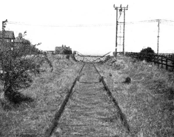
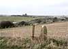
It is not known whether that was a platform or just a stopping place for workers to disembark.
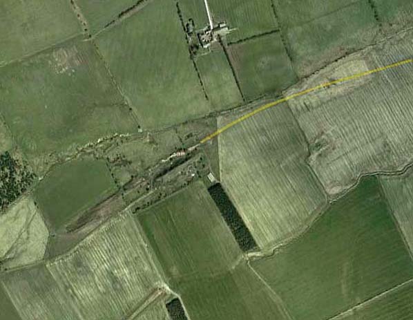
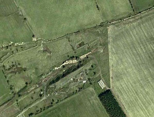
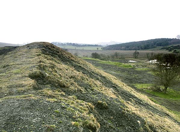
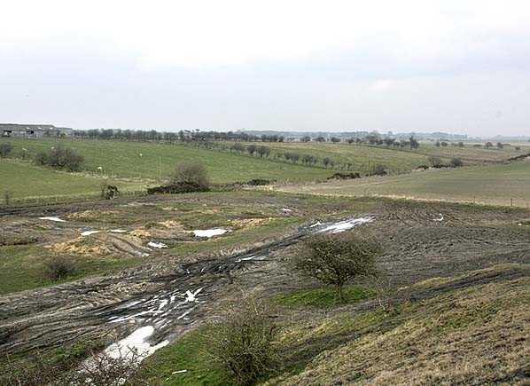
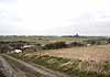
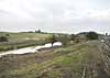
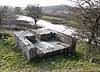
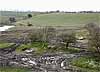
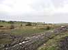
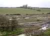
Although all colliery buildings and all trace of the railway have been removed the course of the tramway up to the colliery site is clearly visible as a crop mark on aerial photographs and the colliery site is still heavily disturbed with a waste tip remaining on site and at least one concrete structure of colliery origin.
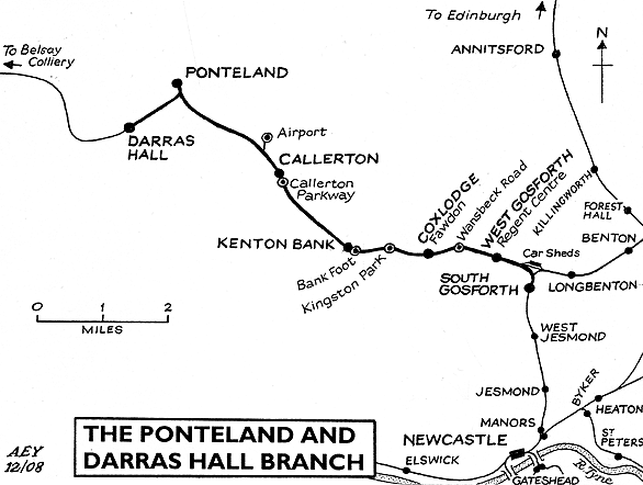
BRIEF HISTORY OF THE PONTELAND AND DARRAS HALL BRANCH
(AND THE WALLRIDGE MINERAL RAILWAY)
The area of Northumberland lying immediately northwest of Newcastle was served by several colliery waggonways before 1900, but no passenger railways entered it. Under the terms of the Light Railways Act (1896) the North Eastern Railway promoted the Ponteland Light Railway branching from the Newcastle – Whitley Bay route at South Gosforth (then known as Gosforth).
Construction began in 1900. The 6¾ mile route was through gently undulating countryside beyond the built-up area of Newcastle, so earthworks were relatively light.
There were several level crossings over public roads, but major roads and mineral lines were crossed by bridges. Goods services began on 1 March 1905, and passenger services on 1 June. It was intended to electrify the route as an extension to the ‘Coast Circle’; however only the extreme east end of the line was electrified to provide access to the new Gosforth Car Sheds from 1923. (Further electrification was delayed for over fifty years!) Operation of branch services was generally by Fletcher ‘BTP’ locomotives fitted with auto apparatus (based at Heaton Shed). Advertised as ‘steam auto-cars’ these push-and-pulls provided nine to ten services between South Gosforth and Ponteland on weekdays (four on Sundays) taking 20 minutes to complete the journey. By June 1920 the Sunday trains had been withdrawn.
In November 1908 the NER deposited plans with Parliament for a 1¼ mile extension to Darras Hall under the name of the Little Callerton Railway. Unlike the parent branch to Ponteland the route was not a Light Railway. The extension was to serve a residential area where development was just beginning. In 1907 Darras Hall Estate began when a group of Newcastle businessmen bought land southwest of Ponteland with the aim of creating a ‘garden city’ for professional and managerial residents. The railway gained Parliamentary approval in 1909, and the Estate entered into an Agreement with the NER on 18 October 1910 for railway access.
The single track was largely on an embankment, but there was sufficient space for the addition of a second track should traffic warrant it. Goods services to Darras Hall started on 27 September 1913 followed by passenger trains on 1 October. The trains operated between South Gosforth and Darras Hall with a reversal at Ponteland: a simple manoeuvre for the ‘auto-cars’. The Darras Hall extension was a financial failure. The estate grew slowly, and its loose grid of roads, with detached houses at a maximum density of six per acre, limited the number of potential passengers. By June 1920 the scanty provision of three trains per day (plus the need to change at South Gosforth) must have served as an additional disincentive to use the service. No industrial development was permitted at Darras Hall, save for the NER goods yard, so even goods traffic was restricted.
As for the original Ponteland branch, following a promising start, Newcastle Corporation buses (which also served Darras Hall and provided direct routes between Kenton, Gosforth and Newcastle) snatched the traffic from the trains. The introduction of Sentinel Steam Cars on the line, running through to Newcastle, failed to revive the traffic. Housing development along the route was limited. So it was that the Ponteland and Darras Hall line was closed at such an early date. Ponteland enjoyed a passenger service for 24 years, and Darras Hall for only sixteen. Parcels traffic ceased to be handled on 5 January 1935, but goods traffic continued. From time to time the branch provided a serene retreat where the Royal Train could pass the night! Darras Hall closed to all traffic in 1954. In the 1960s redundant Coast Circle electric stock was stored at Ponteland and Callerton. Ponteland’s goods service ended in 1967 and the rails were lifted beyond Prestwick ICI explosives factory siding, north of Callerton. This facility closed on 6 March 1989. (A siding between Coxlodge and Kenton Bank serving Rowntrees closed on 28 July 1988.)
After a gap of over fifty years much of the Ponteland branch regained its passenger trains in 1981 when the route from South Gosforth to Bank Foot (Kenton) re-opened, and was finally electrified, as part of the Metro network. The service was extended to Newcastle Airport on 17 November 1991, which involved a very short branch from the Ponteland route. Former station sites at West Gosforth and Coxlodge were occupied by Regent Centre and Fawdon Metro stations respectively, while at Callerton Parkway and Bank Foot Metro stations were sited at the ‘Newcastle end’ of Callerton and Kenton Bank sites. Metro stations at Wansbeck Road (opened 1981) and Kingston Park (1985) were entirely new.
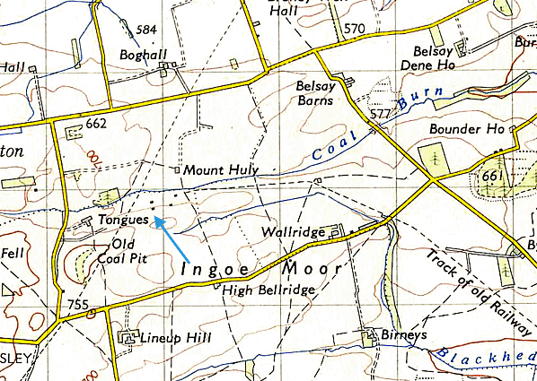
The eccentricity of the Darras Hall branch was compounded by its short-lived extension to Belsay Colliery, four miles SSW of Belsay village in the depths of the Northumbrian countryside. The colliery, which opened in 1923 to extract household coal, was operated by Kirkheaton Coal Company. (This firm’s nearby Kirheaton Colliery and Drift closed in 1924.) The workforce never reached a hundred, production was limited, and the colliery closed in 1930. For some of the colliery’s working life, an untimetabled passenger train service for miners was provided on the 7½-mile single-track route for the final mile between Belsay Colliery and a row of miners’ cottages at Wallridge (NZ059768). It is unlikely that platforms were built either at Belsay Colliery or Wallridge. Motive power was an ex-Glasgow & South Western Railway 0-6-0, and there were six trucks, two passenger coaches and a guard’s van. The line was known as the Wallridge Mineral Railway after the almost uninhabited parish where it terminated: the population in 1901 was two. In 1931 there were 37 inhabitants, and presumably all or most of these people occupied the miners’ cottages. The line was not shown on the Ordnance Survey One-inch Popular Edition map (published 1947) but its route appeared on the first Seventh Series Sheet 78 of 1953 as Track of old Railway.
To see other stations on the Ponteland & Darras Hall branch click on the station name: West Gosforth, Coxlodge, Kenton Bank, Callerton, Ponteland, Darras Hall.
|


 Home Page