|
Notes: The station did not open with the line first appearing
in the company timetable on 10th December 1945 and in Bradshaw
in January 1846.
There was a derailment early in the station's history when
a storm blew the level crossing gates shut; the signalman tried
to open them in time for the train to clear the crossing but
was unsuccessful and was killed.
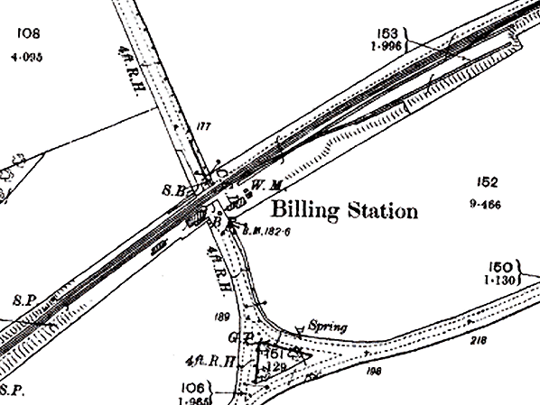
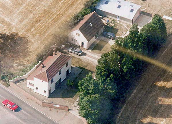
The station opened as Billing Road and was renamed Billing
on 1st April 1893. The two-storey stationmaster's house which incorporated the booking office was a very plain rectangular building. There was a timber waiting room on the on the up platform with no buildings on the down platform.
The station was provided with a small goods yard on the up side of the line east of the level crossing. Access to the yard was controlled by a signal box which was on the down side, east of the level crossing. The yard consisted of a loop giving access from both directions, and a single siding.
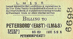
Billing was an early closure losing its passenger
service on 6th October 1952 although it retained its goods
service until 1st June 1964.
BRIEF HISTORY OF THE NENE VALLEY
RAILWAY
The London & Birmingham railway was completed by the autumn
of 1838 and immediately started considering expanding its territory
to Northampton (which it by-passed by some 5 miles due to the
hilly nature of the town) and then down the Nene valley to Peterborough.
In 1843 the L&BR was given parliamentary assent to construct
a line from Blisworth in Northamptonshire to Peterborough.
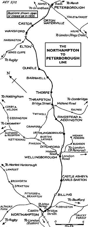 |
Twelve stations were built in an old English or Tudor style:
the names on opening (some changed later) were Northampton,
Castle Ashby, Wellingborough, Ditchford, Higham Ferrers (later
renamed Irthlingborough), Ringstead, Thrapston, Thorpe, Barnwell,
Oundle, Wansford and Overton. The line shared the Peterborough
terminus with the Eastern Counties Railway in return for 'running
powers' over the line to Northampton, giving it access to the
Midlands and the North.
The Northampton to Blisworth section was officially opened
on Tuesday 13 May 1845 and the complete track was opened on
Monday 2 June 1845.
On 16 July 1846 the London and North Western Railway was formed
by merging the London & Birmingham Railway with a number
of other companies and during the mid 1800's, the development
of iron ore mining in the area was reactivated having been suspended
for 200 years by law due to the lack of wood for charcoal. All
available wood being required for the Navy.
The Great Northern Railway opened a line from Stamford to a
junction with the Nene Valley line just east of Wansford on
9th August 1867 and Wansford became a major junction when the
LNWR opened their new |
line from Yarwell Junction (just west
of Wansford) to Seaton on 1st November 1879. The 1923 grouping
took the line into the London Midland and Scottish Railway (LMS).
 |
With the closure of many of the mines and the popularity of
the car both passenger and freight traffic was in decline after
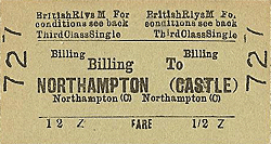
WW2 and in July 1963 the withdrawal of passenger service between
Northampton Castle and Peterborough East was announced. Despite
a vigorous campaign against closure culminating in a public
meeting at Thrapston, little could be done. A |
petition was started and action committee appointed but when the committee asked
for a collection to meet their expenses only £1 18s 3d
was raised! The line was formally closed on Monday 4 May 1964.
Iron Ore trains continued to use the line until 1966 with through
freight traffic finally being withdrawn by British Rail in 1972.
In 1974 the Peterborough Development Corporation bought a section
of the Nene Valley line between Longville and Yarwell Junctions
and leased it to the Peterborough Railway Society to operate
the railway. Between 1974 and May 1977 the line was upgraded
to passenger standards and on 24 May the Railway Inspector passed
the railway as fit for passenger carrying operations and the
Nene Valley
Railway between Wansford and Orton Mere was officially opened
on 1 June 1977.
| In 1986 the line was eastwards to a new terminus at Peterborough
Nene Valley just short of the East Coast Main Line making a
total running length of 7.5 miles and a new station is currently
under construction at Yarwell Junction at the western end of
the line. There are also proposals for a link with the ECML
which would allow trains to run into Peterborough Station. |
 |
Bradshaw from Nick Catford. Route map drawn by Alan Young.
See also: Nene
Valley Railway web site
Further reading: The
Nene Valley Railway by Christopher Awdry ISBN: 1 85895 170
4
To see other stations on the
Nene Valley Railway click on the station name: Northampton
Bridge Street, Castle
Ashby & Earls Barton, Wellingborough
London Road, Ditchford,
Irthlingborough,
Ringstead
& Addington, Thrapston
Bridge Street, Thorpe,
Barnwell, Oundle,
Elton, Wansford,
Castor, Orton
Waterville, Peterborough
Nene Valley & Peterborough
East
|

old1.jpg)
old5.jpg)
old6.jpg)
old3.jpg)
old2.jpg)
old3.jpg)
old4.jpg)
1.jpg)
 Home Page