
CATLOW QUARRIES[Source: Alan Young]
Catlow Quarries Gallery 2 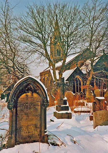 The carts carrying stone from Catlow Quarries to Catlow Stone Works and Chaffers Siding passed the church of St John the Evangelist halfway down Barkerhouse Road. The church was established as a mission in 1845 - in the decade after the quarries opened; the Gothic edifice seen here was constructed in 1848. Unfortunately the building had to be demolished in 1995 owing to damage by dry rot and a smaller building was constructed immediately south to replace it. The photograph was taken on 9 February 1991, looking west.
Photo
by Alan Young
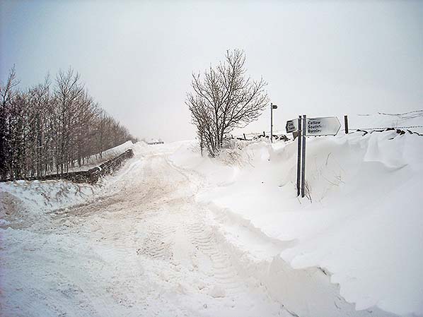
Set on the moorland edge at an altitude of almost 1,000ft the quarrymen at Catlow had to be hardy but snow and ice could bring all work in the quarry – and wages – to a stop, sometimes for weeks on end. Looking north on 23 March 2013, Southfield Lane is blocked by a snowdrift at the junction with Barkerhouse Road.
Photo by Alan Young 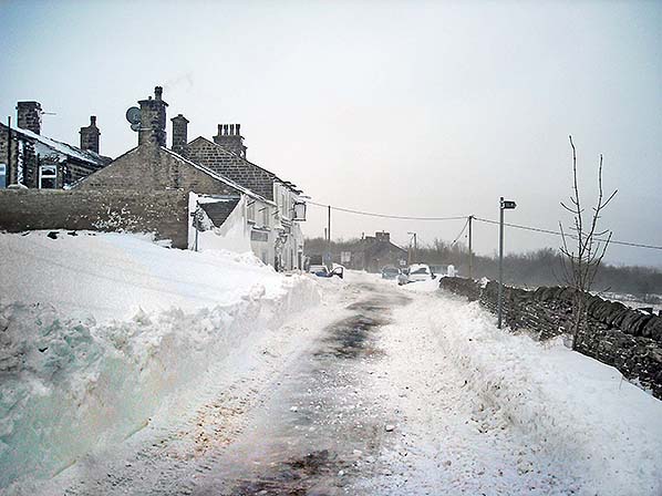
Southfield Lane and the Shooters Arms, looking south on 23 March 2013. In the 21st century despite accurate weather forecasts, gritters and snowploughs, snow can still cause disruption on the edge of the Pennine moorlands; life would have been much harder for the quarrymen and their families in their draughty cottages, especially when the workers were ‘frozen out’ and wages ceased in the coldest winter weather.
Photo by Alan Young 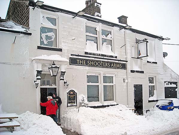 The Shooters Arms met the needs of generations of quarrymen, farmers and weavers since it opened in 1660. Situated on the moorland edge at almost 1,000ft it has frequently been assaulted by snowdrifts, as here on 23 March 2013. Local residents recall that this was as nothing compared with early 1947 and 1963 when snowdrifts had to be tunnelled-through to gain entry.
Photo by Alan Young 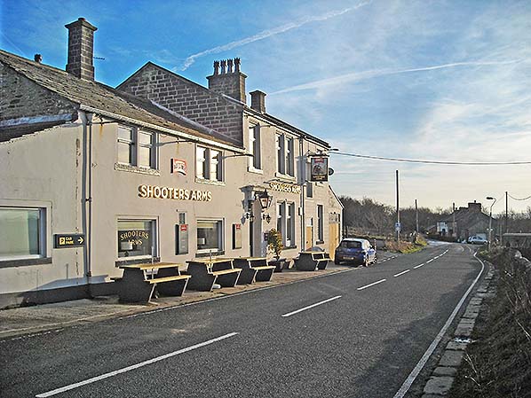
The recently refurbished Shooters Arms is seen here looking south in December 2016. The earlier, lower building which is traced back to 1660 has been extended beyond and behind.
Photo
by Alan Young
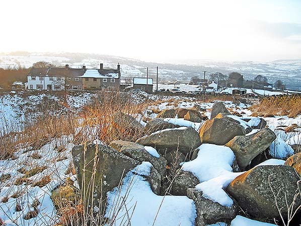
Looking west over the northernmost rim of Catlow Quarries on 26 December 2009. The five (formerly six) cottages of Mount Pleasant which were homes of quarrymen and their families stand on the far side of the excavation, with the quarry office to their right. Soon after quarrying ceased the office was used by the ARP (Air Raid Protection) warden in World War 2 as it has a commanding view to the west.
Photo by Alan Young 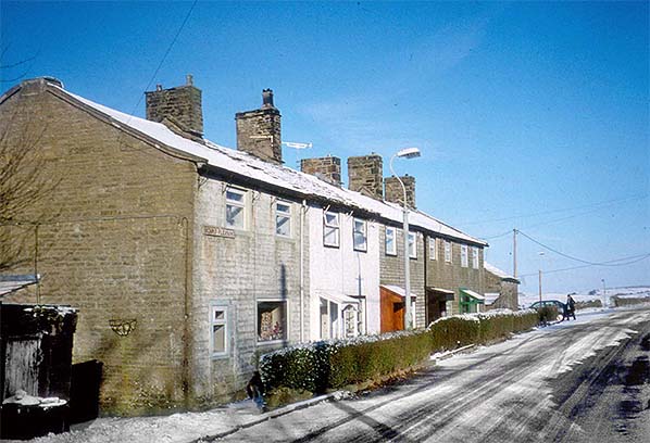
Mount Pleasant cottages on Southfield Lane, looking north on 25 February 2001. These cottages directly face the northernmost section of the old Catlow Quarries and were homes of quarrymen and their families. The quarry office is seen at the end of the row beside the man and the car.
Photo by Alan Young 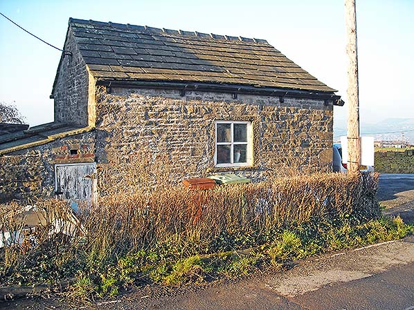 The old office building of Catlow Quarries is seen here, looking west in December 2016. The ‘new’ alignment of the lane to the chapel is seen to the right.
Photo by Alan Young 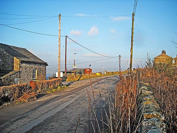
Looking north along Southfield Lane in December 2016. The northern end of the abandoned Catlow Quarries is immediately right of the photograph, beyond the wall. The quarry office is on the far left. One can visualise two hundred or more men reporting to the diminutive office to receive their pay, more than likely walking 100yd ahead to spend some of it at the Shooters Arms, and reserving some for the offertory box in Southfield Methodist Church (indicated left by the modern sign). The only railway content in the view is what looks like a house escaped from a colonial shanty town: the old goods wagon in the centre of the picture is in agricultural use and has recently been extended.
Photo
by Alan Young
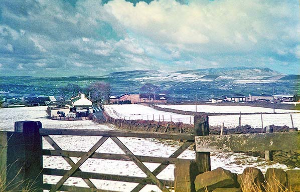 Looking west from the lane to Southfield chapel towards Lower Row (white gable end) and Southfield Fold. Higher Townhouse Farm is far right, and the town of Nelson is in the valley of Pendle Water with Pendle Hill (1,927ft) on the horizon. Lower Row was one of the local rural terraces where quarrymen and their families lived. The photo was taken in winter 1987.
Photo by Alan Young 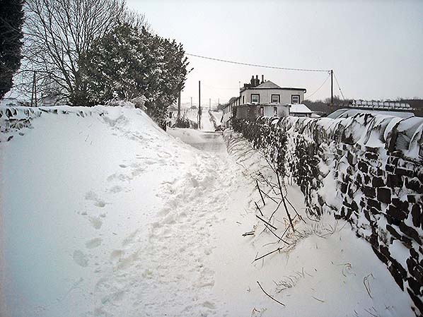
On 23 March 2013 snow blocks the lane past Lower Row, one of the rural terraces where quarrymen and their families once lived. Catlow Quarries were about 300yd ahead at the top of the lane.
Photo by Alan Young 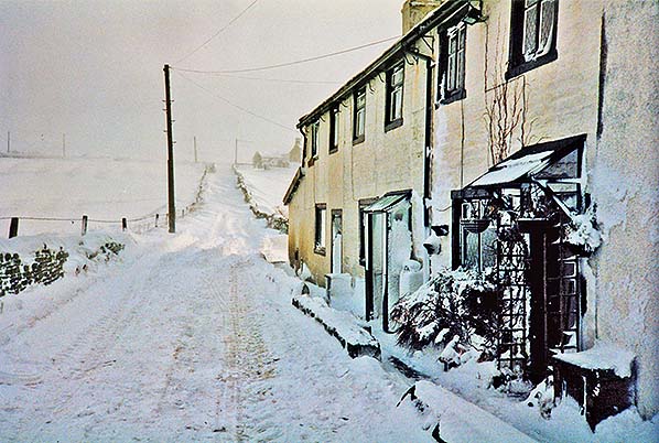
Lower Row, four terraced cottages about 300yd from the abandoned Catlow Quarries, is seen on 8 February 1991 – a month during which snow caused much disruption in the region.
Photo by Alan Young 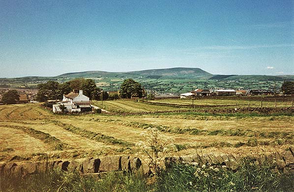 Although quarrying is still carried out on a small scale to the east of the former main Catlow Quarries, the surrounding landscape is principally in agricultural use for raising cattle and sheep. Looking west towards Lower Row from the lane to Southfield chapel in July 1997 the grass has been cut for silage on (left to right) Todd Field / Row Croft, Far Green and Near Green and is awaiting collection. Although quarrying is still carried out on a small scale to the east of the former main Catlow Quarries, the surrounding landscape is principally in agricultural use for raising cattle and sheep. Looking west towards Lower Row from the lane to Southfield chapel in July 1997 the grass has been cut for silage on (left to right) Todd Field / Row Croft, Far Green and Near Green and is awaiting collection.Photo by Alan Young Click here for Catlow Quarries Gallery 3
 Home Page Home Page
|
