
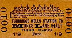
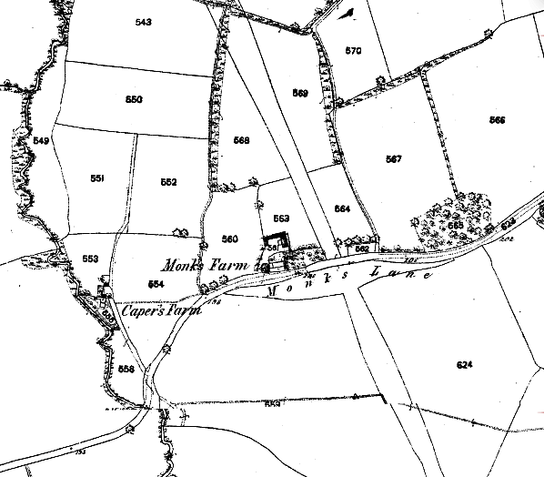
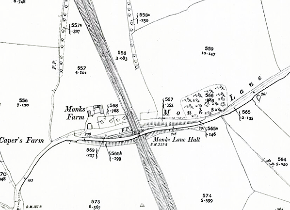
Station Name: MONKS LANE HALT
|
| Date opened: | 1.6.1907 |
| Location: | North side of Monks Lane |
| Company on opening: | London Brighton & South Coast Railway |
| Date closed to passengers: | 11.9.1939 |
| Date closed completely: | Before 1945 |
| Company on closing: | Southern Railway |
| Present state: | Three concrete pillars that once supported waiting rooms survive, two on the up side and one on the down. |
| County: | Kent |
| OS Grid Ref: | TQ422487 |
| Date of visit: | Not visited |
|
Notes: Both Monks Lane Halt and Hurst Green Halt to the south of Oxted opened on 1 June 1906 to cater for expected residential development. At Hurst Green the development came and the halt is still open today but at Monks Lane it failed to materialise and with little passenger traffic the halt closed on 11 September 1939. The halt was reopened during WW2 to serve a near by military camp.
At closure the halt was served by four down trains on weekdays at 07.43, 11.02 am and 12.37 and 8.01 pm. There were only three up trains at 10.31 am and 12.16 and 1.53 pm. The first up service being mid-morning ensured that the halt would be of no use to commuters. There was no Sunday service. To save operating costs a number of new halts were opened in the south east from 1906 with the introduction of single carriage railmotors fitted with mechanically worked controls to enable them to be hauled or propelled by small tank locomotives. These halts were served only by the railmotors; two of these were at Hurst Green and Monks Lane between Oxted and Edenbridge Town. Husrt Green Halt was closed on 12.6.1961 and replaced by a new station on the north side of Greenhurst Lane.
With the closure of the branch from Eridge - Tunbridge Wells West on 8.7.1985, British Rail issued a circular denying rumours of closure south of Hurst Green Junction. Even so a scheme to `Rationalise' and re-signal the line was undertaken and some sections were changed to single track but the line remains open. Tickets from Michael Stewart. Route map drawn by Alan Young. To see the other stations on the Oxted & Groombridge Railway click on the station name: Oxted, Hurst Green Halt, Hever, Cowden, Ashurst & Groombridge |
 The halt consisted of two short timber platforms suitable for use by single carriage railmotors. Each platform had a corrugated iron waiting shelter supported on two concrete pillars to the rear of the platforms. The shelter had an internal wooden seat. On the platform there were two oil lamp standards, a bench seat and a name board. Access to the halt was along two footpaths from Monks Lane running to the north end of the platforms.
 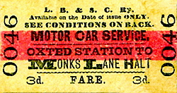 BRIEF HISTORY OF THE OXTED
& GROOMBRIDGE RAILWAY
BRIEF HISTORY OF THE OXTED
& GROOMBRIDGE RAILWAY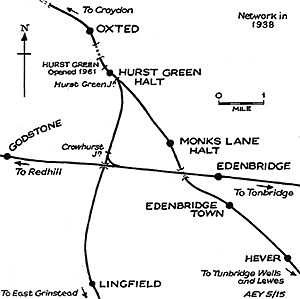 The local company
was incorporated in 1861 and taken over by the LBSCR in 1864
four years before the line opened in 1888. The line opened
to Edenbridge on 2.1.1888 and to Groombridge on 1.10.1888
with intermediate stations at Edenbridge Town, Hever, Cowden
and Ashurst.
The local company
was incorporated in 1861 and taken over by the LBSCR in 1864
four years before the line opened in 1888. The line opened
to Edenbridge on 2.1.1888 and to Groombridge on 1.10.1888
with intermediate stations at Edenbridge Town, Hever, Cowden
and Ashurst. 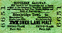 By the 1960's the Beeching era had begun and by 1964 new
timetables were introduced making travel difficult with long
waits for connections, by now a common ploy to reduce the
number of passengers. The railway board wanted to close the
line south of Hurst Green Junction to Lewes, together with
the branch to Tunbridge Wells West. This met with vigorous
opposition from local authorities and private individuals.
Eventually the Minister gave way and agreed closure between
Uckfield and Lewes from 6th January 1969.
By the 1960's the Beeching era had begun and by 1964 new
timetables were introduced making travel difficult with long
waits for connections, by now a common ploy to reduce the
number of passengers. The railway board wanted to close the
line south of Hurst Green Junction to Lewes, together with
the branch to Tunbridge Wells West. This met with vigorous
opposition from local authorities and private individuals.
Eventually the Minister gave way and agreed closure between
Uckfield and Lewes from 6th January 1969.lane_old1.jpg)
Photo from John Mann collection
lane_old2.jpg)
Photo from John Mann collection
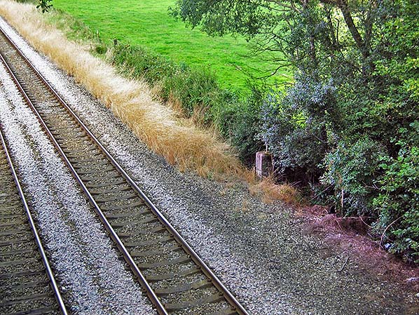
Photo by Colin Watts
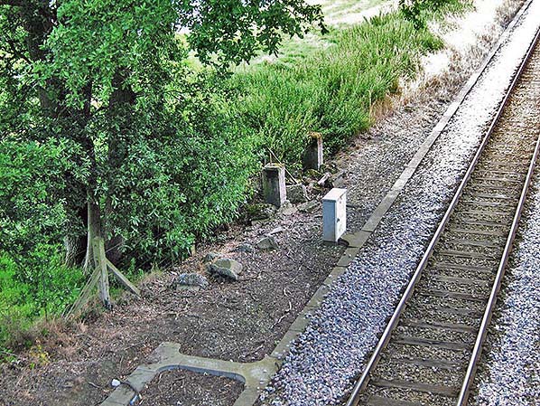
Photo by Colin Watts
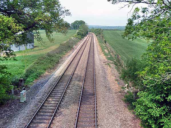
Photo by Robin Webster, reproduced from Geograph under creative commons licence

|
 Home
Page
Home
Page
| Last updated: Sunday, 21-May-2017 15:43:08 CEST |
© 1998-20015 Disused Stations |