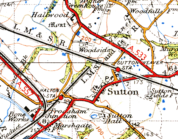
Notes: Sutton Weaver station was situated on the 8.5 mile Ditton Junction to Weaver Junction line that was built by the London and North Western Railway and opened in its entirety on the 1st February 1869. The line was provided with two new stations, one at Runcorn and one at Sutton Weaver. The existing station at Ditton was extensively remodelled and became Ditton Junction. The purpose of the line was to shorten journey times between Liverpool and London. Since the completion of links between the two cities in 1836 trains had had to cross the Mersey at Warrington.
Although work started on the line in 1863 it took six years to build as it had a formidable obstacle along its route that being the River Mersey. The shortest crossing point was at Runcorn Gap, which lay between Widnes in Lancashire and Runcorn in Cheshire. A further complication was the fact that the admiralty insisted on a 75 feet clearance beneath any bridge structure so that the largest naval vessels of the day could pass underneath. The solution was a bridge approached by viaducts on both sides of the river. The construction of the bridge, which was named the Ethelfleda Bridge, was the single biggest engineering project on the line.
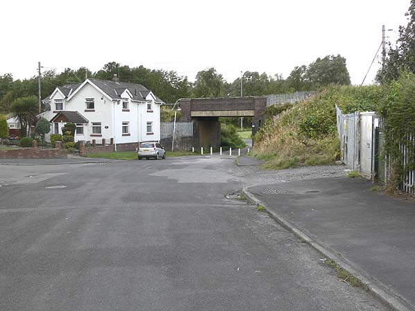
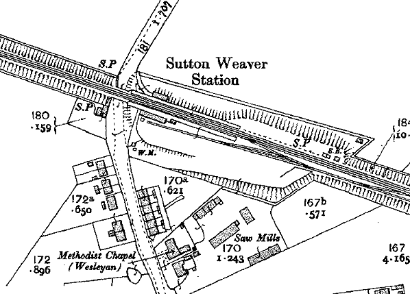
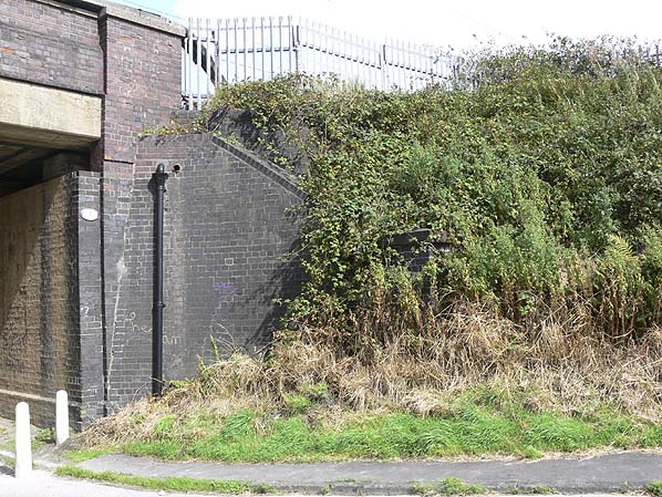
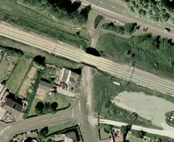
Sutton Weaver station opened on the 1st April 1869 the day that passenger services started to use the line. The station was provided with two platforms situated on an embankment to the south east of an overbridge, which carried the line over what later became Station Road. On the south side of the line a roadway led up to the station and to goods sidings. On the north side of the line a pedestrian footpath connected the southbound platform to the road. Single storey buildings were located on both platforms with the main facilities being on the northbound platform. A small goods yard with a single siding behind the main station building was sited on the south side of the line. The goods yard handled livestock. A house for the station master was provided on the west side of the road on the south side of the line.
Although from the very start the line was a busy trunk route Sutton Weaver Station was served only by local services running between Liverpool Lime Street and Crewe or on shorter workings in between the two. In 1922, the last year of the LNWR timetable, services calling at the station included Liverpool to Crewe, Crewe to Liverpool, Liverpool to Hartford, Hartford to Ditton Junction and Ditton Junction to Hartford. In total there were six services in the Liverpool direction and seven in the Crewe direction on weekdays.
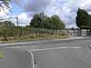
In 1923 the station became part of the London Midland Scottish Railway (LMS). Being located in sparsely populated area, and there being another LMS station, Halton which lay only a very short distance away on the Chester to Warrington line, Sutton Weaver station was not profitable so the LMS closed it to passenger services on the 30th November 1931. It remained in use for goods services until the 30th April 1942. The station was demolished sometime after this date but the station masters house is still extant.
The line through the site of Sutton Weaver is still in use and as busy as ever. It was electrified in 1961 and today it sees a steady stream of express and local passenger services as well as a variety of freight.
See also Ditton & Ethelfleda Bridge |


 Home Page