Station Name: TRANMERE

[Source: Paul Wright]

Date opened: 30.5.1846
Location: On North side of St. Paul's Road.
Company on opening: Chester and Birkenhead Railway
Date closed to passengers: October 1857
Date closed completely: October 1857
Company on closing: Birkenhead, Lancashire and Cheshire Junction Railway
Present state: Demolished - no evidence remains
County: Cheshire
OS Grid Ref: SJ328869
Date of visit: 18.7.2009

Notes: Tranmere Station opened as Lime Kiln Lane in June 1846. The station was situated on the ‘Chester and Birkenhead Railway’ company's Birkenhead to Chester line which had opened on 23 September 1840.

At the time when Lime Kiln Lane station opened the Birkenhead to Chester railway was a single track line so it is likely that it was provided with only one platform. The station was on an embankment on the north side of the bridge that carried the railway over Lime Kiln Lane which was later renamed as St Paul’s Road. Trains serving the station would have run between Birkenhead Monks Ferry, Chester and points to the south of Chester.

On 22 July 1847 the line became part of the Birkenhead, Lancashire and Cheshire Junction Railway and shortly afterwards the new company doubled the track between Birkenhead and Chester. It is likely that at this time Lime Kiln Lane would have gained an extra platform.

By March 1850 Lime Kiln Lane had eight up and down services Monday-to-Saturday as shown in the table below. There were three up and four down trains on Sundays.

Up Trains March 1850 Destination Down Trains March 1850 Destination
7.04am London Euston 5.25am Birkenhead Monks Ferry
8.34am London Euston 9.05am Birkenhead Monks Ferry
10.49am London Euston 11.05am Birkenhead Monks Ferry
12.34am London Euston 12.35pm Birkenhead Monks Ferry
3.34pm Chester 2.35pm Birkenhead Monks Ferry
5.19pm Chester 5.15pm Birkenhead Monks Ferry
7.34pm Chester 6.35pm Birkenhead Monks Ferry
9.04pm London Euston 9.20pm Birkenhead Monks Ferry

In 1853 the station was renamed as Tranmere. However it was not to last for very long closing in October 1857 (last appeared in timetable).

The site of Tranmere Station has been altered many times since 1857. On the 15 June 1891 the Mersey Railway opened an extension from Green Lane to Rock Ferry. The Mersey Railway lines ran parallel to the Birkenhead to Chester railway at the Tranmere Station site. The Birkenhead to Chester line itself was quadrupled between Birkenhead Town and Capenhurst between 1900 and 1905. There were then six tracks running through the site of Tranmere, all raised above street level on embankments and bridges. Any remains of Tranmere Station would have been swept away by this time.


Today the situation has changed once again. The tracks of the former Mersey Railway, now part of the Merseyrail Wirral Line which links Liverpool to Chester, still pass through the site and remain as busy as ever. Only two of the original lines that formed the Birkenhead to Chester line remain, both heavily overgrown as they have been out of use since freight services to Birkenhead Docks ceased in the early 1990s. They remain in situ pending re-opening at some future date.

To see other closed stations on the Birkenhead Woodside to Chester line click on the station name: Birkenhead Woodside, Birkenhead Monks Ferry, Birkenhead Town, Rock Lane, Ledsham, Mollington & Upton-by-Chester


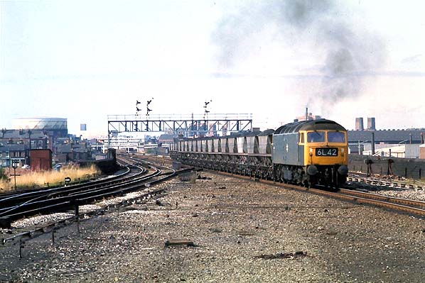
Looking north towards the site of Tranmere station on 17 August 1975. The signal gantry marks the site of the station. Class 47 locomotive number 47 214 is seen heading south on what had been the down line (Birkenhead direction) with 6L42 an MGR working. By 1975 the down line at this location had become a bi-directional section of single track between the site of Tranmere station and a point just to the south of Rock Ferry station.
P
hoto by Keith Holt from the KDH Flickr photostream


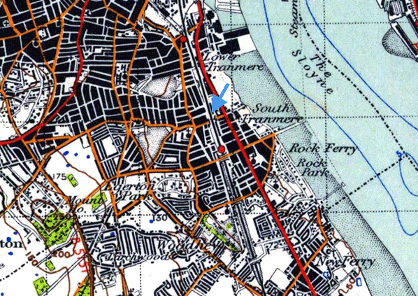
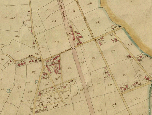
1830s tithe map dating from before the railway had been built does not show the site of Tranmere station which opened six years after the line. Lime Kiln Lane was later renamed St. Paul's Road.


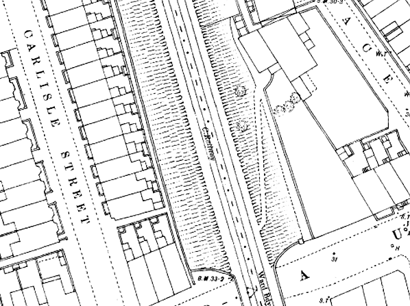
The site of Tranmere station shown on a town plan from the 1870s.A building can be seen to the east of the line with a footpath leading up to track level.


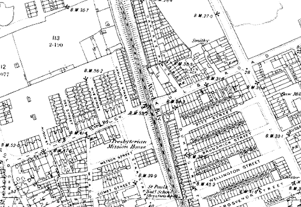
An 1880s map showing the site of Tranmere station and the railway before it was quadrupled.

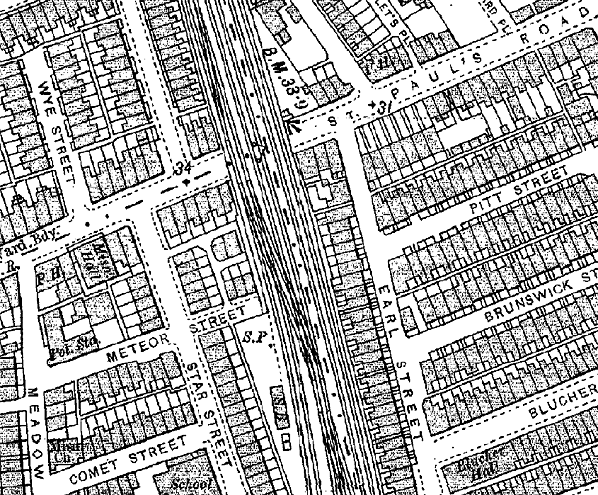
By 1900 the line had been quadrupled.


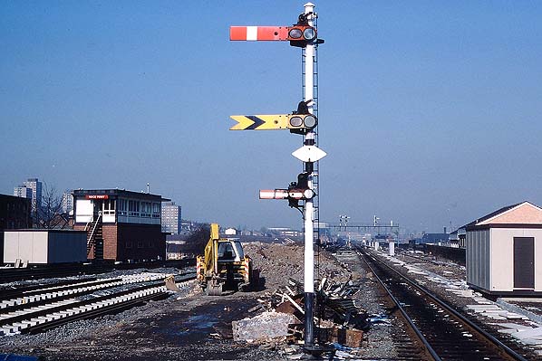
Looking north towards the site of Tranmere station from the north end of Rock Ferry station on 15 February 1985. The line to the right was the former down main line (Birkenhead Direction). It was at this time the up and down goods line. To the left work is underway on a connection between the former Mersey Railway and the main line as part of the extension of electrification to Hooton.
Photo by David Ingram from his Flickr photostream

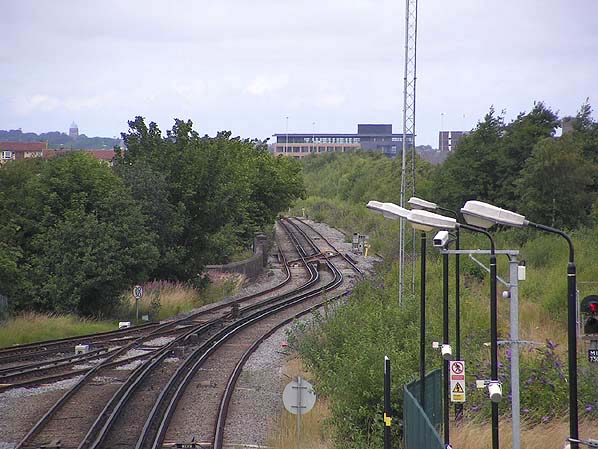
Looking north towards Tranmere Station from Rock Ferry Station in July 2009. The station was located at a point adjacent to the furthest yellow gradient post from the photographer. The electrified lines that can clearly be seen to the left follow the alignment of the Mersey Railway, today's Merseyrail Wirral Line that runs from Liverpool to Chester. Further to the right running parallel the overgrown tracks of the original line can just be made out. At one time there were six tracks at this location.
Photo by Paul Wright


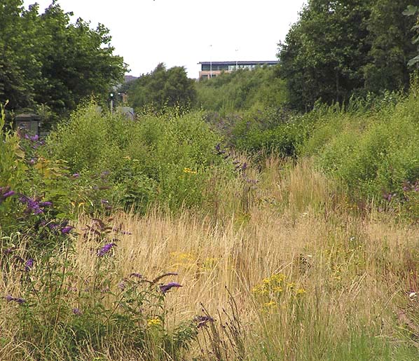
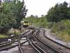
Looking north towards the site of Tranmere Station along the alignment of the Birkenhead to Chester line in July 2009. Tranmere station would have been at a point adjacent to the signal which is showing a green aspect.
Photo by Paul Wright


July 2009

July 2009


click on thumbnail to enlarge


[Source: Paul Wright]


Last updated: Friday, 26-May-2017 08:57:30 CEST
© 1998-2013 Disused Stations