
Station Name: BEVERLEY
|
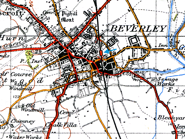
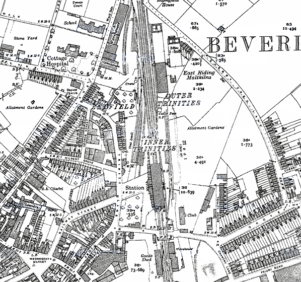
Notes: Beverley station was opened by York & North Midland Railway. The station had two facing platforms and, being one of the larger communities in the East Riding, the station was given an overall (trainshed) roof in line with company policy. Like all stations on the line, Beverley was designed by George Townsend Andrews. The main station building was on the northbound platform at the end of Railway Street. There was a range of low buildings with tall chimneys and deep windows, fine cornices, and stone quoins. The stationmaster's house was incorporated into the south end of the building. Rooms included (from north to south) toilets, porters’ room, general waiting room, stationmaster's office, booking office, booking hall, refreshment room and then domestic rooms for the stationmaster. There were iron columns between the tracks supporting the trainshed roof. The roof was replaced in 1908 and (probably at the same time) the entrance portico was removed and replaced with a canopy. There was a book stall on the opposite platform. A distinctive North Eastern Railway iron covered footbridge was sited just to the south of the trainshed, with stairs coming down through the end wall of the trainshed. There were three signal boxes. 'Beverley North', half a mile north of the station at the A1035 level crossing, also controlled Beverley Junction. 'Cherry Tree' 400 yards north of the station controlled the Cherry Tree level crossing and the north end of the goods yard. 'Beverley' signal box was immediately south of the station and west of the line, just north of the Chantry Lane (now Armstrong Way) level crossing. This box also controlled the south end of the goods yard. There was a fourth box, south of Beverley, called 'Flemingate'
There were extensive goods facilities at the station, and these were sited on both sides of the line, north and south of the station. To the north of the station there was a large coal depot on the west side whose entrance was in Railway Street, with cattle docks and pens on the east side. South of the station the large brick goods shed was west of the line, with a railway warehouse to the east. One of the sidings also traversed the level crossing, passing to the east of the trainshed. In 1911 the population of the station’s catchment area was 18,587. 167,616 tickets were sold that year, and the main freight handled was cement with 5,360 tons, oil cake (3684), grain (2631) and manure (2170) being dispatched. In 1913 1,119 wagons of livestock were loaded at the station. Today the station has a basic half-hourly service to Hull and Bridlington, with nine trains a day extended to Scarborough on weekdays. At peak times, a number of extra trains from Hull terminate/start here. Some services to Hull continue to Doncaster and Sheffield or York. Trains run hourly in each direction on Sundays, with two-hourly extensions northbound to Scarborough all year since the December 2009 timetable change - this service level previously ran only in summer. In recent years the station has undergone extensive restoration which has included the removal of all the paint on the inside walls to reveal the original brickwork, and removal of the canopy over the station entrance which has been replaced with a replica of the original portico. For many years Beverley had an award-winning station garden at the south end of the station.
This L&HR was one of a number of contemporary projects aimed at linking the east and west sides of northern England. The Leeds & Hull scheme soon stagnated, due in part to the stock market crash of 1825. In the meantime, the Knottingley & Goole Canal opened in 1826, turning Goole into a viable transhipment port for Europe. The growth of Goole as a port to rival Hull was sufficient to spur the Hull-based shareholders of the Leeds & Hull railway into action. At the end of 1828, they motioned that the railway should be built as far as Selby, with the remainder of the journey to Hull being made by steam packet, most importantly, bypassing Goole. The shareholders passed the proposal at a general meeting in Leeds on 20th March 1829, and the Leeds & Selby Railway Company was formed. The shortened line from Leeds to Selby was resurveyed by James Walker in 1829; he reported that the stationary engines were not required, with tunnels and cuttings being built in their place. Despite strong opposition from the Aire & Calder Navigation, who had a practical monopoly on transportation in the area, a Bill was passed by Parliament on 29th May 1830 allowing construction of the double-track line. By 22nd September, a single complete line of track had been built, and the railway was officially opened to passengers from a temporary terminus adjacent to the quayside at Selby. Both lines were complete by 15th December 1834, on which date the railway began to take goods traffic.
During this period of 'Railway Mania' there were proposals to build 107 miles of new railway in East Yorkshire, not all of which would come to fruition. One of these schemes was for a line between Selby and Driffield via Market Weighton, while another line from York to Beverley would also pass through Market Weighton. Although four lines into Market Weighton were eventually completed separately, George Hudson’s York & North Midland held powers for a complete route from York to Hull which was authorised by an Act of 18th June 1846, including a requirement that the line should be completed within five years. On the same date the Y&NMR. (East Riding Branches) No. II Railway Act authorised the building of a 22-mile single-track line from the Hull & Selby line to Market Weighton. Running across flat open ground with 22 level crossings, the line would have no major engineering features apart from a bridge over the River Derwent at Bubwith. The contractors for both lines were Messrs. Jackson and Bean with stations built by Burton & Son. Construction started on 12th August 1846, and the board expected completion on 30th September 1847 – they were out by only four days. It was hoped the Selby line would open two months later, but it was delayed, eventually opening on 1st August 1848.
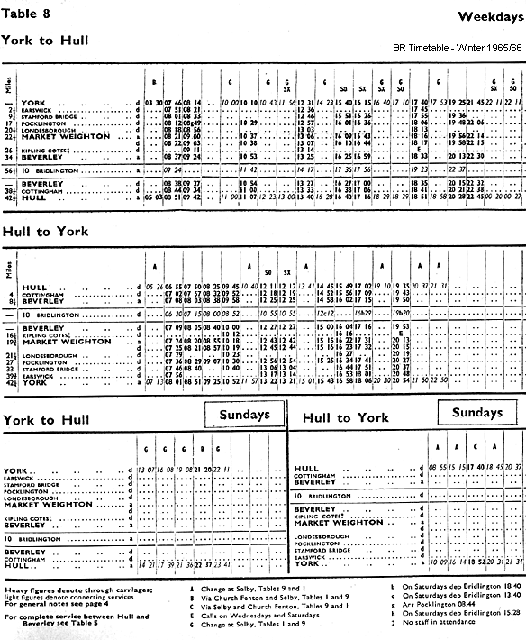
Initially three trains ran daily in each direction between York and Market Weighton, with two trains between Selby and Market Weighton. It was suggested that by juggling the timetable only one locomotive would be required to run both services - but this could not be achieved. By 1850 one of the Selby trains started at Pocklington on the York line, after a petition for better market travel facilities, which resulted in a general market ticket scheme from April 1851. The York line failed to live up to expectations. In August 1850 the directors heard that receipts at Huntington barely exceeded the stationmaster's wages, and there was a proposal to close the station. This did not happen, although there were some redundancies in an attempt to save money, and there was a proposal to single the line as early as 1853- while the doubling of the Selby line started in 1889.
The stations on the York line eventually suffered heavily from the North Eastern Railway policy of renaming, which avoided any possibilities of confusion, but resulted in many stations conveniently situated for a particular village receiving the name of one much further away. Huntington became Earswick, Stockton turned into Warthill, Burnby to Nunburnholme, and Shipton to Londesborough. From its opening Market Weighton had been a terminus, but it was always intended that the York line should be extended south to Beverley, and the Selby line east to Driffield. The extension to Beverley proved problematic due to the routing of the line across the Dalton Holme Estate. By this time the Y&NMR were in financial difficulties, and they argued that there was now little public demand for the line. This view angered local people and, when the Y&NMR became part of the North Eastern Railway in 1854, the company found itself under the local pressure to complete the line.
The single-track extension opened on 1st May 1865, and a new revised timetable was immediately introduced with four stopping trains from York to Hull completing the journey in two hours. There was also a fast service that called only at principal stations. The NER began a programme of doubling the line in 1899 with a second platform being provided at the two intermediate stations. At this time the NER had no plans to extend eastward from Market Weighton to Driffield but, after several failed proposals, the Scarborough Bridlington & West Riding Junction Railway began building a line between Driffield and Market Weighton in 1888, having secured an agreement to work the line with the North Eastern Railway. The line opened to passenger traffic on 21st April 1890, having opened to goods traffic some weeks earlier. Following the 1923 general grouping, the LNER improved the service on both the York and Selby lines. In 1925 there were eight daily trains between York and Hull and seven in the opposite direction; not all trains called at all stations. There were two additional Saturday workings between York and Pocklington which were used to trial a new petrol rail car. One was in the morning and the other in the evening, but only the outward journey to Pocklington in the evening carried passengers. While the Market Weighton to York service still carried a reasonable number of local passengers, many of the stations on the Selby line were little used and had all closed by 20th September 1954. A limited passenger service between Selby, Market Weighton and Bridlington was retained, until final closure of the line to all passenger traffic was proposed for 15th June 1964. An appeal was rejected and the service was withdrawn on 14th June 1965. With the closure of Holme Moor and Everingham goods depots on 2nd August 1965, the whole route was completely defunct.
In May 1961 a contract for further modernisation work on the route was agreed with the engineering firm Westinghouse. Within weeks the first consignments of equipment were being delivered to Pocklington. The main part of the plan was to reduce costs further by singling the track but providing passing loops at Pocklington and Market Weighton. The line would be operated from a Centralised Traffic Control installation at Bootham Junction, York. Work was also to include the conversion of 19 of the line's 22 remaining gated level-crossings to automatic half-barriers and an overhaul of the signalling system, allowing the whole route to be controlled from fewer signal boxes.
Very little work had been carried out before the modernisation scheme was suddenly halted in February 1962, with British Railways announcing that the plans had been suspended for "re-assessment". What was happening became clear on 27th March 1963 when Dr. Richard Beeching released his report. The York to Beverley route was earmarked for closure, and was one of only three lines in the report to be presented as an economic case study. Beeching considered that closure was justified on the grounds that it was actually losing money when all the "terminal costs" were taken into account, and that closing the seemingly-profitable line would create greater savings that were more beneficial than the income it was making. He also argued that the majority of passengers were simply travelling between York and Hull, and that intermediate stations were underused. This made the line an unnecessary duplicate of the Hull to York Line (via Selby) despite the fact that the more direct line was far from underused.
Passenger services officially ceased as from 29th November 1965. The Minister's consent caused widespread bitterness. Critics of the closure claim that if the C.T.C. scheme had been revived it would have paid for itself in seven years and, thereafter, have permitted an annual profit of some £7,000. It also appeared that was an error over the alleged losses as, at the public inquiry, the British Railways Board stated these had been reduced by dieselisation and improved working to some £11,000. Yet the Ministry spoke of an annual deficit of some £100,000; a gentleman at Pocklington (who organised a protest) wondered, quite seriously, whether some secretary typed one naught too many. Four years after closure all the lands and assets of the mothballed route were sold off by British Rail, mostly to local landowners and developers, resulting in the construction of houses on parts of the route in built-up areas. Nonetheless the majority of the trackbed and several railway buildings survive to this day. Pocklington station (a Grade II listed building) has been preserved and is now the sports hall of Pocklington School. In Stamford Bridge the station house and engine shed survive in other uses as do the platforms on both sides of the old trackbed. The impressive brick and cast-iron viaduct at Stamford Bridge that carried the line across the River Derwent was spared from demolition in 1991 and subsequently repaired. Other railway and station buildings still survive in good condition at Warthill, Holtby, Fangfoss, Nunburnholme, Londesborough, Cherry Burton and Kipling Cotes. The 11-mile long Hudson Way footpath and cycleway follows the course of the line from Market Weighton – Beverley, with a car park at Kipling Cotes station.The substantial station buildings at Market Weighton were left abandoned before being pulled down in 1979, leaving no trace. Earswick was the only other station on the line to be totally demolished, although its position is marked by a railway signal outside the pub that now occupies the site. The continuation of the line from Beverley to Hull was spared from closure and today forms the southern end of the Yorkshire Coast Line between Hull and Scarborough. In recent years, there has been considerable public support among local residents for the reopening of the line between York and Beverley. There has even been campaigning to this effect, led largely by the Minsters' Rail Campaign pressure group who argue that the railway was unfairly closed and that East Yorkshire's roads, particularly the A1079, are struggling to cope with increasing traffic to and from Hull. A report by the Carl Bro Group for East Riding of Yorkshire Council in 2004 concluded that the project was feasible, but would cost around £239 million to build. The council subsequently gave their complete backing to the proposals, however no further developments have taken place.
Sources:
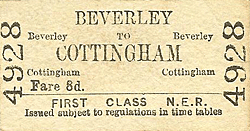
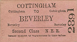
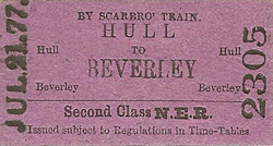
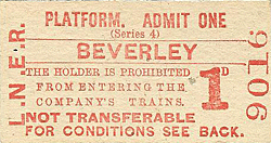
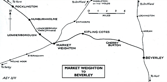
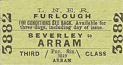
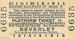
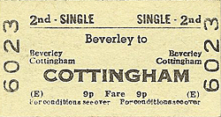
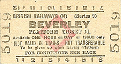
Tickets from Michael Stewart, timetable from Alan Young, route map drawn by Alan Young. To see other stations on the Earswick, Warthill, Holtby, Stamford Bridge, Fangfoss, Yapham Gate, Pocklington, Nunburnholme, Londesborough Park, Londesborough, Market Weighton, Kipling Cotes & Cherry Burton |
||||||||||||||||||
old13.jpg)
Beverley station looking north in 1957.
.
old23.jpg) Looking north towards Beverley station in April 1961.
Looking north towards Beverley station in April 1961.old16.jpg) The 14.50 Hull - York DMU arriving at Beverley station on 27th November 1965, the last day of public service on the York Line.
The 14.50 Hull - York DMU arriving at Beverley station on 27th November 1965, the last day of public service on the York Line.Photo by Alan Brown
old10.jpg)
Photo by M A King
old3.jpg)
a warehouse on the left.
Photo by M A King
old20.jpg)
Photo by Alan Young
old21.jpg)
1.jpg)
Photo by David Wright, reproduced from Geograph under creative commons licence
2.jpg)
Photo by John Furnevel

 Home Page
| Last updated: Sunday, 04-Jun-2017 09:42:54 CEST |
© 1998-2011 Disused Stations
|