|
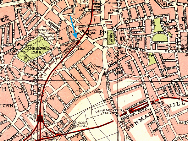
Notes: Camberwell station opened with the LCDR's Metropolitan Extension on 6 October 1862. The station was built on a viaduct. The entrance was though a yellow-brick street level building on the down side, three storeys in height. The building was typical of others provided by the LCDR for their inner London stations and was almost identical to the main building at Elephant & Castle, having arched doors and orange-lined windows: these can still be seen at Elephant & Castle and Herne Hill. Seven months after opening the station was renamed Camberwell New Road on 1 May 1863.
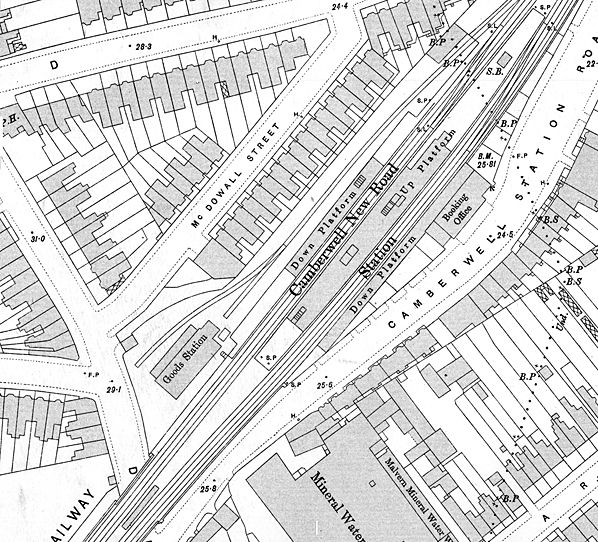
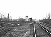
 As built the station had two facing platforms but, when the line was quadruped, the station was rebuilt at track level with two side platforms and a central island; the original street level building was retained. The island platform was 580ft in length and the two side platforms were about 350ft. The three platforms were linked through the arches of the viaduct. All three platforms had substantial canopies. That on the island and the down side platform were 290ft long while the up side platform was somewhat shorter at 175ft. The two additional lines were brought into use on 1 January 1866. As built the station had two facing platforms but, when the line was quadruped, the station was rebuilt at track level with two side platforms and a central island; the original street level building was retained. The island platform was 580ft in length and the two side platforms were about 350ft. The three platforms were linked through the arches of the viaduct. All three platforms had substantial canopies. That on the island and the down side platform were 290ft long while the up side platform was somewhat shorter at 175ft. The two additional lines were brought into use on 1 January 1866.
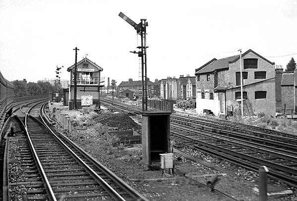
A two-storey signal box was located at the Blackfriars end of the island platform, and this was built to the LC&DR’s own in-house design in 1885/6. It was virtually a mirror image of the signal box which still survives at Shepherds Well and is the only surviving example of the standard design box produced between the late 1870s and early 1880s by the LC&DR. It survives with the original windows and decorative end bargeboards intact and is Grade II listed.
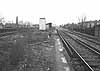
 The signal box controlled all movements around the station including the small goods yard on the up side. The yard was at a lower level with a set of steps down to it from the west end of the up platform. The yard opened with the station and comprised two sidings with a generous goods shed at the west end which was not directly rail-connected. Access to the yard was from the north side of Denmark Road close to its junction with McDowell Street. The yard had limited facilities and handled only general goods and parcels. It was also used by the Great Northern Railway and the Midland Railway via the Metropolitan Extension and by the London & South Western Railway via the LB&SC and SE&C lines. The signal box controlled all movements around the station including the small goods yard on the up side. The yard was at a lower level with a set of steps down to it from the west end of the up platform. The yard opened with the station and comprised two sidings with a generous goods shed at the west end which was not directly rail-connected. Access to the yard was from the north side of Denmark Road close to its junction with McDowell Street. The yard had limited facilities and handled only general goods and parcels. It was also used by the Great Northern Railway and the Midland Railway via the Metropolitan Extension and by the London & South Western Railway via the LB&SC and SE&C lines.
The station reverted to its original name, Camberwell, on 1 October 1908. It was initially well used but, as with many inner London stations, the introduction of electric trams brought a dramatic reduction in passenger receipts dropping from £3,000 in 1905 to just £900 in 1912 and £700 in 1914. This low passenger use could not be maintained. One-by-one trains on a variety of routes ceased to call at Camberwell, and the station closed on 3 April 1916 with the withdrawal of the SEC's circuitous Metropolitan Extension service from Moorgate Street to Victoria. The LSW service from Ludgate Hill to Richmond had stopped calling at Camberwell a few years earlier. At the time the closure was considered temporary but it was never to reopen. The goods yard remained in use and was now the only SE&CR-owned goods yard located between Blackfriars and Herne Hill.
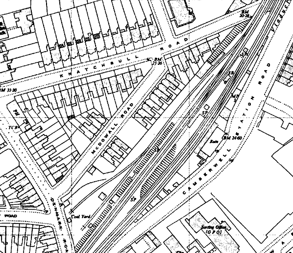
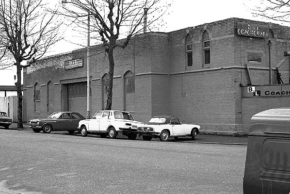
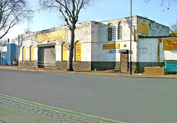
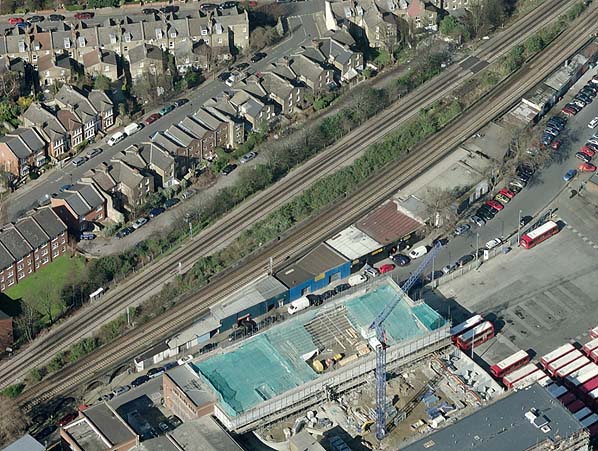
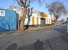
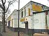
All the track level buildings were demolished by 1924. Only the island platform with its signal box and the street level building survived. At some time the building lost its upper floor, perhaps following enemy action in WW2. A 1952 map, reproduced below, shows the building as a ruin. It was later renovated and to this day it remains on use as a motor repair workshop.
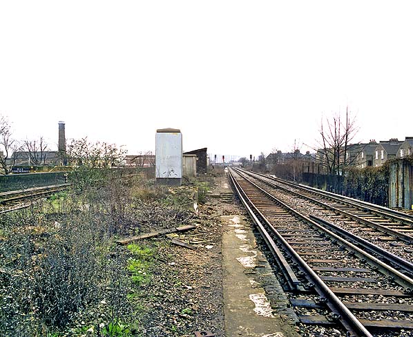
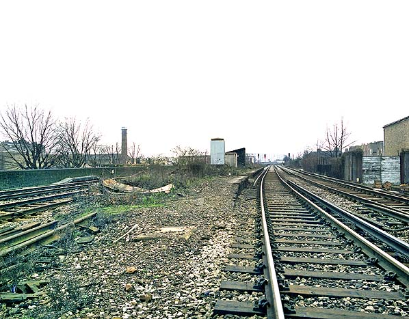
By the early 1950s the goods shed had been demolished and it is likely the yard handled only coal by this date. The yard remained open until 18 April 1964 leaving only the signal box still in use. This was given new signage by 1967, seeing an early usage of British Rail's new Corporate Identity which was launched in 1965.The box finally closed on 15 February 1970.
 In the 1990s there was a well organised campaign to reopen the station but if Camberwell does ever get a new station it is more likely to be an underground station. Camberwell was almost provided with a tube station in the 1930s. This was scuppered by the war, but was revived in the late 1940s when an extension of the Bakerloo line from Elephant & Castle appeared on some maps as 'under construction'; it was even shown on illuminated signs such as this one at Maida Vale. Southwark Council has now pledged £50,000 to carry out a feasibility study for a tube station. In the 1990s there was a well organised campaign to reopen the station but if Camberwell does ever get a new station it is more likely to be an underground station. Camberwell was almost provided with a tube station in the 1930s. This was scuppered by the war, but was revived in the late 1940s when an extension of the Bakerloo line from Elephant & Castle appeared on some maps as 'under construction'; it was even shown on illuminated signs such as this one at Maida Vale. Southwark Council has now pledged £50,000 to carry out a feasibility study for a tube station.
Additional sources: London's Disused Stations Volume 3 - The London Chatham & Dover Railway. JE Connor. Connor & Butler 2002. Kent Rail web site.
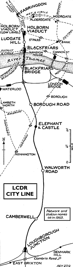 BRIEF HISTORY OF THE LCDR's 'CITY
LINE' BRIEF HISTORY OF THE LCDR's 'CITY
LINE'
The Metropolitan Extensions Act of 1860 gave the London Chatham
& Dover Railway access to the City, authorizing a 4.5 mile
line from Herne Hill across the river to join the Metropolitan
Railway at Farringdon Street.
The 'City Line' was far more than the Chatham could cope with
financially, but the possibilities for through traffic were vast.
To the north the G N R and the Midland could be reached and to
the south were the L B S C R and L S W R at Clapham Junction from
where the G W R and L N W R could be reached via the West London
Line. All these companies were approached to partake financially
and all eventually profited from the scheme gaining the right
to work trains to their own goods and coal depots in South London.
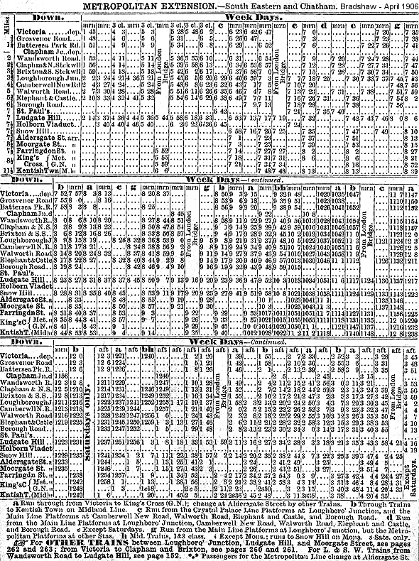
The line from Herne Hill to the Elephant and Castle was opened
on 6 October 1862 and on to Blackfriars Bridge on 1 June 1864.
Intermediate stations were initially provided at Camberwell, Walworth
Road and Borough Road and later at Loughborough Junction.
The Thames was eventually bridged and by 21 December 1864 a temporary
station at Ludgate Hill was in use, a permanent station being
opened on 1st June 1865. It had two narrow island platforms but
the station was rebuilt in 1910 with a single broader island platform.
On 1st January 1866, L C D R passenger trains began running into
the Metropolitan's Farringdon Street station and the connection
was soon carrying a wide variety of passenger and freight services.
Then, by an Act of 13 July 1871, the Chatham became committed
to yet another project. A nominally independent Holborn Viaduct
Station Company (for the bankrupt Chatham was not allowed to raise
capital) was authorized to build a 292 yard branch from the Ludgate
- Farringdon line to a new terminus, complete with hotel, fronting
on the new thoroughfare of Holborn Viaduct. It was opened on 2nd
March 1874.
On 1st August 1874 a low-level station, Snow Hill ('Holborn Viaduct
Low Level' from 1912), was opened at the foot of the 1 in 39 incline.
Finally, on 10th May 1886 a parallel bridge across the Thames
was opened with, at the northern end, yet another new station,
St. Paul's, the original Blackfriars Bridge being closed. St.
Paul's was renamed Blackfriars on 1st February 1937. The existing
layout was completed when the South Eastern Railway opened the
Union Street spur on 1st June 1878 creating a through route into
Charing Cross.
 The difficulties of inter-terminal transfer through the congested
streets of mid-Victorian London assured considerable transfer
traffic. All L C D R mainline trains, including continental ones,
carried a City portion attached or detached at Herne Hill. Eventually
however the development of the underground network led to the
withdrawal of the through services and the demise in the importance
of Holborn and Blackfriars with a dramatic reduction in off peak
services. Holborn retained very heavy parcels traffic, including
continental and three of its six platforms, too short for electric
trains were utilised. The difficulties of inter-terminal transfer through the congested
streets of mid-Victorian London assured considerable transfer
traffic. All L C D R mainline trains, including continental ones,
carried a City portion attached or detached at Herne Hill. Eventually
however the development of the underground network led to the
withdrawal of the through services and the demise in the importance
of Holborn and Blackfriars with a dramatic reduction in off peak
services. Holborn retained very heavy parcels traffic, including
continental and three of its six platforms, too short for electric
trains were utilised.
The first casualty on the line was Borough Road which closed
on 1st April 1907 due to competition from the Northern Line. As
an economy measure during WW1 through services from south of the
Thames to Moorgate via the Smithfield Curve (opened 1.9.1871)
were withdrawn on 1st April 1916 with Camberwell and Walworth
Road stations closing two days later. Holborn Viaduct Low Level
closed on 1st June 1916 and with it through passenger traffic
on the City Line ceased.
Less than 700 yards separated Holborn Viaduct from Blackfriars.
Ludgate Hill thus became increasingly redundant, especially after
the through trains stopped. The intensive Ludgate Hill - Victoria
services were withdrawn during the First World War. The Wimbledon
trains were the last to call and with their electrification it
was closed on 3 March 1929.
 In 1902, 19.2 million passengers used Holborn, Ludgate and St.
Paul's. Use declined with the loss of the cross London traffic
until electrification. The growth of L.C.C. estates in S E London
and Kent increased traffic but this was not maintained and in
1960 they were back to the 1902 level with 88% of the traffic
arriving or departing during the rush hour. The 'City Line' was
still a vital north-south freight link with some 90 trains a day
in 1962, but all regular freight and parcels services were withdrawn
in 1969. Although disused for many years the Snow Hill tunnel
was finally abandoned in 1971 and the track was lifted. In 1902, 19.2 million passengers used Holborn, Ludgate and St.
Paul's. Use declined with the loss of the cross London traffic
until electrification. The growth of L.C.C. estates in S E London
and Kent increased traffic but this was not maintained and in
1960 they were back to the 1902 level with 88% of the traffic
arriving or departing during the rush hour. The 'City Line' was
still a vital north-south freight link with some 90 trains a day
in 1962, but all regular freight and parcels services were withdrawn
in 1969. Although disused for many years the Snow Hill tunnel
was finally abandoned in 1971 and the track was lifted.
The Snow Hill tunnel was reopened in 1988 as part of the new
Thameslink
network which came into service in May 1990, initially as part
of British Rail but private since March 1997. To coincide with
the opening of Thameslink,
Holborn Viaduct Station was closed on 22nd January 1990. The line
into Holborn Viaduct over Ludgate Hill was removed and a new line
built that drops down steeply from Blackfriars station into a
new station called City Thameslink (opened 29.5.1990) beneath
the former Holborn Viaduct Station. The station was originally
called St. Paul's Thameslink but was renamed in 1991 to avoid
confusion from St. Paul's station on the Central line.
 The northern part of the Thameslink
network replaced the 'Bedpan' service from Bedford to St. Pancras
and uses the existing Midland Main Line. In the south there are
two branches. The main route runs through London Bridge to East
Croydon and Brighton while the second branch initially ran into
Guildford via West Croydon but has now been rerouted through Mitcham
to terminate at Sutton. The northern part of the Thameslink
network replaced the 'Bedpan' service from Bedford to St. Pancras
and uses the existing Midland Main Line. In the south there are
two branches. The main route runs through London Bridge to East
Croydon and Brighton while the second branch initially ran into
Guildford via West Croydon but has now been rerouted through Mitcham
to terminate at Sutton.
Thameslink
has become a significant commuter route serving the airports at
Gatwick and Luton and carries around 40 million passenger journeys
on the system annually.
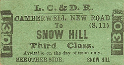
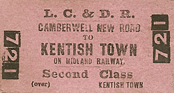
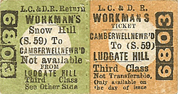
Tickets from Michael Stewart. Bradshaw from Chris Hind. Route map drawn by Alan Young.
Sources: A
regional history of the railways of Great Britain - Volume
3 Greater London by H P White. David & Charles 1963 &
1971 ISBN 0 7153 5337 3
Other web sites: Abandoned
Tube Stations - includes a cab ride from Farringdon - Blackfriars
To see the other stations on the
L C D R's 'City Line' click on the station name: Loughborough
Junction, Walworth
Road, Borough Road,
Blackfriars Bridge,
Blackfriars, Ludgate
Hill, Holborn
Viaduct,
Snow Hill/Holborn Viaduct
Low Level & Farringdon |

new_road_old1.jpg)
new_road_old2.jpg)
new_road14.jpg)
new_road13.jpg)
 Home Page
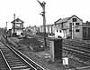
new_road_thumb23.jpg)
new_road_thumb24.jpg)
new_road_thumb25.jpg)
new_road_thumb26.jpg)
new_road_thumb27.jpg)
new_road_thumb19.jpg)
new_road_thumb20.jpg)
new_road_thumb21.jpg)
new_road_thumb22.jpg)
new_road_thumb15.jpg)
new_road_thumb12.jpg)
new_road_thumb17.jpg)
new_road_thumb16.jpg)
