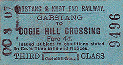
Notes: Cogie Hill Halt was originally known as simply Cogie Hill and it was a stopping point on the Garstang & Knot (sic) End Railway (G&KER) from when the line opened on 5 December 1870. At the time of opening the line ran between Garstang station on the London & North Western Railway (LNWR) and Pilling, a distance of 7 miles. The LNWR Garstang station was located on their west coast trunk route between London and Glasgow and it was 1¾ miles from the town.To avoid confusion the LNWR station was referred to as Garstang Junction from 1870 (although officially it was still Garstang). Originally the G&KER had been authorised on 30 June 1864 to build an 11 mile 29 chain line between Garstang & Catterall and Knott End but financial difficulties resulted in Pilling becoming the western terminus.
 Cogie Hill was at about the mid-point of the 7 mile single track line and it was chosen as the site for an intermediate station. However in the early days of the construction of the line, following representations from the local landowners and farmers, a decision was made to build the station further east, at what eventually became Nateby station. Cogie Hill was at about the mid-point of the 7 mile single track line and it was chosen as the site for an intermediate station. However in the early days of the construction of the line, following representations from the local landowners and farmers, a decision was made to build the station further east, at what eventually became Nateby station.
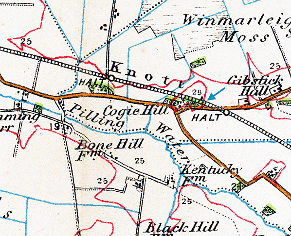
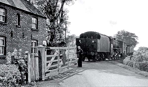
At Cogie Hill Island Lane crossed the railway by means of a level crossing. A crossing keeper’s cottage (one of six along the line) was located on the east side of the crossing and on the south side of the line. At the time of opening there were only two trains in each direction that served Cogie Hill. They ran as mixed passenger and goods. The G&KER only been able to afford one engine which they obtained through a hire purchase arrangement, the engine was an 0-4-2ST locomotive called Hebe.
There were no passenger facilities at Cogie Hill and the exact point at which the trains stopped is not known. A platform and waiting shelter were erected to the west of the level crossing (on the south side of the line) shortly after 1893 and it possible that this was the spot at which the trains had always stopped. Equally they may have stopped by the crossing keeper’s cottage which is marked on the 1915 1inch scale map as the halt.
 The line struggled financially and by 1872 the G&KER was having mechanical problems with Hebe (due to inadequate maintenance). When the engine failed passenger services ceased to run on 11 March 1872. Services started up again after repairs were made but further problems resulted in them ending again on 29 March 1872. The line struggled financially and by 1872 the G&KER was having mechanical problems with Hebe (due to inadequate maintenance). When the engine failed passenger services ceased to run on 11 March 1872. Services started up again after repairs were made but further problems resulted in them ending again on 29 March 1872.
Arrangements were made to purchase an engine and on 17 May 1875 a full service was reintroduced. Financial troubles continued and in 1878 the line was put into the hands of a receiver.
In 1881 the LNWR renamed their Garstang station as Garstang & Catterall.
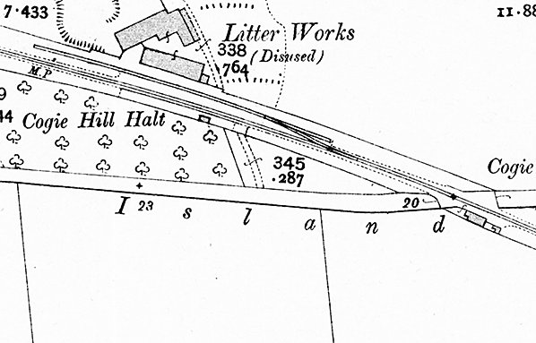
In August 1889 a Moss Litter Works opened on the north side of the line and was provided with its own private siding.
As has been pointed out in an earlier paragraph a platform and waiting shelter were provided shortly after 1893. The platform was linked to Island Lane by a footpath.
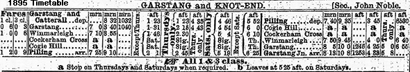
The December 1895 timetable showed that Cogie Hill was only being served by four trains in each direction on Thursdays and Saturdays only.
Aspirations of reaching Knott End had not gone away but the G&KER was not able to raise the capital. On 12 August 1898 the Knott End Railway (KER) was authorised to build a 4½ mile line between Pilling and Knott End. On 1 July 1908 the KER bought the G&KER and on 29 July 1908 the line to Knott End opened. Under the KER passenger services were improved especially during the summer months.
The term ‘Halt’ was being used on maps from 1912.
In 1920 a railmotor was hired from the LNWR and it was used to operate most of the passenger services (Click here to see an OS quarter-inch scale map of the line as it was in 1920).
On 1 July 1923 the KER was absorbed into the London Midland & Scottish Railway (LMS).
During the 1920s competition from buses led to a decline in passenger numbers and on 31 March 1930 the LMS withdrew the passenger service from the line. Cogie Hill Halt was closed completely but the degraded remains of the platform and the waiting shelter could still be seen in the late 1940s.
Goods services continued to run on the line but from 13 November 1950, when the line was in British Railways ownership, the section of line between Knott End and Pilling was closed completely. On 1 August 1963 goods services ceased running between Garstang Town and Pilling. The track was lifted a couple of years later.
CLICK HERE FOR A DETAILED HISTORY OF COGIE HILL HALT
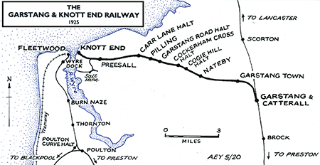
Route map by Alan Young
Sources:
- Awdry, C British railway companies (Guild Publishing,1990)
- Clinker, C R Clinker’s register of closed passenger stations and goods depots in England, Scotland and Wales 1830-1977 (Avon-Anglia,1978)
- Cobb, M H The Railways of Great Britain – vol.1 (Third Edition) (Author, 2015)
- Holt, G O A Regional History of the Railways of Great Britain – vol.10 (David & Charles, 1978)
- Quick, Michael Railway passenger stations in Great Britain - a chronology (RCHS, 2009 and on-line supplements)
- Richardson, D The Pilling Pig - A History of the Garstang and Knott End Railway (Cumbrian Railways Association, 2019)
To see the
other closed of the Knott End Branch
click on the station name: Garstang & Catterall, Garstang Town, Nateby, Cockerham Cross, Garstang Road, Pilling, Carr Lane, Preesall and Knott End
Click here to see Register of Closed Railways 1901 - 1994 |

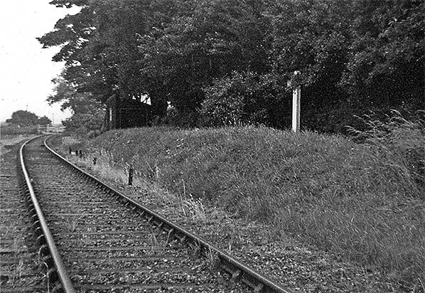

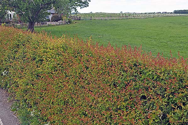 A view looking west at the site of Cogie Hill Halt in May 2020.
 Home Page