
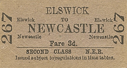
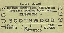
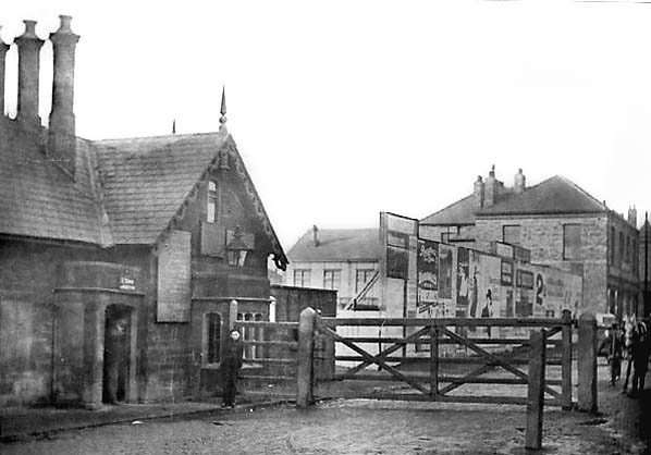
Station Name: ELSWICK
|
| Date opened: | 2.9.1889 |
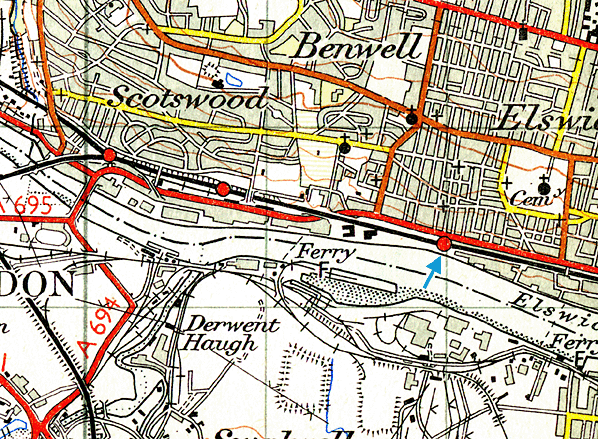
| Location: | South side of Scotswood Road, about 100yd east of junction with William Armstrong Drive |
| Company on opening: | North Eastern Railway |
| Date closed to passengers: | 2.1.1967 |
| Date closed completely: | 2.1.1967 |
| Company on closing: | British Rail (Eastern Region) |
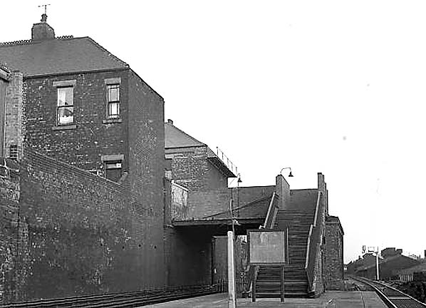
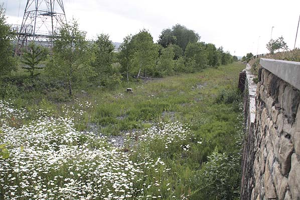
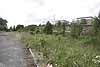
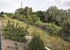
| Present state: | Demolished |
| County: | Northumberland |
| OS Grid Ref: | NZ220634 |
| Date of visit: | July 1961, May 1967, August 1972 & 4th June 2009 |
|
Notes: This populous industrial suburb of Newcastle grew from a population of 3,500 in 1851 to almost 28,000 in 1871 yet it did not have a station until 1889. The station was built at the western end of Armstrong’s huge Elswick Works site, its workforce (exceeding 11,000 by 1900) providing a significant proportion of the station’s traffic.
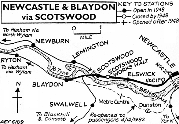
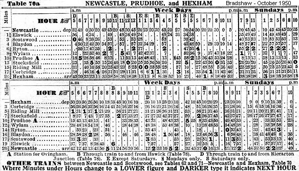
BRIEF HISTORY OF THE NEWCASTLE - CARLISLE EAILWAY The first few miles of the cross-country journey from Newcastle to Carlisle were thoroughly urban and industrial. To the left, the extensive buildings of Vickers-Armstrong’s Elswick engineering works hugged line, whilst to the right, immediately beyond the famous Scotswood Road, rows of impossibly steep streets of terraced flats plastered the slope. After Paradise Bridge, shortly before Scotswood station, the Victorian landscape gave way to a council estate, and a clear view of the river. Approaching Scotswood, the railway divided; the main pair of tracks diverged to the left through the station’s lower platforms, and crossed the Tyne on a six-span hogback girder bridge into Blaydon in County Durham. The lesser-known ‘North Wylam loop’ carried straight on through the higher-level platforms, and disappeared into a short tunnel. The Blaydon and North Wylam routes reunited before Prudhoe, and the remainder of the journey to Carlisle was through some of England’s finest rural landscapes.
The Newcastle (or, more accurately, Gateshead) to Carlisle line was the first to cross the breadth of England from the east to the west coast. Horse-drawn goods trains commenced between Blaydon and Hexham in late-1834, and passenger services on 9 March 1835. Newcastle passengers were conveyed to and from Blaydon by horse-omnibus or boat. Steam locomotives hauled passenger trains from the opening day. On 11 June 1835 a 1¼ mile extension opened eastwards to Derwenthaugh, followed by 7½ miles from Hexham to Haydon Bridge on 28 June. Carlisle to Blenkinsopp Colliery, near Haltwhistle (20 miles), opened on 19 July 1836. On 1 March 1837 trains were introduced on the 2½ miles from Derwenthaugh to Redheugh (Gateshead), passengers being ferried by steamboat across the Tyne to a ‘station’ in Newcastle at No. 66 The Close, where the later High Level Bridge crossed the river. (The Close was one of a scarce breed of rail-less stations in Britain, others being Dartmouth and Hull Corporation Pier.)
N&CR rails reached Newcastle via a three-mile route including a ‘temporary’ Tyne bridge at Scotswood (which was eventually replaced with the present structure in 1870). Formal opening to a station at Railway Street, close to the Shot Tower, took place on 21 May 1839; regular services began on 21 October. The new Forth terminus, replacing that at Railway Street, opened on 1 March 1847. From 1 January 1851 the company used Newcastle Central, shared with the York, Newcastle & Berwick Railway. Although access to Carlisle Citadel had yet to be achieved, the 60½-mile route was complete.
The Newcastle & Carlisle was absorbed into the North Eastern Railway empire in July 1862. Its eccentric arrangement of right-hand running was discontinued after the re-signalling of the route for the standard left-hand operation in 1863-4. In the 1960s the transformation of the townscape surrounding the railway between Newcastle and Blaydon began. Many of the terraces of two-storey Tyneside flats were demolished and high-rise blocks took their place, and more recently the Elswick works site has been all but cleared and redeveloped as a business park.
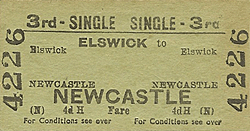
Tickets from Michael Stewart Sources:
To see other stations on the Newcastle - Blaydon click on the station name: Newcastle (N & C 1st site), Newcastle (N & C 2nd site), Scotswood Works Halt, Scotswood & Blaydon |
old1.jpg)
old2.jpg)
Photo by Brian Johnson
old_thumb4.jpg)
old_thumb3.jpg)

|
 Home Page
 | Last updated: Thursday, 18-May-2017 11:15:50 CEST |
© 1998-2009 Disused Stations
|