
Station Name: SCOTSWOOD WORKS
|
| Date opened: | 1915 |
| Location: | Between Scotswood Road and Coanwood Road |
| Company on opening: | North Eastern Railway |
| Date closed to passengers: | 1944 |
| Date closed completely: | 1944 |
| Company on closing: | London & North Eastern Railway |
| Present state: | Demolished |
| County: | Northumberland |
| OS Grid Ref: | NZ207637 |
| Date of visit: | September 1962 & 4th June 2009 |
|
Notes: The halt was about 700yd east of Scotswood station, opened in World War I for workers at Armstrong Whitworth’s munitions factory. It was built at that company’s expense following an Agreement with the NER of 25 August 1915. The 150 yd island platform was reached by a footbridge. Because of the large volume of traffic Armstrong Whitworth and the Ministry of Munitions paid for the halt to be enlarged. A further platform, 150yd long and 10-14 ft wide, was constructed south of the down line. The existing island platform became the up platform, fenced on its southern side. Shelters were installed centrally on both platforms, that on the up platform being larger. The new platform was used from 30 May 1919. The layout thus had two platforms facing in the same direction – an unusual arrangement, also found at West Auckland (County Durham). The train service was intensive, as shown in the November 1918 working timetable. The halt did not appear in public timetables, but tickets were issued from it. On weekdays between 5:30 and 7:00 am twelve trains called (eight of them workmen’s trains - not publicly advertised). Four were from Newcastle, three from Scotswood, and one each from Hexham, North Wylam, Newburn, and Lintz Green. A further service ran from Blackhill for workmen, but its advertised origin was Lintz Green. On Saturday four calls were made between noon and 1:00 pm. On Monday-Friday evening, trains to a variety of destinations made fifteen calls between 4:00 and 7:00 pm; the majority, again, were workmen’s trains. The 5:08 pm to Newcastle actually started at the halt. Seven trains called on Sunday between 4:15 and 7:00 pm.
BRIEF HISTORY OF THE NEWCASTLE - CARLISLE EAILWAY The first few miles of the cross-country journey from Newcastle to Carlisle were thoroughly urban and industrial. To the left, the extensive buildings of Vickers-Armstrong’s Elswick engineering works hugged line, whilst to the right, immediately beyond the famous Scotswood Road, rows of impossibly steep streets of terraced flats plastered the slope. After Paradise Bridge, shortly before Scotswood station, the Victorian landscape gave way to a council estate, and a clear view of the river. Approaching Scotswood, the railway divided; the main pair of tracks diverged to the left through the station’s lower platforms, and crossed the Tyne on a six-span hogback girder bridge into Blaydon in County Durham. The lesser-known ‘North Wylam loop’ carried straight on through the higher-level platforms, and disappeared into a short tunnel. The Blaydon and North Wylam routes reunited before Prudhoe, and the remainder of the journey to Carlisle was through some of England’s finest rural landscapes. The Newcastle (or, more accurately, Gateshead) to Carlisle line was the first to cross the breadth of England from the east to the west coast. Horse-drawn goods trains commenced between Blaydon and Hexham in late-1834, and passenger services on 9 March 1835. Newcastle passengers were conveyed to and from Blaydon by horse-omnibus or boat. Steam locomotives hauled passenger trains from the opening day. On 11 June 1835 a 1¼ mile extension opened eastwards to Derwenthaugh, followed by 7½ miles from Hexham to Haydon Bridge on 28 June. Carlisle to Blenkinsopp Colliery, near Haltwhistle (20 miles), opened on 19 July 1836. On 1 March 1837 trains were introduced on the 2½ miles from Derwenthaugh to Redheugh (Gateshead), passengers being ferried by steamboat across the Tyne to a ‘station’ in Newcastle at No. 66 The Close, where the later High Level Bridge crossed the river. (The Close was one of a scarce breed of rail-less stations in Britain, others being Dartmouth and Hull Corporation Pier.)
The omnibus service from Blaydon to Newcastle continued; its terminus in Newcastle was at an office at 50 Westgate Road. The gap between Blenkinsopp and Haydon Bridge was eventually completed, allowing directors to travel between Redheugh and Carlisle (London Road) on 15 June 1838. The formal opening was on 18 June. This event was less than successful; heavy rain drenched the passengers, and many were left shaken, and some injured, by two collisions.
The Newcastle & Carlisle was absorbed into the North Eastern Railway empire in July 1862. Its eccentric arrangement of right-hand running was discontinued after the re-signalling of the route for the standard left-hand operation in 1863-4. In the 1960s the transformation of the townscape surrounding the railway between Newcastle and Blaydon began. Many of the terraces of two-storey Tyneside flats were demolished and high-rise blocks took their place, and more recently the Elswick works site has been all but cleared and redeveloped as a business park. On 4 October 1982 passenger services ceased to use the Newcastle – Scotswood – Blaydon route. Trains were diverted from Newcastle West Junction over King Edward Bridge, then via Norwood Junction and Dunston to Blaydon. This alteration saved expenditure on maintaining Scotswood Bridge, and on points and crossings renewals at Blaydon and Newcastle West Junction. Tracks were removed from Scotswood Bridge and eastward beyond Elswick, leaving only a one-mile siding from Newcastle. The diversion added four minutes to journey times. On the new route the intermediate station at Dunston (closed 1926) was reopened in 1984, but for some years has enjoyed only a token service. The Metro Centre is adjacent to this route, and its station (opened in 1987) provides additional passenger traffic. Between Elswick and Scotswood the track is now a cycleway and footpath known as Hadrian's Wall Path, part of an 84 mile national trail. A regular user of the line through Scotswood Works Halt from 1941-7 recalls that the nameboard misleadingly read 'Delaval': perhaps this was to distract from the real function of the station during wartime. He also remembers that the station was unlit, and that, as the halt was unstaffed, alighting passengers' tickets were collected by the train guard.Tickets from Michael Stewart Sources:
To see other stations on the Newcastle - Blaydon click on the station name: Newcastle (N & C 1st site), Newcastle (N & C 2nd site), Elswick, Scotswood & Blaydon |
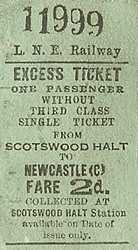
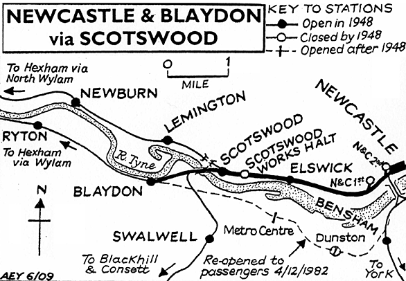
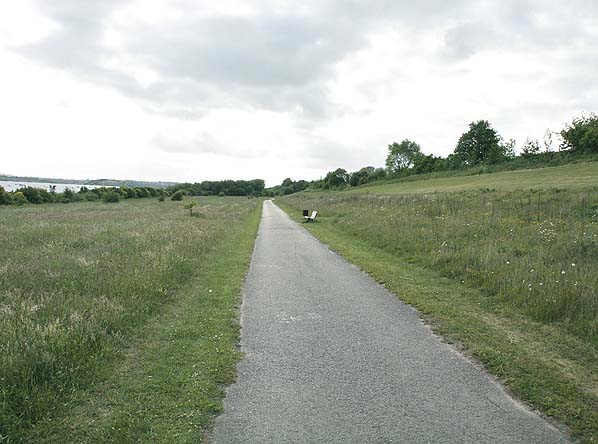
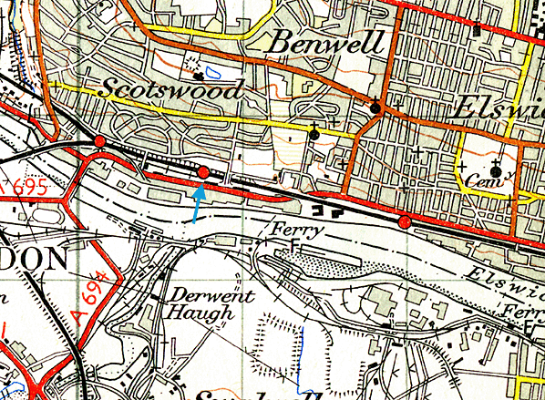
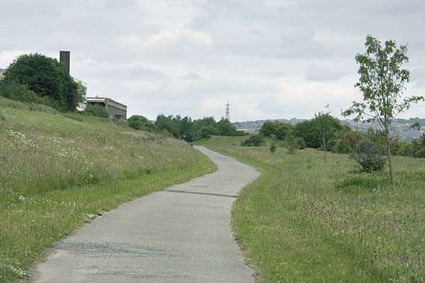
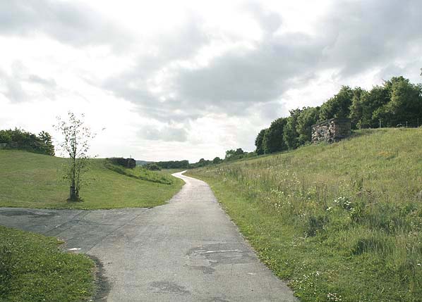
Photo by Ali Ford

|
 Home Page
 | Last updated: Friday, 26-May-2017 10:53:30 CEST |
© 1998-2009 Disused Stations
|