
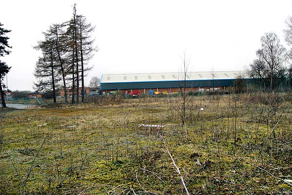
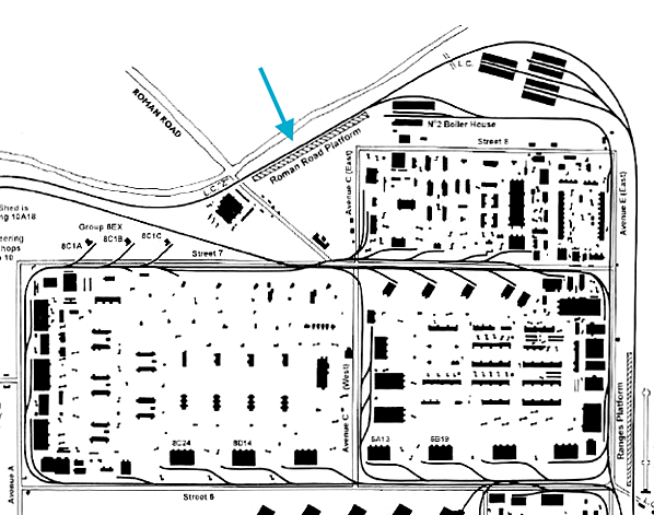
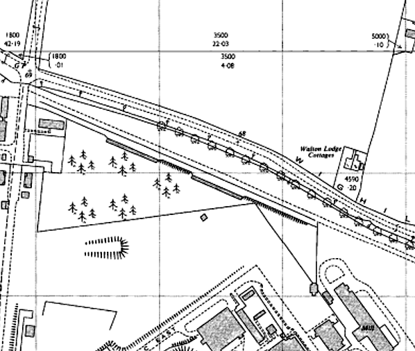
Station Name: ROMAN ROAD PLATFORM
|
| Date opened: | 1941 or 1942 |
| Location: | On the south side of Wighill Lane; the roundabout at the junction with Avenue C East is on the site of the east end of the platform. |
| Company on opening: | Thorp Arch Military Railway |
| Date closed to passengers: | 1957 |
| Date closed completely: | 1957 |
| Company on closing: | Thorp Arch Military Railway |
| Present state: | Demolished - no trace remains |
| County: | Yorkshire |
| OS Grid Ref: | SE453469 |
| Date of visit: | 12.4.2013 |
Notes: Roman Road Platform was one of four stops on the Thorp Arch circular railway. It was opened in 1941/2 during the construction of the Royal Ordnance Factory. The platform was initially used by construction workers and then by the regular workforce which, at its peak, reached 18,000. During WW2 the factory operated 24 hours a day with three shifts. Roman Road, and the three other platforms, allowed workers to disembark close to their actual place of work. Roman Road consisted of a single platform constructed of earth and cinders and faced with old sleepers. It had electric lighting, a nameboard and two lines of brick waiting shelters. It was sited at the north-east corner of the factory site. Two of the platforms on the Thorp Arch circular railway were brought into use in November 1941, whilst the other two were used from 19 April 1942. The regular passenger service ceased in 1957. The track was lifted c1959. The 1991 the 1:2,500 OS plan still shows the platform, but nothing remains today. Part of the site is lost under a new roundabout, and the rest has been cleared and fenced but is currently undeveloped. No photographs of the platform in use or after closure have been found. To see other stations on the Thorp Arch Military Railway |

|
 Home Page
 | Last updated: Monday, 22-May-2017 13:02:50 CEST |
© 1998-2013 Disused Stations
|