
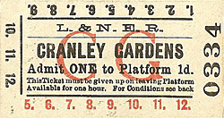
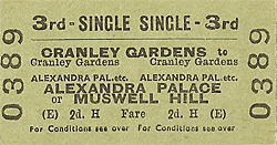
Station Name: CRANLEY GARDENS[Source: Nick Catford]
old6.jpg)
Cranley Gardens station looking east c.1905. Access to the platforms was from the rear of the street level building on Muswell Green Road. At the back of the building there was a footbridge which spanned the tracks immediately west of the Muswell Road bridge. From the bridge two ramps led down to the platforms; that serving the down platform is seen here.
Copyright photo from Paul Laming collection 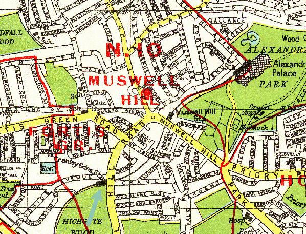 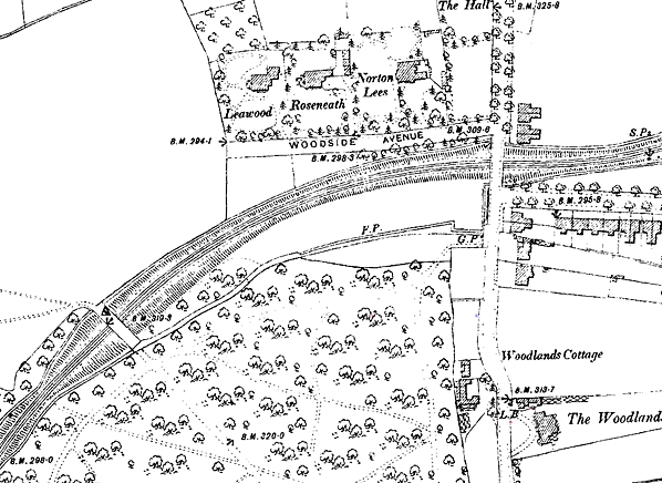
1896 1:2,500 OS map. Although the station didn't open till 1902 the goods yard opened in 1897. Although no sidings have yet been laid this map shows the land required has been cleared
ready for the yard. 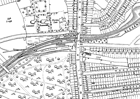
1912 1:2,500 OS map shows the layout of Cranley Gardens station and goods yard, The station had two facing platforms in a cutting and on a curve, The main station building was on the up (south) platform with a smaller building on the down platform. Both buildings are shown with a canopy stretching across to the platform edge (it only stretched part way). The booking office is seen on the west side of Muswell Hill Road on the up side of the line, At the rear of the building s footbridge spans the tracks with ramps down to the platforms. The down ramp also has an entrance on Muswell Hill Road. The entrance to the goods yard is to the south of the station alongside the booking office. Coal Merchants' offices are seen alongside the booking office and a weighbridge (WM) is seen just inside the entrance. The yard comprises three sidings, two running either side of the coal depot. The station signal box is shown on the down side opposite the entrance to the goods yard. Down sidings are also shown these are the truncated remains of sidings laid in 1906 for contractors building the Fortis Green reservoir. Once this had been completed the sidings were truncated in 1908 and used during the construction of the Fortis Green pumping station. Click here for larger version
1912 1:2,500 OS map. Little has changes since the earlier map. There is a new building just inside the entrance to the goods yard. The down sidings have been removed with the Fortis Green pumping station now on the site. Click here for larger version
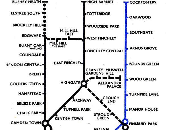 1948 pocket map of the London Underground showing the lines under construction. Click here to see the full map.
gardens_old3.jpg)
Looking north along Muswell Hill Road c 1905. The entrance to the goods yard is on the far left, next to it are several coal merchants' offices and, beyond that, the entrance to the booking office. Beyond the booking office the hump of the bridge over the line is clearly seen.
Photo from John Mann collection old5.jpg)
Cranley Gardens station looking east from the down platform c 1905. Both platforms were provided with similar wooden buildings with a flat roof that also acts as a canopy stretching part way across the platform. Both canopies have a deeply fretted wooden valance around three sides. The gents' toilet is seen at the west end of both buildings. At the far end of the up platform building the ramp up to the booking office on Muswell Hill Road is seen.
Photo from John Mann collection old4.jpg)
The grouping in 1923 brought new signage to the station as seen in this view of Cranley Gardens street level building on Muswell Hill Road in August 1935. Herbert Clark, one of the coal merchants at the station has his office next to the booking office.
Photo from Jim Lake collection gardens_old9.jpg) A Gresley designed N2/2 0-6-2T 4614 is seen at Cranley Gardens station in June 1937 with an Alexandra Palace to Finsbury Park train. The ramp up to the bridge at the rear of the booking office is seen on the right. This loco was built at Doncaster works in August 1921. The small chimneys were to suit the Metropolitan loading gauge for working to Moorgate. 4614 lasted until 30 September 1961 when it was withdrawn from New England shed and cut up at Doncaster works the next month.
Photo from John Mann collection gardens_old8.jpg)
Cranley Gardens station presents a clean and tidy appearance in this view east along the down platform in June 1937. Note the station name in the glass panel on the gas lamps which helped passengers identify the station at night.
Photo
from John Mann collection
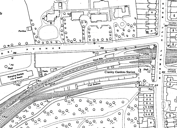
gardens_old10.jpg) Looking east from the footbridge from Lanchester Road towards Cranley Garden station circa early 1950s.The main lines are to the left with the line on the right running into Cranley Gardens goods yard. The station signal box is seen in the centre. The building on the left is the Looking east from the footbridge from Lanchester Road towards Cranley Garden station circa early 1950s.The main lines are to the left with the line on the right running into Cranley Gardens goods yard. The station signal box is seen in the centre. The building on the left is theFortis Green pumping station. Click here for a larger version of this photo. Photo from John Mann collection gardens_old2.jpg)
Looking west at Cranley Garden station c 1957 shortly after closure of the station to all traffic. Station signs have been removed but the track is not rusty and has clearly been used recently.
Photo from John Mann collection 21.jpg) Cranley Garden station looking east from the derelict down platform in April 1961. The track was lifted in 1958 and the station is slowly returning to nature. The goods yard was on the right behind the trees.
Photo by Ron Fisher from his Flickr photostream 22.jpg)
Cranley Gardens signal box in April 1961. The Metropolitan Water Board's Fortis Green pumping station in Woodside Avenue is seen in the background. The box controlled access to the goods yard and sidings on the site of the pumping station. These was laid in 1906 to facilitate the construction of the Fortis Green reservoir. After the reservoir was completed in 1908, the sidings remained in a truncated form and was used in the construction of the pumping station.
Photo by Ron Fisher from his Flickr photostream
|
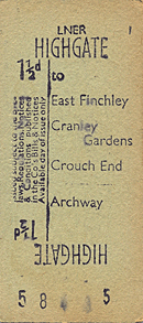
 Notes: Cranley Gardens station was a later addition to the line, opening on 2 August 1902 although the adjoining goods depot had been in use since 29th June 1897. The station had was a timber single-storey booking office with a hipped slate roof at street level on the west side of Muswell Hill Road. At the back of the booking office a bridge spanned the line with ramps down to the platforms. Each platform was provided with a similar timber building with a flat roof that incorporated a canopy. The canopies had a deeply fretted wooden valance around three sides. The up platform buildings comprised waiting rooms and toilets, with the gents' at the west end; it was somewhat longer than that on the down platform.
  In 1906, a number of down sidings were laid to the west of the station for use by contractors during the construction of the Fortis Green reservoir. Once this was completed in 1908, the sidings were shortened for use during the construction of the Fortis Green pumping station. They are not shown on later maps so are assumed to have been lifted once the construction had been completed.
  BRIEF HISTORY OF THE FINSBURY PARK TO ALEXANDRA PALACE LINE
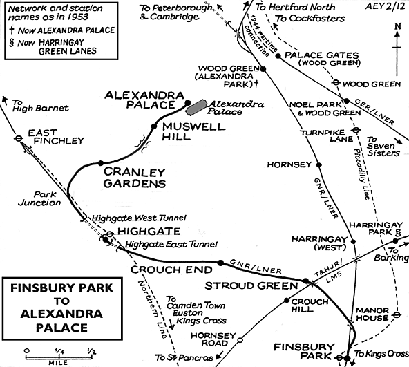
 The ‘main line’ between Seven Sisters Road and Edgware proved more costly than expected and shortly before completion the local company was taken over by the Great Northern who opened the line on 22nd August 1867 with intermediate stations at Crouch End, Highgate, East End Finchley, Finchley, Hendon and Mill Hill; but the extension to Watford was never built. On the 1st April 1872 the High Barnet branch was opened with the Alexandra Palace branch opening on 24th May 1873; the section between Muswell Hill and Alexandra Palace was still owned by the Muswell Hill & Palace Railway although worked by the GNR. The Alexandra Palace branch was an immediate success providing the most convenient route to the Palace from central London but the services was suspended a few weeks after opening when the palace was gutted by fire and was not reinstated until May 1875. Initially the branch was well used but within a year the MH & PR was in financial difficulty as passenger numbers fell dramatically. Several periods of closure for the terminus followed as the GNR failed to attract residential traffic to the line.
 Suburban growth on the main line as far as Finchley began in the 1860’s and a further station at Stroud Green was opened on 11th April 1881. Residential traffic between Muswell Hill and Highgate was also improving and an additional station at Cranley Gardens was opened in 1902 but Alexandra Palace station continued to be underused.
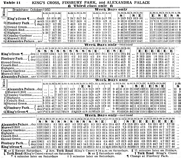
 London Transport had every intention of completing their New Works plan and although several lines, including the Alexandra Palace branch were shown 'under construction' on some underground maps until 1950 work never restarted.On 3rd July 1939 the existing northern line service was extended from Archway to East Finchley where it surfaced alongside the LNER line from Finsbury Park just south of the station. The steam trains which formerly served High Barnet and Edgware was cut back to East Finchley and after March 1941 all trains were diverted to Alexandra Palace instead but this improvement in service was short lived with all through trains were withdrawn and once again replaced by a limited shuttle.
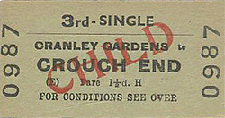 Freight traffic continued to serve Muswell Hill until 14th June 1956, and Cranley Gardens until 18th May 1957 after which date the line north of Park Junction was abandoned. The conductor rails were removed between January 1954 and February 1955 and the track north of Park Junction was lifted by early 1958. The section of line between Finsbury Park and Highgate remained open to freight traffic with Highgate High Barnet and Mill remaining open until 1st October 1962 and Edgware until 1 June 1964
 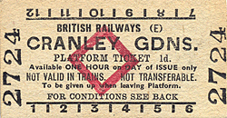 Before final closure the line had been used as an unofficial walkway. The section between Cranley Gardens and Alexandra Park including the St. James Lane viaduct was adopted as a Parkland Walk by Haringey Council in 1976 and the section between Finsbury Park and Highgate was similarly adopted a few years later. The Parkland Walk was officially opened in 1984 following extensive re-surfacing and improvements to access. The 3.9 mile walkway and cycleway is divided into two sections Finsbury Park to Highgate and Cranley Gardens to Muswell Hill and is now London's longest nature reserve and is incorporated into the 78 mile Capital Ring.
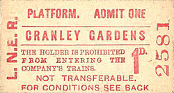

 Home Page