Notes: Haslingden station was located on the East Lancashire Railway’s (ELR) Clifton Junction to Accrington line which had opened in stages between September 1846 and August 1848. The section of line on which Haslingden stood was originally promoted by the Blackburn, Bury, Accrington & Colne Extension Railway (BBACER), which was incorporated on 30th June1845 to build a T-shaped line between Stubbins and Colne/Burnley via Accrington. Three weeks later, on 21st July 1845, BBACER was absorbed into the East Lancashire Railway (ELR).
 |
By 1845 the ELR was in the final stages of building a line from Clifton Junction to Rawtenstall via Stubbins. The aims of the ELR and the BBACER were so much in alignment, to create a route from the east Lancashire area to Manchester, that a merger of the two companies was seen as the best way forward. The economy of the town of Haslingden, like its |
neighbouring settlements, was expanding as the cotton industry – both spinning and weaving in this town - grew and prospered, promising rich financial rewards for the railway.
Haslingden station opened along with the entire 7.4 mile section of line between Stubbins Junction and Accrington on 17th August 1848, the line from Stubbins to Clifton Junction having opened nearly two years previously on 25th September 1846. The line required heavy engineering works and had severe gradients as it ascended from about 450ft to the summit of 771ft at Rising Bridge in only 2½ miles. From Accrington there was a lengthy climb at 1 in 40, easing to 1 in 47, and then 1 in 100 through Baxenden to Rising Bridge. To the south the gradients were less dramatic, but there were long stretches at 1 in 76 for much of the distance to Stubbins Junction.
 |
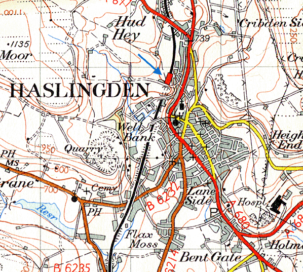
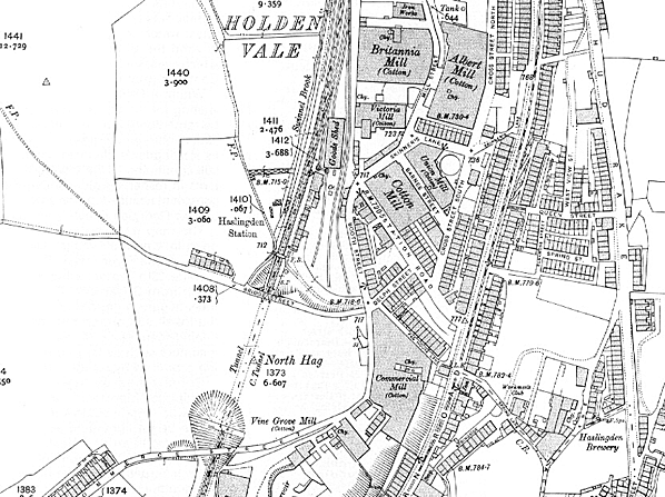
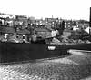
The station was located on the northwest outskirts of the town, at the north end of the 146-yard Haslingden (or North Hag) Tunnel. As the line was double-track the station was provided with two platforms. The main station buildings were located east of the line on the Manchester-bound platform. An approach road led to the main entrance of the station from the junction of Bridge Street and Booth Street.
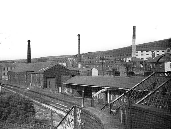
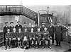
The main building was a long, single-storey stone built structure, with paired round-headed windows and recessed areas serving as passenger shelters on the platform. The slate hipped roof projected a short distance over the platform to provide an awning. On the Accrington-bound platform a long ridge-roofed timber shelter, amply supplied with windows, was provided. A lattice-pattern footbridge linked the two platforms at the south end of the station. The station also possessed goods facilities including sidings and a goods shed located east side of the line, a little north of the station.
The 1849 timetable showed seven weekday trains from Haslingden to Colne, and six to Manchester which originated at Colne. Four services ran to Colne on Sundays and three to Manchester from Colne.
On 13th May 1859 the Lancashire & Yorkshire Railway (LYR) absorbed the ELR. The LYR started to use the route through Haslingden as an alternative to its congested |
main line between Manchester and Leeds, which brought much extra traffic. The LYR also routed much of its holiday traffic through Haslingden. By 1882 fourteen trains called in each direction.
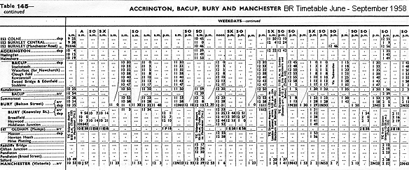
On 1st January 1922 Haslingden became part of the London & North Western Railway (LNWR) but a year later that company was in turn absorbed into the London Midland & Scottish Railway (LMS). By summer 1932 the station had seventeen northbound services on weekdays; most went to Colne, but three travelled only as far as Accrington. The first northbound service was for Colne, and it left Haslingden at 6:12 am. The last service, which had originated from Manchester Victoria, left Haslingden for Colne at 11:12 pm. Eighteen trains travelled south from Haslingden to Manchester Victoria on weekdays. The first southbound departure was at 6:15 am, and the last was at 10:18 pm.
On 1st January 1948 Haslingden became part of the nationalised British Railways (London Midland Region). In 1959 there were thirteen trains in each direction on weekdays, but that year trains ceased to call on Sundays. In the station’s final timetable its demise was foretold as some weekday trains, which called at Helmshore, omitted the Haslingden stop. The |
 |
Ordnance Survey One-inch map represented Haslingden as a principal station (although the criteria for identifying such stations were - and still are – arbitrary!) and it served a town of over 14,000 inhabitants, yet it closed to passengers on 7th November 1960, six years before the line itself. This apparently curious decision reflected the local geography. The station was on the very edge of the town, at the foot of a steep hill whilst frequent bus services ran through the town centre towards Accrington, Bury and Rossendale.
As with the other stations between Accrington and Bury - apart from Baxenden, which closed in 1951 - Haslingden was fitted with BR (LMR) enamel totem signs: they had probably been installed for under three years when the station closed.
 |
Goods ceased to be handled at Haslingden on 2nd November 1964, but both passenger and goods trains continued to pass through the station site until December 1966, after which the line was closed. Track remained in situ until October 1971. By April 1976 the station had been entirely demolished, leaving an untidy wasteland. However the scene was to |
change dramatically as the station site and track-bed were requisitioned for the A56 Haslingden bypass. The railway engineers tunnelled through North Hag ridge; the road engineers blasted their way though to create a cutting for the road, which opened on 4th December 1981. All evidence of the former railway and station at Haslingden has been obliterated
.See also the Ramsbottom Model Railway Club web site which features 106 old photographs of the East Lancashire Railway and photographs of the clubs excellent layout of Ramsbottom & Stubbins.
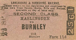
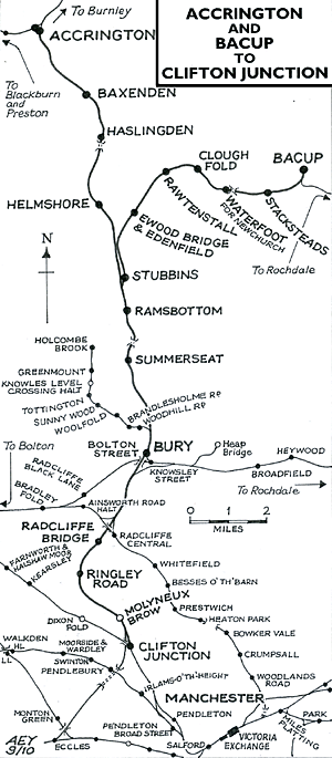
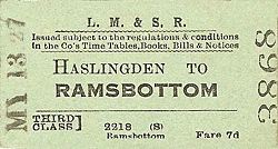
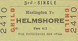
Tickets from Michael Stewart , route map drawn by Alan Young, timetables from Chris Totty
Sources:
To see other stations on the East Lancashire Railway Clifton Junction - Bacup line click on the station name on the station name:
Clifton Junction, Molyneux Brow, Ringley Road, Radcliffe Bridge, Withens Lane, Bury Bolton Street, Summerseat, Ramsbottom, Helmshore, Baxenden & Accrington
See also Stubbins Junction to Bacup: Stubbins, Irwell Vale (new station on the ELR), Ewood Bridge & Edenfield, Rawtenstall, Clough Fold, Waterfoot for Newchurch, Stacksteads & Bacup |

old5.jpg)
old14.jpg)
old9.jpg)
old7.jpg)
1.jpg)
4.jpg)
2.jpg)
old_thumb1.jpg)
old_thumb2.jpg)
old_thumb3.jpg)
old_thumb11.jpg)
old_thumb8.jpg)
old_thumb6.jpg)
old_thumb4.jpg)
thumb3.jpg)

 Home Page