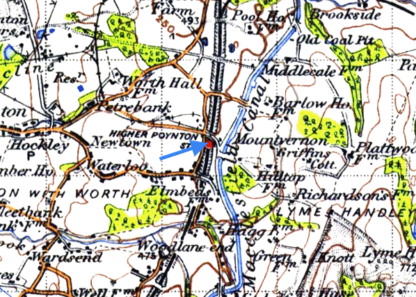
Notes: Higher Poynton station was on the 11-mile Macclesfield Committee (MC) railway. The line linked Macclesfield and Marple and was opened as the Macclesfield, Bollington & Marple Railway (MB&MR) on 2 August 1869. The line linked the North Staffordshire Railway (NSR) at Macclesfield to the Manchester, Sheffield & Lincolnshire Railway (MSLR) at Marple. The two companies were involved with the MB&MR scheme as they saw it as a means of creating a main line to Manchester that avoided having to use routes in the ownership of the London & North Western Railway (LNWR) which was the dominant company in the area. Ironically, before the line was opened, relations between the LNWR and the NS had improved resulting in it becoming nothing more than a local route. The MB&MR became a joint line of the MSLR and NS (the MC) in 1871.
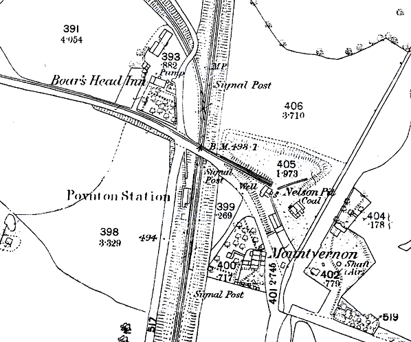
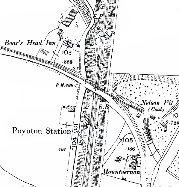
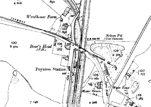
 Higher Poynton opened as Poynton. It was in a sparsely inhabited area, about a mile-and-a-half east of the village which was more conveniently served by the LNWR’s station on the Stockport Edgeley to Macclesfield route. The station was located on the south side of Lyme Road which passed over the line on a bridge. Originally the line was single-track and the platform was located on the west side of the line. Access was via a sloping path that connected the platform to Lyme Road. Facilities were within an austere single-storey brick building whose pitched roof extended forward as a platform canopy, supported by a series of unadorned wooden brackets. Higher Poynton opened as Poynton. It was in a sparsely inhabited area, about a mile-and-a-half east of the village which was more conveniently served by the LNWR’s station on the Stockport Edgeley to Macclesfield route. The station was located on the south side of Lyme Road which passed over the line on a bridge. Originally the line was single-track and the platform was located on the west side of the line. Access was via a sloping path that connected the platform to Lyme Road. Facilities were within an austere single-storey brick building whose pitched roof extended forward as a platform canopy, supported by a series of unadorned wooden brackets.
On the north side of the Lyme Road bridge a branch line curved westwards; it connected to the Ansons Pit and the colliery lines of Lord Vernon.
In 1871 the line was doubled at a cost of £16,000 and an extra platform was provided at Poynton which became the up (Macclesfield direction) while the original platform handled the down trains. The up platform was also connected to Lyme Road by a sloping path. It was provided with a brick-built pent-roof open shelter. Access between the platforms was via timber plank crossing at the north end of the station.
A signal box was located at the north end of the up platform which controlled the junction with the Ansons Pit line.
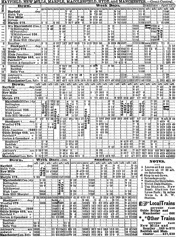
When the line opened there were four trains in each direction on weekdays and two on Sunday. Train services over the line were operated by the MSLR who were also the employers of the staff at the stations.
By October 1875 Poynton had six trains in each direction Monday-to-Friday, seven on Saturday and four on Sunday. All of the up trains ran to Macclesfield Central. Most of the down trains ran to Manchester London Road, some via Bredbury and others via Guide Bridge.
In 1885 the NS introduced a train service between Macclesfield and Buxton which called at Poynton via the Middlewood curve, which opened that year. The service was not a huge success and was quickly relegated to running on summer Saturdays only.
On 1 August 1897 the MSLR changed its name to the Great Central Railway (GCR).
In 1908 the MC altered its title to the GC/NSR Joint Committee.
At the start of the First World War there was a reduction in services including the complete withdrawal of the NS Macclesfield and Buxton trains. However the reductions were soon considered unnecessary, and before the conflict had ended there were almost as many trains running as there had been in 1914.
After the war a GCR Sentinel petrol railcar, built in 1912, was introduced onto a shuttle service that ran between Bollington and Macclesfield. It also operated on some shuttle services that extended to Middlewood Higher and Rose Hill Marple on Saturday. The railcar was affectionately known as the ‘Bollington Bug’ by local people because of the buzzing noise that it made.
In 1922 the Macclefield and Buxton services were reintroduced.
 On 1 January 1923 the GCR became part of the London North Eastern Railway (LNER) and the NS became part of the London Midland & Scottish Railway (LNER). As a result Poynton and the MC line became the joint property of the two companies. The LNER, as successor to the GCR, provided the train services. On 1 January 1923 the GCR became part of the London North Eastern Railway (LNER) and the NS became part of the London Midland & Scottish Railway (LNER). As a result Poynton and the MC line became the joint property of the two companies. The LNER, as successor to the GCR, provided the train services.
Having run erratically since its reintroduction the Buxton service was withdrawn for good in 1927.
On 30 April 1930 Poynton was renamed Higher Poynton; this was to distinguish it from the former LNWR station which retained its name.
 In 1935 the petrol railmotor was replaced with a Sentinel steam railcar. Around the same time the Ansons Pit line went out of use. In 1935 the petrol railmotor was replaced with a Sentinel steam railcar. Around the same time the Ansons Pit line went out of use.
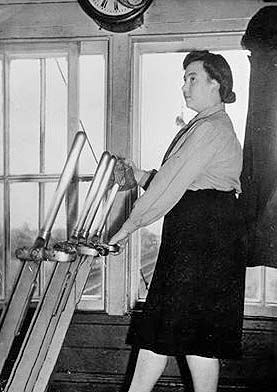
By 1938 Higher Poynton had 11 up and 13 down trains. However, with the outbreak of the Second World War on 3 September 1939, there was a drastic reduction in services. After the war the service did not return to its 1939 levels and the LNER summer timetable for 1947 showed 11 services to Macclesfield Central and 11 to Manchester London Road on Monday-to- Friday. On Saturday there were 13 trains to Macclesfield, 12 to Manchester London Road and one to Romiley. On Sunday there were six trains in each direction. During WW2 Higher Poynton had a lady signalman, Gladys Parker, pictured right.
On 1 January 1948 Higher Poynton became part of British Railways (London Midland Region) (BR[LMR]). No significant modernisation took place under LMR administration, with oil lanterns and existing signage retained.
In the late 1950s DMUs were introduced onto the line. Higher Poynton had 15 trains in each direction on Monday-to-Saturday that ran between Macclesfield and Manchester London Road, but the shuttles were not restored. The Manchester trains, however, were mostly routed via Guide Bridge which resulted in a slower journey. Consequently usage did not grow as it should have done and, especially south of Rose Hill, the numbers of passengers dwindled.
 In 1960 Macclesfield Central station was rebuilt as the main line station for the town (replacing Hibel Road) and given the name Macclesfield. The creation of the new Macclesfield station provided good connections with services to London Euston for Higher Poynton passengers for the first time. However the journey opportunities were not promoted as well as they might have been. In 1960 Macclesfield Central station was rebuilt as the main line station for the town (replacing Hibel Road) and given the name Macclesfield. The creation of the new Macclesfield station provided good connections with services to London Euston for Higher Poynton passengers for the first time. However the journey opportunities were not promoted as well as they might have been.
The September 1962 timetable showed 15 Macclesfield trains on Monday-to-Friday and 14 on Saturday. There were 16 trains to Manchester Piccadilly (formerly London Road) on Monday-to-Friday and 15 on Saturday. There was no Sunday service.
The Reshaping of British Railways (‘Beeching’) report of March 1963 earmarked the Romiley (Marple Wharf Junction) – Macclesfield line for closure to passengers. It was not until 29 December 1966 that formal publication of the proposal to withdraw this line’s passenger services took place, by which time many other condemned lines and stations had already closed; it is not known why the process was delayed. The closure hearings ended on 31 March 1967, but matters 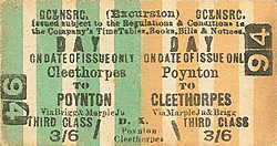 progressed slowly and it was not until 12 June 1969 that Richard Marsh, Secretary of State for Transport, consented to closure, but reprieved Rose Hill (Marple) station at the northernmost end of the branch, leaving it as the terminus. The last train to depart from Higher Poynton was the 10.30pm from Macclesfield to Manchester Piccadilly on Saturday 3 January 1970. A later train passed through the station just before midnight, without stopping, on its way back to Macclesfield. The station closed completely on 5 January 1970 with the section of line from Rose Hill to Macclesfield. progressed slowly and it was not until 12 June 1969 that Richard Marsh, Secretary of State for Transport, consented to closure, but reprieved Rose Hill (Marple) station at the northernmost end of the branch, leaving it as the terminus. The last train to depart from Higher Poynton was the 10.30pm from Macclesfield to Manchester Piccadilly on Saturday 3 January 1970. A later train passed through the station just before midnight, without stopping, on its way back to Macclesfield. The station closed completely on 5 January 1970 with the section of line from Rose Hill to Macclesfield.
Early in 1970 a deputation headed by Dr Michael Winstanley, Liberal M.P. for the Cheadle constituency, obtained an assurance from BR that the Macclesfield line would be left in situ until August to allow for the possibility of SELNEC deciding to reopen the line. SELNEC was not, however, very interested as they were short of money; and in any case half of the line, including the section through Higher Poynton, lay outside their area.
In May 1970 a group of railway enthusiasts and other interested people launched an attempt to save the line, and formed the ‘Lyme Handley Railway Preservation Society’ taking their name from a parish on the route. Their immediate aim was to prevent BR from lifting the track, and then raise the £50,000 necessary to purchase the line and the equipment to operate it. A public meeting to drum up support was held in Marple Bridge in June 1970 and was attended by Dr Michael Winstanley M.P. as well as Local Councillors, members of the Dinting Railway Centre, and some railwaymen - about 80 people in all. There was some enthusiasm for the scheme, but one 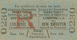 railwayman, a former driver on the line, said that in the 30 years he had worked on the line, he had seen more trains run empty than full. It was, however, decided to form a working party to negotiate with BR and report back to a public meeting in Hazel Grove in July. The working party delivered 9,000 leaflets to the area and produced very detailed plans and costings for the reopening and operation of the line. However, at a meeting held with BR (LMR) in June it transpired that they required an immediate payment of £1,400 as compensation for not lifting the track in August, and this would buy only three months’ respite. This was the rock on which the scheme foundered. Although frantic attempts were made to raise the sum required, only about £300 was in hand by the crucial date, and so the scheme was forced to fold up. Lifting south of Rose Hill commenced late in 1970 and was completed by March 1971. railwayman, a former driver on the line, said that in the 30 years he had worked on the line, he had seen more trains run empty than full. It was, however, decided to form a working party to negotiate with BR and report back to a public meeting in Hazel Grove in July. The working party delivered 9,000 leaflets to the area and produced very detailed plans and costings for the reopening and operation of the line. However, at a meeting held with BR (LMR) in June it transpired that they required an immediate payment of £1,400 as compensation for not lifting the track in August, and this would buy only three months’ respite. This was the rock on which the scheme foundered. Although frantic attempts were made to raise the sum required, only about £300 was in hand by the crucial date, and so the scheme was forced to fold up. Lifting south of Rose Hill commenced late in 1970 and was completed by March 1971.
The station buildings at Higher Poynton were demolished shortly after closure.
In 1985 a footpath/cycleway called the Middlewood Way opened along the course of the line. The platforms at Higher Poynton were refurbished as a feature of the path.
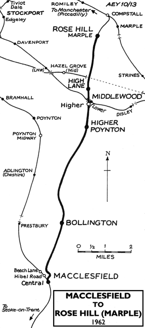
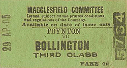
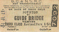
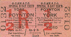
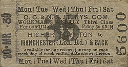
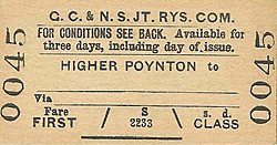
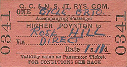
Tickets from Michael Stewart, Bradshaw from Chris Totty, route map drawn by Alan Young
Sources:
To see other stations on the Marple and Macclesfield line click the name:
Rose Hill Marple, High Lane, Middlewood Higher, Bollington,
Macclesfield MSLR/NS and Macclesfield Central
| 
poynton_old3.jpg)
poynton_old4.jpg)
poynton_old1.jpg)
poynton_old2.jpg)
poynton_old5.jpg)
poynton1.jpg)
poynton16.jpg)
poynton5.jpg)
poynton7.jpg)
.jpg)
pit_thumb.jpg)
poynton_thumb3.jpg)
poynton_thumb2.jpg)
poynton_thumb4.jpg)
poynton_thumb6.jpg)
poynton_thumb16.jpg)
poynton_thumb8.jpg)
poynton_thumb9.jpg)
poynton_thumb10.jpg)
poynton_thumb11.jpg)
poynton_thumb12.jpg)
poynton_thumb13.jpg)
poynton_thumb14.jpg)
poynton_thumb15.jpg)

 Home Page