
Station Name: NUNHEAD (1st site)[Source: Nick Catford]
 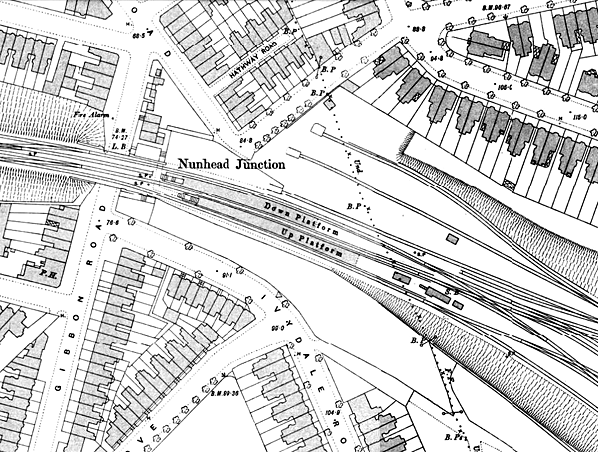 1895 1:1056 OS map shows the layout of the first Nunhead station which had two island platforms with steps up from an entrance on Gibson Road. Thewre is a signal box at the east end of the southern island, this controlled the junction with the Crystal Palace branch. Click here for a larger version
of this map. 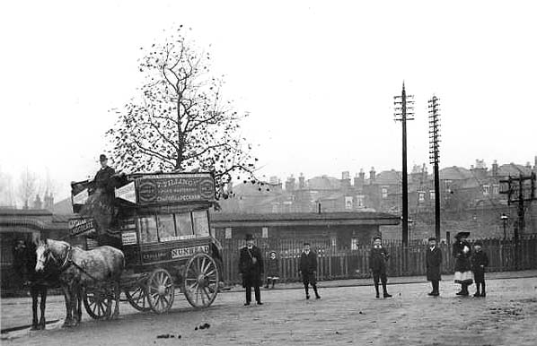
Looking north from the north end of Ivydale Road over Nunhead station towards Telegraph Hill in Deptford c1905. Horse buses were reaching the end of their effective life by 1900. From 1870 they had been superceded in volume, comfort and speed by horse trams and this service in turn was soon to be electrified. Thomas Tilling, who had his office and depot in Peckham, was one of the main bus operators in London and still exists today as a coach operator.
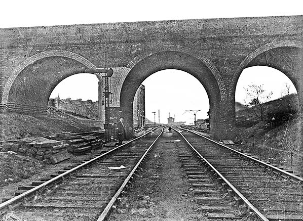
Nunhead station is seen from the Greenwich Park branch, which at the time remained in use for access to the ex-GNR coal depot at Brockley Lane. The presence of the electrical sub-station (left) and new passenger station (in the distance), but the old LC&DR signal box, suggest that the photo was taken in 1925 when electric trains commenced operation, initially just between Nunhead and Crystal Palace HL. A new SR-built signal box replaced the old ex-LC&DR one in 1925 and may well have followed rebuilding of the station.
Photo from Duncan Chandler collection from his Flickr photostream 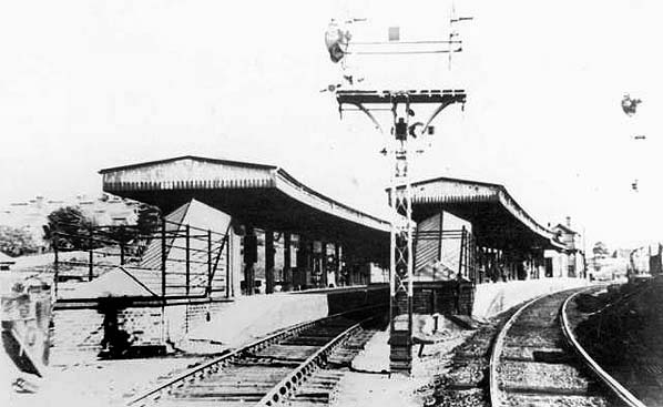 Nunhead station looking east
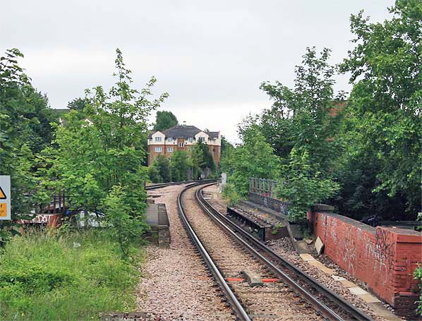
Looking east towards the site of the first Nunhead Station in June 2006. The station was sited beyond the bridge where the line comes out of the curve. Seen from the second Nunhead Station.
Photo by Nick Catford
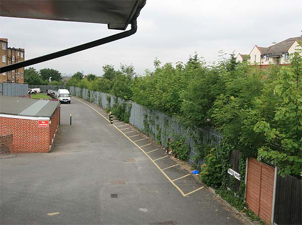
Looking west at the site of Nunhead Station in June 2007. One platform was sited where the road now runs, the other platform was behind the fence on the right.
Photo by Nick Catford
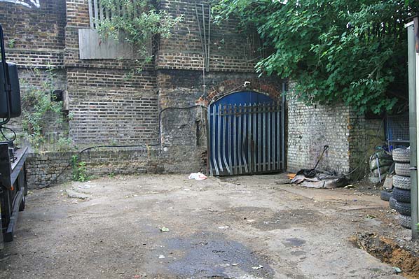
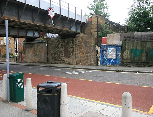 The two blue gate posts to the right of the bridge might be an original
entrance to Nunhead Station (June 2007). Although the booking office was on the other side of the bridge, there was anb entrance on this side as shown on the map above. Photo by Nick Catford
 There is a blocked subway under the road at the west end of Nunhead station (June 2007). The subway is shown on the map above.
Photo by Nick Catford
 Home Page Home Page
|
 Notes: The Crystal Palace and South London Junction Railway from Canterbury Road Junction, near Brixton to Crystal Palace (High Level) was opened by the London, Chatham and Dover Railway (LCDR) on 1 August 1865, to take passengers to the Crystal Palace. Train services on the Crystal Palace High Level line ceased in 1917–1919 and 1944-1946 for wartime economies. The line closed to all traffic on 20 September 1954.
 In 1925 the lines were electrified, and a new station at Nunhead was built on the London side of the original site. In 1929 the Greenwich Park branch was reopened as far as the site of Lewisham Road where a new connecting line to Lewisham enabled cross-London freight trains to be re-routed to Hither Green. The line was electrified in 1935 for peak hour passenger trains. There is now frequent service of passenger trains.
old5a.jpg) Nunhead station street level entrance on Gibbon Road c1910
Nunhead station street level entrance on Gibbon Road c19103a.jpg)
